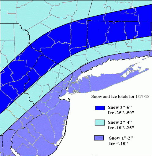
Two areas of low pressure will affect us tonight and tomorrow. First one goes into Great Lakes. The second tracks east of tri-state area. There airmass over us will be cold enough initially for all precip to start as snow. But warm air intrusion, first aloft and then at surface, the snow will change over ice or rain for most areas.
Snow will arrive around midnight and then change to sleet and freezing and then plain rain along the coast tomorrow morning. Inland areas will see snow last longer before changing over to sleet and freezing rain during afternoon hours. A change to plain rain eventually is possible. But the cold air at surface is will tough to get rid, with the coastal low tracking east. Moderate snowfall and significant ice accumulations are likely for many inland areas N&W of NYC. The most being over the highest elevations. I used a blend of the warmer NAM and colder GFS bufkit soundings for snow and ice amounts.
