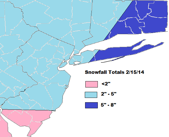
Models have been trending stronger and NW this system. Particularly with closing off 700mb and 850mb lows near our area. The GFS has been leading way in these trends. The 0z run tonight back a little bit from it’s 18z run. Which would given NYC around 6″ of snow and LI and CT 6-12″ of snow. But it still more amplified than the 12z run. The 0z UKMET and ECMWF has also come in further west tonight. So my forecast will follow the 0z GFS closely. Note that initially BL temps may be warm enough for some mixing or melting at the start. Especially over LI. So this may cut-down to the low-end of these ranges.