A frontal system and strong shortwave trough will give the region a period of rain from later this morning into this afternoon. The rain can be seen on radar over PA. Temperatures aloft are enough for the area to only see rainfall from this event. However, surface temperatures may be slow to rise above freezing, due to the snowpack. Which could cause rain to freeze on surfaces. Especially north and west of NYC. Therefore, the National Weather Service has issued a Freezing Rain Advisory for NW NJ and Orange and Rockland Counties in NY. Rainfall totals are likely between .25″ – .50″ across the area. So no significant flooding is expected. However snow melt today may cause some ponding on the roadways. So wear waterproof boots. Rain should ending this evening.
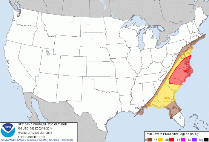
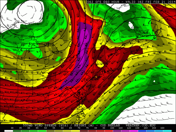
 A cold front will move through on Friday, with some showers and possibly some thunderstorms. SPC has places southern parts of the tri-state area in a 5% or 15% risk for thunderstorms with damaging wind gusts. Models don’t show any surface-based instability. So severe weather is not likely. But with a strong 500mb jet streak and some elevated instability there is potential for a forced low-topped squall line that produce wind gusts of at least 40mph. Temperatures will also likely rise into 50s ahead of this front.

 These weekend will feature mostly dry weather, with a gradual step down with temperatures. Next week still looks much colder with a threat of more snow.