The cold pattern that has been discussed for this week, has arrived. An artic front pass through overnight with some showers. As colder continues filter into region, temperatures may fall back in the lower 30s and upper 20s. Before rising back into middle 30s this early this afternoon. Tonight will be much colder, with temperatures dropping into lower 20s in NYC and the teens for most of the suburbs. Tomorrow will be mostly sunny with temperatures rising into upper 20s or lower 30s for highs.
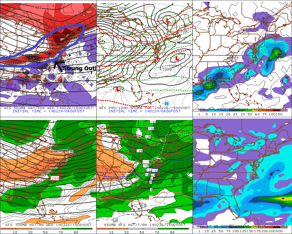
The storm for Wednesday, now appears will far enough south, it will just give us a light snowfall at best. We have seen storms this season trend stronger or farther NW, just inside 24-48hr. However, latest model trends show the shortwave energy along trough, that will responsible for spawning this storm, is more strung out Without this energy being more consolidated, the trough can’t sharpen, to tighten the baroclinic zone farther NW. There is also other polar jet disturbances, keep the height flatter ahead and behind this system. This results in weaker low developing along Mid-Atlantic coast and tracking well south and east of the 40/70 benchmark. I will still monitor this for any significant changes in handling shortwave energy and other features. But right now I don’t expect no more than a couple of inches of snow accumulation.
Thursday and Friday will be high pressure will be control resulting in cold and dry weather. Then pattern will be more active, starting this weekend. The Polar Vortex will slowly begin to retrograde and with the MJO entering phase 8, the sub-tropical jet will become active with disturbances moving across the southern CONUS. There will also be high-amplitude ridge along the West Coast of North America. So anyone of these disturbance has potential to interact or phase with northern stream disturbances, and produce a significant storm for the Eastern US.
However details vary with each prognostication of every disturbance on the models from run to run. It’s important for everyone to not get infatuated with model solutions, at this point. Instead use pattern recognition, ensembles and trends to determine the probability of that solution occurring, without getting into specifics. I will have more posts here this week about these storm threats.
