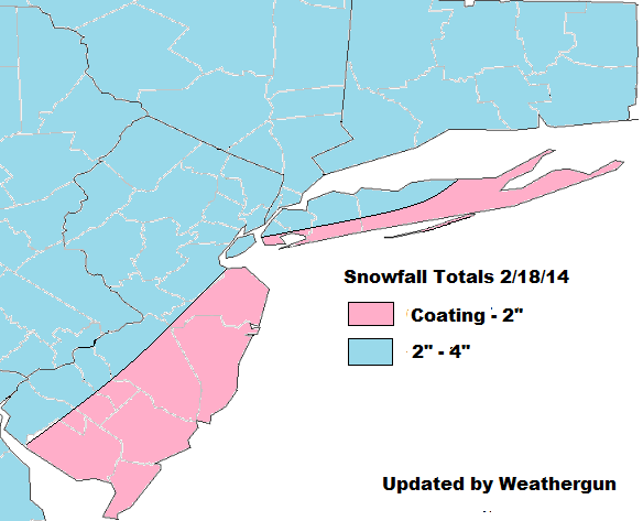
***Updated snowfall map, based latest guidance and observation and radar trends. It appears this system moving faster, and less snowfall will fall for areas NW of NYC. Still anyone visibilities may reduced to 1/4 mile for a couple hours, in heavy bands of snow.***
Cold high pressure will slide to the east tonight. Winds will turn more southeasterly. Temps will probably not drop much this evening and the may rise after midnight, near the coast. A 500mb shortwave will phases into closed low over Great Lakes region than open up as it heads east. At the surface, a small but robust area of low pressure will into Ontario and weaken. A secondary low will form near NJ/DE coasts and track into New England. This will set the area up for another moderate winter storm.
Precipitation with this system should arrive late tonight. There will be enough cold air in place, for everyone to start as accumulating snow. However, a low-level southeast flow increases, enough warm air arrive to change coastal sections to rain or drizzle before ending tomorrow afternoon. Exactly when this happens and how snow fall before it, is problematic as mesocale models such as the NAM and RGEM are showing more liquid amounts than the global models. As they develop secondary low faster. Dynamics may also come into playing in keep boundary level temps cooler. The NAM model shows strong upward vertical velocities and mid-level instability (H5-7 lapse rates 7.1 C/km and total totals in upper 40s) that would result in band producing 2-3″ per snowfall rates tomorrow morning with perhaps some thunder, before any changeover. The shortwave energy with system is also very potent. At this time, I will stay under the NAM’s totals. But if the NAM is correct, or the changeover is delayed, snowfall totals could be a few inches higher than on snowfall map.
 Areas that see the least snowfall on the map, are south and east face shores that will most influenced by 15-30kt SE winds off the ocean and changeover to rain quickly. Just little farther inland over north side of NYC and north shore of LI snow will last longer, and come down moderate to heavy at times. Before changeover to rain and ending after 1-3 hours. Further NW in NNJ and theLower Hudson Valley, should remain mostly snow (perhaps ending as light rain and drizzle).
I might update this forecast map this evening or tonight, if more guidance comes in supporting a bigger/smaller snowfall. Tomorrow morning, I will be nowcasting here.
 Another minor stratospheric warm event is occurring. The EP vectors are forecast shift more to right (poleward) by ECMWF. This would means that warm would be downwell in higher latitudes. Possibly resulting more west-based blocking over Greenland/Davis Strait.
 The MJO still forecast by GFS and ECMWF ensembles to head in through phases 7 and 8. These forecasts are a little less than reliable. But they have been fairly consistent this week. There is more support for progression by westerly vector wind anomalies being shown at 200mb and 850mb, over the Central Pacific.
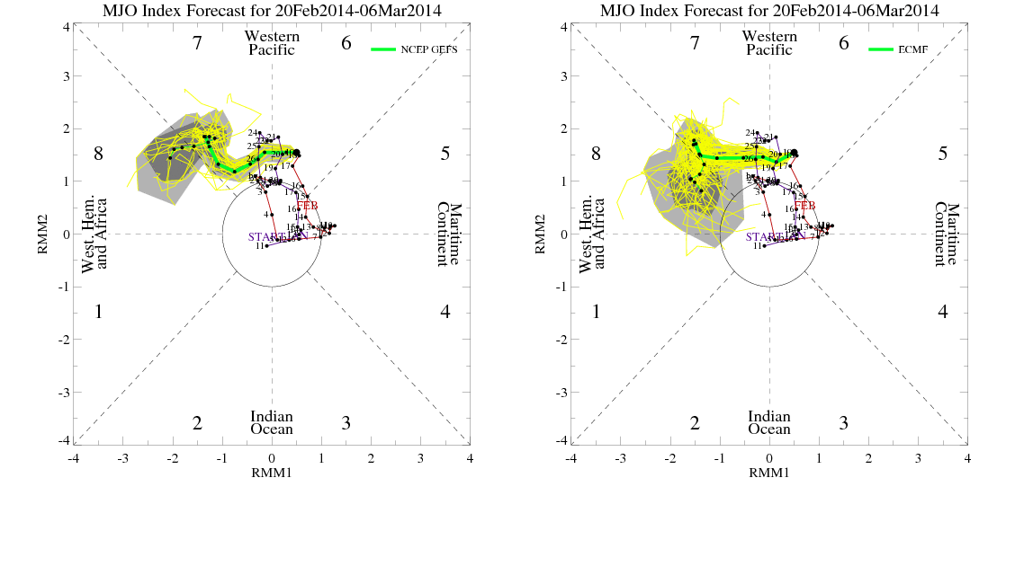 More later…