After some moderation with temperatures this week, the ECWMF, GFS and CMC ensembles are showing +PNA/West Coast Ridge for the last week of February. This will produce a mean trough over the Eastern US again with colder temperatures. Also note the Polar Vortex centered over Baffin Island:
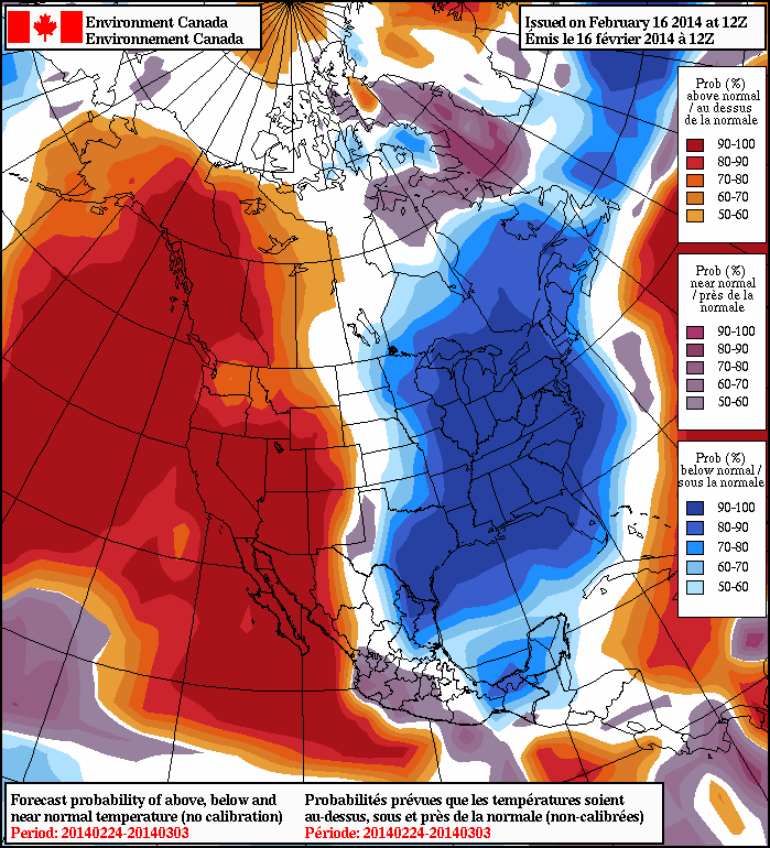 The 8-14 day NAEFS shows 80-100% probabilities for below normal tempartures, for the Eastern half of the US:
Persistent warmer than normal sea-surface temperatures, have resulted in a resurgence of the ridge over Northeast Pacific region, since the fall. As of Feb 15th, the warm SST anomaly remains:
 The latest ECMWF and GFS ensemble forecasts have the MJO going into phases 7 and 8 at end of this month. Which support the +PNA at end of this month into March.
Currently analysis of 200mb vector wind anomalies show strong easterly jet over the Tropical Pacific. Which support the MJO propagation into phases 7 and 8.
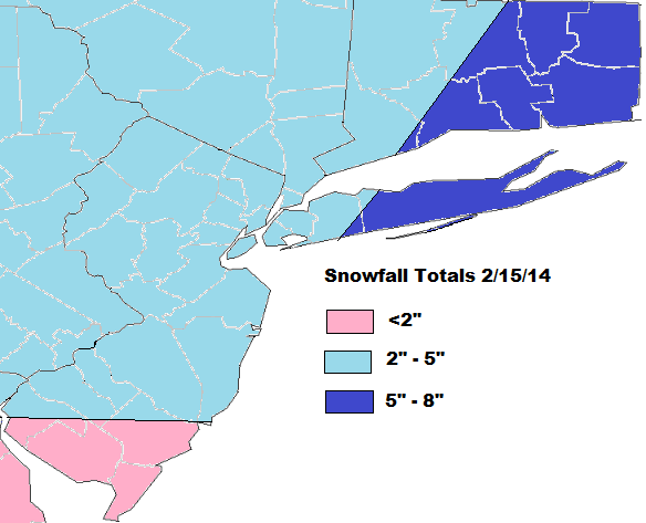
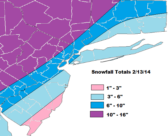
 Every time we’ve seen the -EPO/+PNA pattern reload, we seen a winter storm of at least moderate size. Models do show storms off and on, beginning next week. But the one that has most interested in is on Feb. 26-27th. The GFS and it ensembles have featuring this threat for possibly a Nor’easter. Several members show amplifying trough or closed low over the Eastern US, with a big ridge over the Northern Rockies.
 To conclude, I think we are seeing the pattern cycle repeat itself, every few weeks, since November. However, the ensembles keep the Polar Vortex near Baffin Island. So while temps will average below normal, I don’t expect to see the extreme cold we saw back in January. There will be winter storms between the end of February and into first 10 days of March. But how large each of them will be for the area, will depend on the position +PNA/West Coast Ridge axis or the amount (if any) blocking on the Atlantic side.