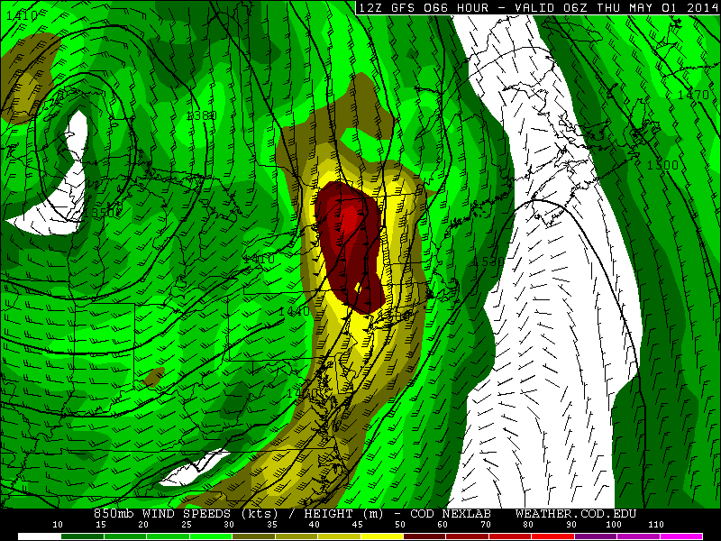
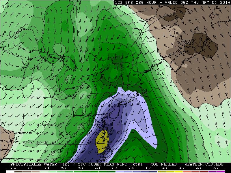
Hope you enjoyed today’s weather. A large, slow moving cut-off low will bring cooler and wetter beginning tomorrow. This is part of the same storm system that also causing severe weather with tornadoes to our West. Severe weather is not expected for the Tri-State area, due to onshore winds bring stable marine airmass over our area. But periods of rain likely to begin Tuesday afternoon and last into Wednesday. Then that rain will become steadier and heavier at times by Wednesday night. As a warm front approaches from southwest, with a 50kt+ low-level jet and precipitable water amounts 1.50″+. This will result in strong moisture convergence and elevated instability, enhancing heavy rainfall and isolated thunderstorms. Total rainfall totals from this storm are likely to range between 2 to 4 inches, for the most of the area. Some spots could receive more. Some flash flooding may occur in the typical poor-drainage areas. Some small stream or river flooding may also occur. Minor coastal flooding may also occur with easterly winds and astronomically high tides with the new moon. Especially for areas around New York Harbor and Western Long Island sound, Wednesday night.
The cut-off low will gradually weaken and move north of the area late this week. The warm front is forecast to lift well north of the area on Thursday. Some sunshine will break out between clouds, causing temperatures to rise into the 70s away from immediate coast. However, this may also cause more instability, for more scattered showers and thunderstorm to develop with an approaching cold front in afternoon and evening hours. Friday is looking cooler but drier. More disturbances coming from the northwest may bring scattered showers and thunderstorms this weekend and early next week. But there will be some sunshine as well.
