A large upper-level trough over Mississippi River valley will be taking a negative tilt. A deep southerly flow ahead of it, will transport an abundant amount of moisture from Gulf of Mexico and Atlantic moisture up the Eastern Seaboard between Thursday and Friday. At the surface, a cold front with couple of low waves running along it, will be a focus for strong convergence and instability. This will enhance an area of heavy rainfall with embedded thunderstorms. Widespread rainfall totals of 2 to 3 inches are likely from Pennsylvania southward to Georgia. Localized higher totals are possible, especially where thunderstorms train.
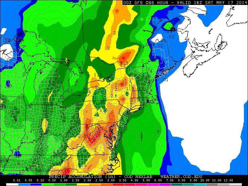
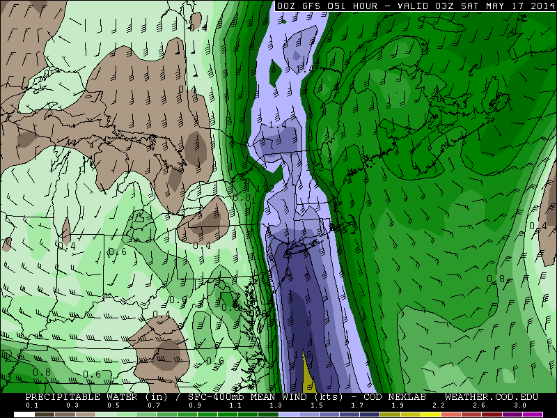
For the New York City Tri-state area, a strong high pressure centered over Western Atlantic, should keep most of the rain away until it begin shift east on Friday. Showers will likely increase from west to east during the day Friday, as the cold front slowly nears the the area. Some of these showers can produce some downpours. Then a wave forming along cold front, will enhance more rainfall Friday night. A strengthening southerly low-level jet and high precipitable water values 1.50″ will produce moisture convergence and elevated instability for more heavier showers and scattered thunderstorms.
When all is set and done early Saturday morning, rainfall totals will likely be between 1 to 2 inches for much of the tri-state area. Locally higher totals are possible in spots where thunderstorms occur. his could cause some minor flooding in poor drainage areas. As well some renewed flooding across streams and rivers. But major flooding is not expected. The good news is that rest of the weekend is look dry and comfortable with high temperatures in the lower to middle 70s.
