Update: Not surprisingly, tropical depression 2 has degenerated to a tropical wave.
A tropical disturbance in Central Atlantic had become organized enough to be classified as tropical depression 2 yesterday. However, it doesn’t appear likely to be a major threat to anyone, at this time. The 5am National Hurricane Center forecast today, keep this under tropical storm strength through 48 hours. Then weaken and dissipate by 72 hours, before reaching the Lesser Antilles. No tropical storm watches or warnings have been issued for this region, for this reason.
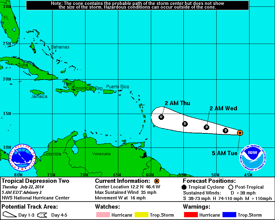 Current water vapor imagery shows a very dry and stable environment just to the north and west of system, associated with high pressure system over the Central Atlantic. This is keeping deep convection minimal around the low-level center. So little change in strength is likely over the next couple days. Afterwards, the depression will run into more shear being produced by a TUTT (tropical upper tropospheric trough) over the Western Atlantic and Eastern Caribbean. Any land interaction with Puerto Rico or Hispaniola may also hinder further development down the road. For these reasons, our most reliable global models show very little development. With these factors considered, the probability of this depression becoming a strong tropical storm or hurricane the next five days is very low.
 The depression will be carefully monitored through out this week. At this time, there is no reason for the anyone living along United States East or gulf coasts to be alarmed. Any possible threat to United States is least a week away and will dependent on the pattern at that time. Current guidance shows a deep mid-latitude trough over the Eastern US for the 7-10 day period, that might force this system to recurve into open Atlantic. But there is a far greater chance the depression will not survive the hostile environment it will endure over next few days.