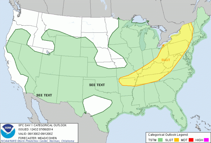
The Storm Prediction Center has issued a slight risk of severe thunderstorms for far western parts of the area today. The rest of the area including the Northeast NJ, NYC and Long Island area are in a lower 5% risk for thunderstorms producing damaging wind gusts and large hail. An upper-level trough and cold front approaching from the west, will trigger showers and thunderstorms, late this afternoon and this evening. With a humid airmass in place and temperatures rising into lower to middle 90s today away from the shore, the atmosphere will become very unstable some of those thunderstorms to possibly become strong or severe.

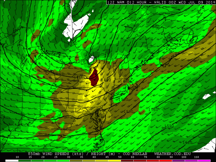
The severe threat is greatest over Upstate New York, Pennsylvania and extreme Northwest New Jersey. Where they will be closer to an embedded 500mb shortwave trough and a 40-60kt southwesterly low-level jet streak late this afternoon and early evening. Both features will enhance shear and lift for more organized severe thunderstorms that can produce damaging winds, large hail and isolated tornadoes. For areas closer to to I-95 corridor, with less shear and lifting later today, the threat for severe thunderstorms with damaging winds and large hail is more isolated.

The cold front will move through area tonight and tomorrow, with more showers and thunderstorms with heavy downpours. Shear and lifting will be more sufficient. But a slightly cooler and drier airmass behind front, will mean less instability for severe thunderstorms. For more organized, widespread severe thunderstorms, sufficient lifting, shear, instability, and moisture need to all come together. But forecasting how all these ingredients will come together for severe, is hardly ever simple in Northeast US, even on the same day of threat. For this reason, I will continue to monitor this potential here today and tomorrow.