Some new developments since my earlier post this morning. SPC has upped damaging wind probabilities from 15% to 30% for New York City, New Jersey, Eastern PA and the Lower Hudson Valley. Probabilities for large hail and tornadoes remain lower and unchanged: 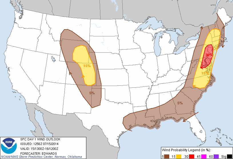 The 12z OKX sounding from a balloon launch by the National Weather Service, showed a cap inversion layer around 900mb. Also a 500-850mb lapse rate of 6.4 C/km and 37kts of 0-6km bulk shear . As a result, with enough sunshine, we will be able to destabilize at faster pace than yesterday. Before more forcing arrives to overcome that cap. Hence the forecast SBCAPE at 2016 J/kg (click on image to see clearer):
 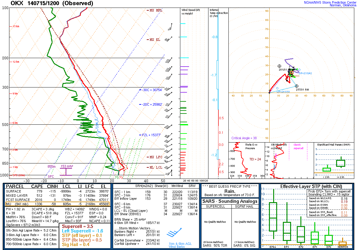 Also, the threat for isolated tornadoes increases. For example, the 12z HRRR from the College of Dupage website shows also 2500 J/kg- 3000 J/kg SBCAPE with low-level winds backing to SE late this afternoon over NE NJ/NYC area, These parameters combined along with low LCL and high helicity results in significant tornado parameter greater than 3.0 over that area. Which is very substantial for the local area:
 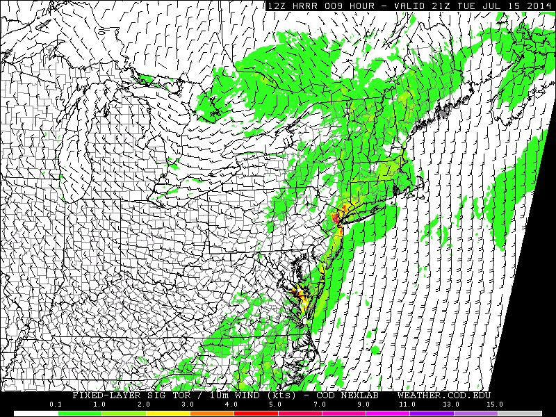 This may not played out as precisely as this models shows. But the potential is worth monitoring today. I might have other updates through the day today, if there are major changes or new developments.
- Comment
- Reblog
-
Subscribe
Subscribed
Already have a WordPress.com account? Log in now.

[…] ← Quick Update on Severe Wx Threat Today […]