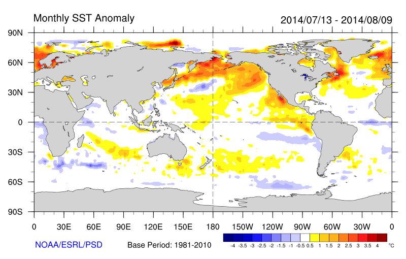
Warmer than normal sea-surface temperatures over Northern Pacific Ocean also known as +PDO (Pacific Decadal Oscilliation), have enhanced ridge over heights over West Coast of North America from time to time. This was has resulted in troughiness over Eastern North America, with virtually no prolonged or extreme heat this summer for Northeast United States. In fact, temperatures have been near or below normal for the last several weeks:
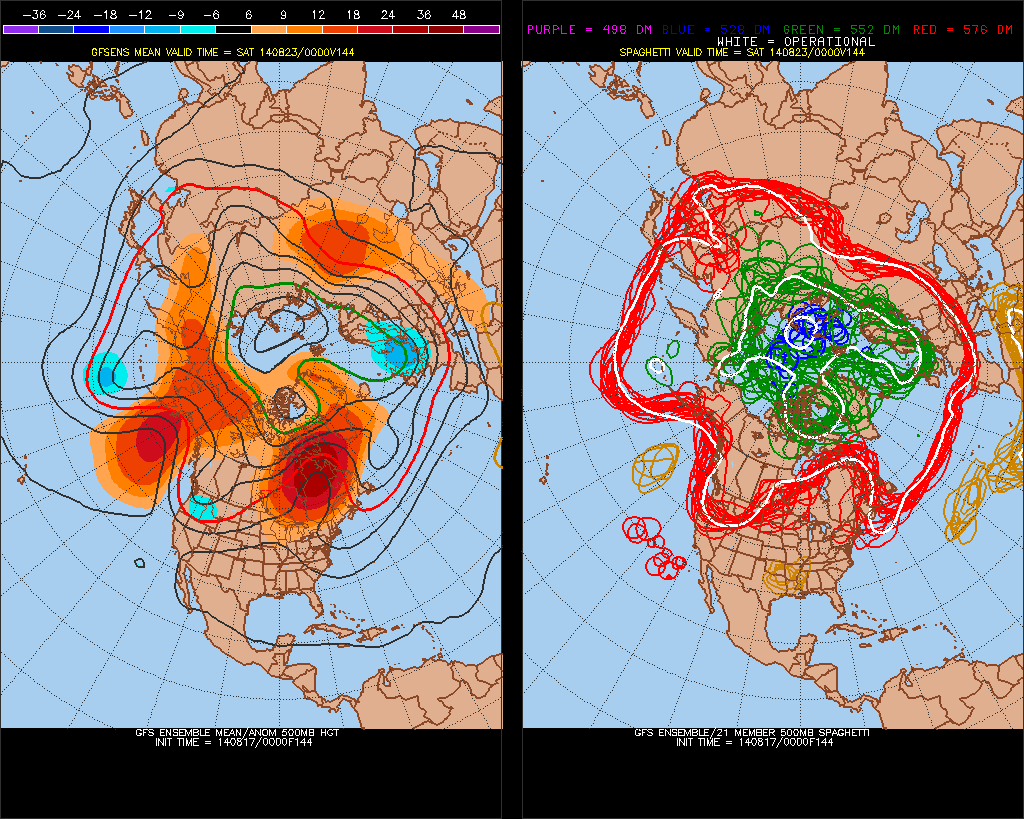
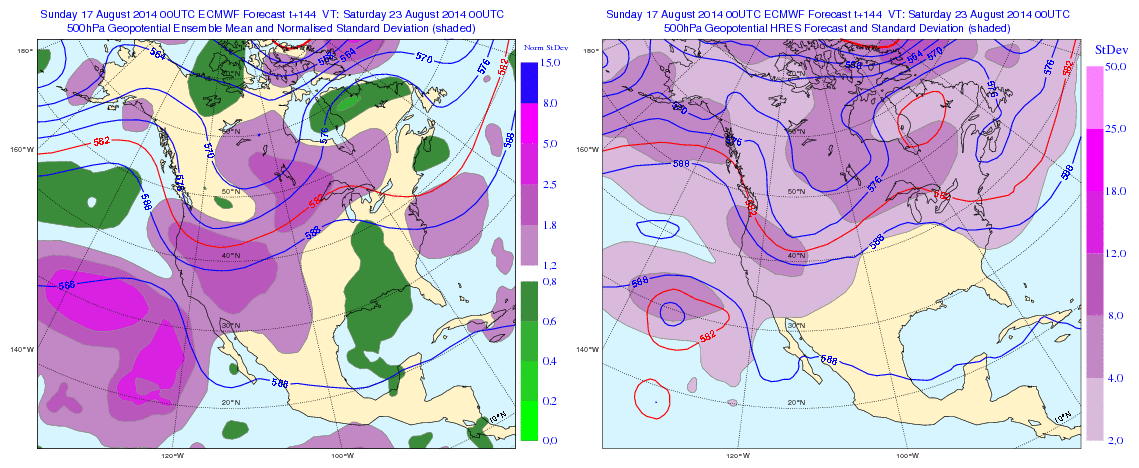
Continuing this theme, the GFS and ECMWF ensemble means for later this week shows at 500mb, shows a Northeast Pacific ridge with heights extending up to Alaska and trough digging into Pacific Northwest. This is a classic -EPO/-PNA pattern. This results in ridge building over Central United States. But the amplification of this ridge into Hudson Bay/Southeast Canada, leads to lower heights over the parts of the East Coast/Western Atlantic. Somewhat reminiscent of an omega block. This supports disturbances to drop down from the north or an onshore flow with high pressure to the north and east:
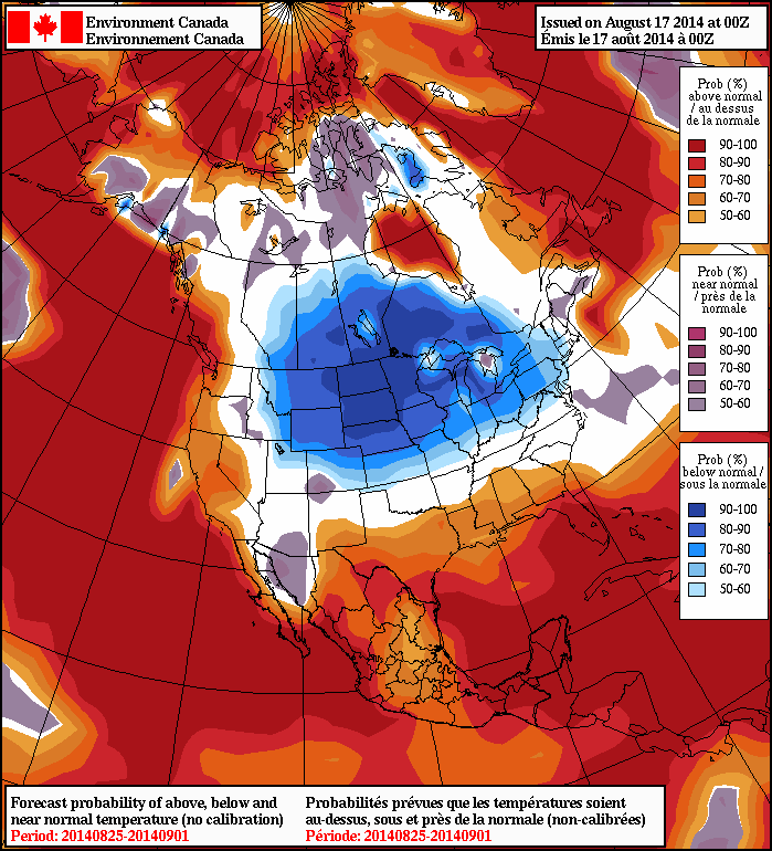
 The trough over the Western US will eventually shift eastward, after this period. A brief surge warmth and humidity, may proceed it. But another cooler airmass will likely come behind it. Overnight guidance is starting to pick up on this as well. The 8-14 day outlook from the NAEFS, basically last week of August, now showing 50%> probabilities of temperatures averaging below normal from over the Northern Plains into the Northeast: