High pressure will be over East today. Bringing party sunny skies. With light onshore winds highs temperatures will only be upper 60s to near 70 today. Enjoy because the weather make take turn for the worst starting tomorrow night.
This high pressure will begin to weaken and slide east into Nova Scotia on Wednesday. This will allow low pressure developing off the Southeast US, to track northward up the Mid-Atlantic coast. There are some differences in the guidance in how they handling this system. But the overall trend past three runs has been further north. Clouds will likely increase on Wednesday, with some rain overspreading the area from north to south Wednesday night and into Thursday.
A few things to watch here, before I hone in on details. First, how strong is subsidence or high pressure will be in this area. This will be a factor in how rainfall we receive. Most guidance seems to show heavy band of rain making as for north as Central New Jersey before weakening. Although this morning’s 6z GFS and it’s ensembles have coming with an even wetter solution. Sea-surface temperatures off the east running warmer than normal. This may enhance more deepening of coastal storm than what models show. As was seen with Sunday’s coastal storm that was a near miss for the Tri-state area.
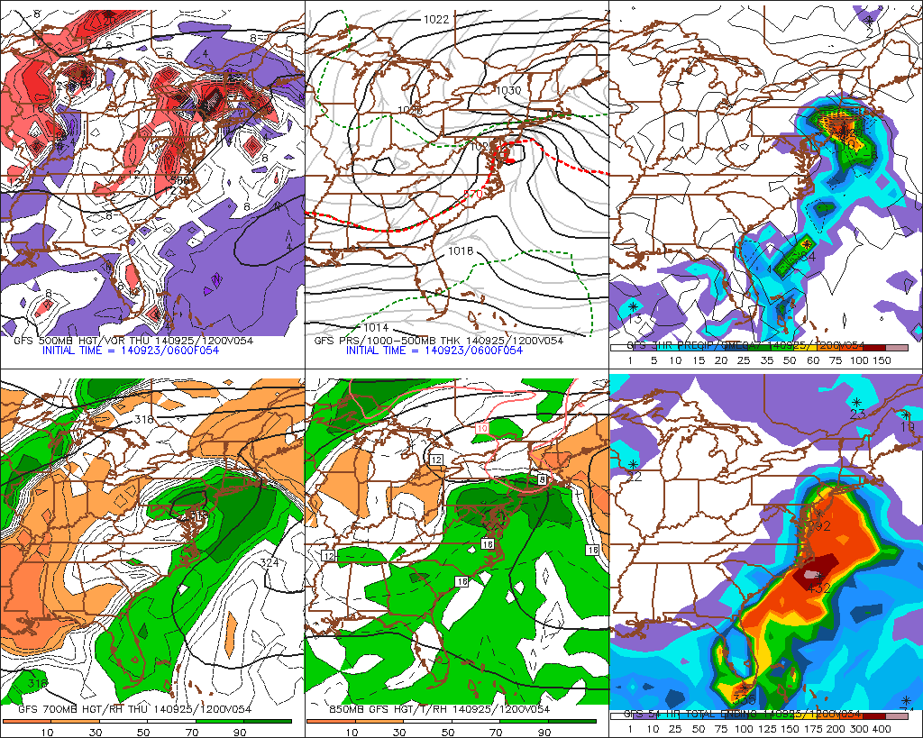
There will also be tight pressure gradient developing with strong high pressure north of this low. This could cause winds out the east to northeast to increase near the coast Wednesday night How strong these winds be in the area will depend on the intensity and track of the low. Some high surf and rip currents are likely over the ocean. There will also be new moon on Thursday. So minor coastal flooding at high tides is possible. I will have more updates and details here are coming as new guidance comes today.
This storm will begin to weaken and drift slowly away from the Tri-state area later Thursday afternoon. Leaving behind perhaps a few some scattered light showers for the Derek Jerek’s last home game at Yankee Stadium night. Friday and this weekend are looking better with high pressure building back over the Central and Eastern US. Temperatures will begin moderate to above normal. Perhaps near 80 degrees, away from the coast.
