Unsetteled Weather This Week, Cooler Weather To Follow Next Weekend

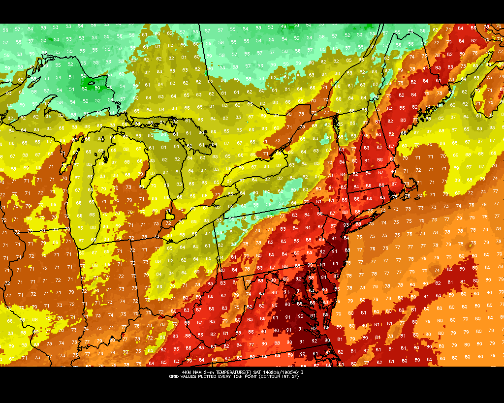
Today like another pleasant day with a mixture of sunshine and clouds and east winds keep high temperatures in middle to upper 70s. However, the weather becomes more unsettled starting tonight. Low pressure currently over Carolinas, will slowly move northeastward through Wednesday.  There are some model differences handling of this system. But most models keep this keep this low far enough south and east, to spare most of the region any heavy rainfall. At this time, I expect clouds to increase across the entire region tonight. Some periods of light rain, are possible for the coastal sections, especially over Long Island and Central New Jersey starting late tonight through tomorrow night. Areas farther northwest, will remain dry. I will continue to be monitor this low with future model runs and some nowcasting.  Just a 50 mile shift west will bring more significant rainfall. On the hand, a 50 mile shift further east might mean more sunshine tomorrow, for parts of the area.

Regardless the small differences, there will tight pressure gradient between this low and a strong high pressure over Maine or Nova Scotia. East to northeast winds will increasing to 10mph to 20mph with gusts 25mph near the coast by tomorrow and persist into Wednesday. With a full moon tomorrow, some minor coastal flooding and beach erosion is possible for multiple high tide cycles. Especially along the New Jersey shore and around Western Long Island sound. The National Weather Service in Upton, NY has issued a coastal flood statement for this reason.  Important to note, that this isn’t a powerful storm and any impacts along the coastline, look to be minimal. Strong or damaging winds are not expected out this storm.

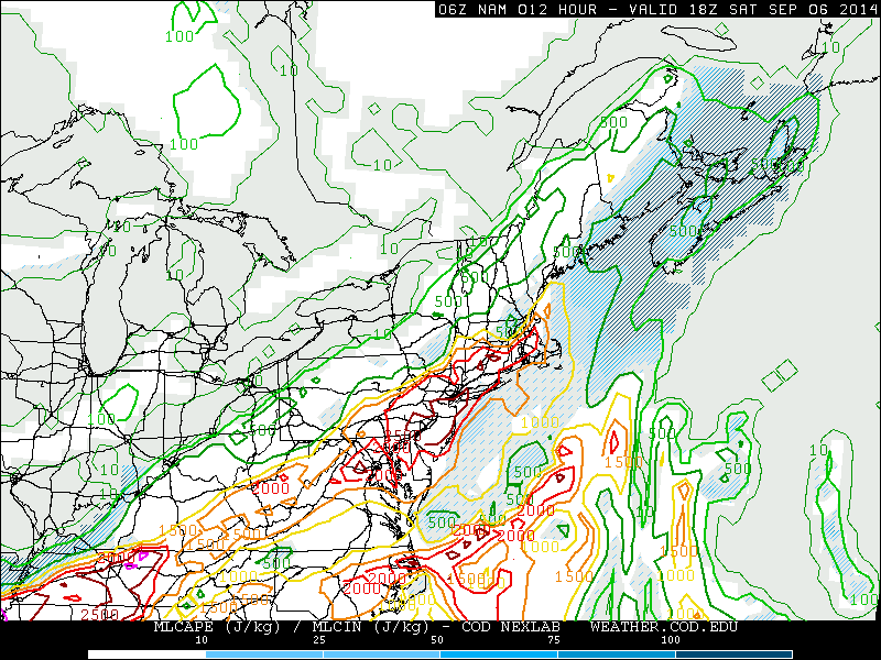
Clouds should break for some sunshine later on Wednesday afternoon as this low begins consolidated and track into the Atlantic. Easterly winds, will only allow high temperatures in there middle to upper 70s. Another low pressure system will be track to over the Great Lakes Wednesday night. The warm front associated with this system  through area on late Wednesday night and early Thursday with some isolated showers or thunderstorms possible. If this warm front moves north, as the GFS and the ECMWF to a lesser extent shows, much of the Tri-State area could be in the warm sector with more humidity and high temperatures in middle to upper 80s on Thursday. On the other hand, if the warm front stays further south, we could be stuck with an onshore flow and more clouds. Right now, I will lean towards more reliable GFS and ECMWF model solutions. Regardless, a strong cold front will approach the area with some showers and thunderstorms likely by Thursday night.

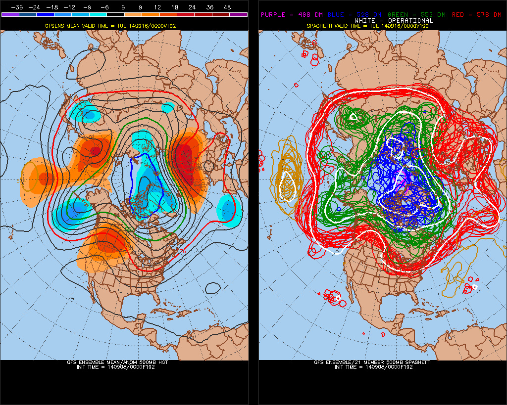
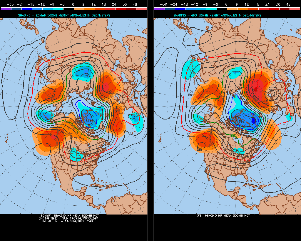
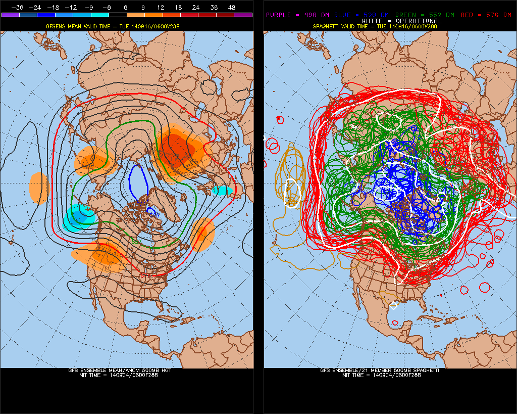
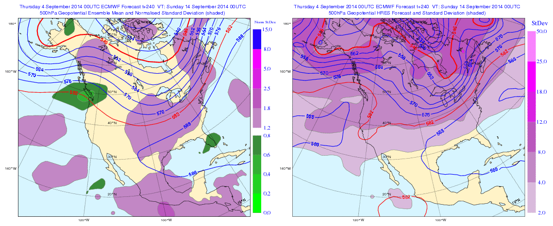
Some uncertainty afterwards, as the ECMWF is much slower with the cold front passing through the area. The GFS would much cooler and drier for Friday and Saturday.  While the ECMWF keep more showers and thunderstorms into for Friday and Saturday, with a wave forming along frontal boundary. The GFS might be too progressive and ECMWF might to be strong with the east coast ridge at the end of the week. Regardless of either solution, below normal temperatures look likely starting next weekend and continuing into much of next week. As most guidance shows a strong West Coast ridge, causes a large trough over the Central and Eastern United States.

0zGEFSf192


Hot & Humid With Strong Thunderstorms Possible Today

Yesterday south to southeast winds, transported a very muggy airmass into region. However, these winds off ocean, cause marine inversion with low clouds to develop. This kept atmosphere from mixing and less stable. Temperatures in the 80s across most of the Tri-state area. Today will be hot and humid as we much deeper westerly to southwesterly flow with 850mb temperatures near 18C this afternoon. This will likely allow for deeper mixing and temperatures to rise into the lower 90s, across much of New Jersey and into New York City. The only caveat here is that some convective debris from decaying showers and thunderstorms Western New York and Pennsylvania early this morning, works it east today.  This could possibly keep high temperatures in the upper 80s.  Closer to coast sea-breezes will develop this afternoon and keep high temperatures in middle to upper 80s.

temp13

A pre-frontal trough developing over the area, will trigger some scattered showers and thunderstorms this afternoon and early this evening. These will form over interior areas for first then move southeast towards the coast. Latest NAM model guidance is showing 2000 – 3000 J/kg of MLCAPE, 20-25kts unidirectional 0-6km bulk shear, precipitable water values 1.5″ – 2.0″ ahead of this activity this afternoon, away from the shore. This is enough instability and moisture for thunderstorms to become strong or severe and produce very heavy rainfall in a short period of time. But shear is insufficient for thunderstorms to sustain their updrafts and organize into bow lines. At this time, I expect scattered thunderstorms to be pulsing up and down in intensity. Isolated damaging wind gusts and flash flooding in poor drainage areas will be the main threats. The Storm Prediction Center has already included much of the area in a 15% slight risk. So stay tuned for any severe thunderstorm watches this afternoon or evening.

namNE_con_mlcape_012A cold front passing through the area, may trigger more showers and thunderstorms early tonight. However with the sun going down, instability will diminish. So these thunderstorms will be less capable of becoming severe. Behind this front is cooler and less humid airmass. Sunday will mostly sunny with high temperatures in the upper 70s to lower 80s. Monday and Tuesday will looking more questionable some model guidance showing a coastal low impacting the area with some rain and wind. Another post here will come later today on this system with new model data. 9/7 Update (that post will be delayed for model data today..)

Volatile Weather Pattern the Next Few Weeks

Currently the guidance has an incoherent or erratic MJO, next the 15 days or so. This has an influence on model and ensemble long-range 500mb forecasts for North America. We’ve see go back and forth between a strong ridge over the United States to not deeper trough. Until the MJO signal becomes more coherent or weakens to point where there will be little influence, we continue to see alot of volatility on guidance:

NCPE_phase_21m_full

ECMF_phase_51m_full

Overnight guidance looks unsettled next week, with a couple a waves of low pressure over the Mid-Atlantic states. If correct, this will have an influence on temperatures next week. Otherwise temperatures will start out near to slight below normal next week. Then trend above average later next week. Whether we same type of heat or large positive departures, we saw this week, remains to be seen. Long guidance overnight seems to be more pronounced with the trough over North America. But the GFS and it ensembles still faster bring the trough to the east than the Euro and it’s ensembles overall. The Euro still holds on to WAR and well above average for day or two before trough and cold front arrives Sept 13-14th. Their might be some GFS trough and Euro ridge bias at play here. So I’d be careful picking one guidance over the other right now, and look for consistency, trends first:


0zGFSEC500mb

6zGEFSf2880zECENS

The NAFES 8 to 14 day outlooks shows high probabilities of below normal temperatures over Midwest, Great Lakes and Ohio Valley  Lower probabilities for below normal temperatures further east. Probably due to strong Western Atlantic ridge keep cooler anomalies to the west. At this time, for the local tri-state area, I’m leaning towards temperatures fluctuating  between slightly below normal to well above average and precipitation near normal, for the next 15 days at least. More updates this discussion may over the next couple days as more data comes in:


00zNAFES