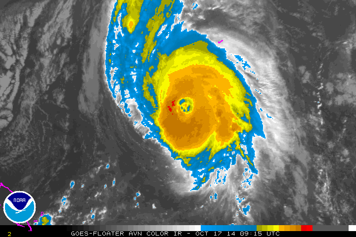
Hurricane warning remains in effect for Bermuda, as the island expects severe impacts from Hurricane Gonzalo. On Thursday, the storm restrengthened to category 4 hurricane with maximum sustained winds of 145mph. Then turned to north-northeast on a track towards Bermuda. This morning, Gonzalo is still a category 4 storm with maximum sustained winds decreased to 130mph. Over the past 12 hours, the hurricane has being undergoing an eyewall replacement cycle. This is where an outer eyewall forms and begins to replace the inner eyewall. During this cycle, some weakening typically occurs, until it’s complete.
Gonzalo will be moving over cooler sea-surface temperatures later today. Upper-level shear is also increasing from a upper-level trough moving off the East Coast of the US. So some further weakening is possible today and tonight. But Gonzalo still expected to remain a major and dangerous hurricane, while passing over or near the island of Bermuda this evening. Gonzalo is expected to bring heavy rains and winds over 100mph to Bermuda. According to the National Hurricane Center Gonzalo’s current forecast track will also create a significant storm surge for the island, that could rival the 10-foot surge produced by major Hurricane Fabian in 2003.
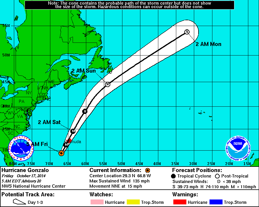
Gonzalo will produce some swells along the East Coast through this weekend. As it moves by Bermuda then tracks more northeast into the North Atlantic. For the local area, Wave Watch model 6-12″ feet waves over the New Jersey and Long Island coastal waters on Saturday morning. Gonzalo will weaken further then transition to a post-tropical system by Sunday. Stay tuned for more updates here on this storm. Residents of Bermuda, should follow updates the National Hurricane Center for more updates system through tonight
