We had the chillest morning of the season so far. Temperatures got down into the lower 40s over New York City. While most of the suburbs dropped into 30s. Many part of the interior also saw their first frost or freeze of season. With a mixture of sunshine and clouds temperatures still rose into the upper 50s to near 60 this afternoon areawide, However, the weather will more unsettled after today. A cut-off low in upper-level of atmosphere will develop over the Northeast and Mid-Atlantic regions on Tuesday. At the surface, an area of low pressure of Great Lakes will move southeast towards the northern Mid-Atlantic region and then merge with another area of low pressure developing south of Long Island on Wednesday. This low will begin slowly deepen, as it moves north into New England on Thursday.
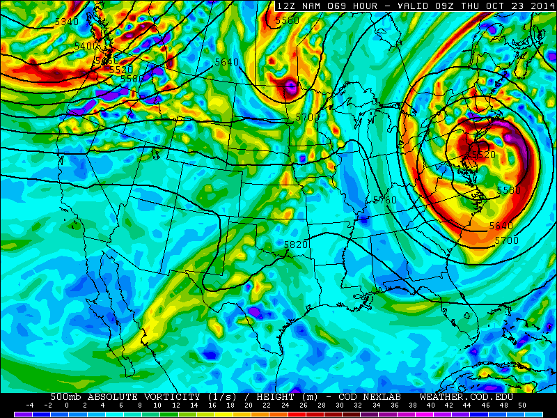
Disturbances rotating around this low will trigger intermittent periods of rain in Tri-state area. On Tuesday some periods of rain and drizzle could start developing across the region by the late afternoon or evening hours and continue into the night. On Wednesday, more periods of rain are likely as this storm begins to consolidate and organize more south of Long Island. Some of the rain could heavy at times. But rain is likely to intermittent enough over next few days, to not cause any serious flooding issues. Rainfall totals will generally be somewhere between .50″ to 1.50″ for the entire area. But some spots may get less and more, depending on the banding. Winds will begin to increase from the north to northwest at 15mph to 25mph with gusts to 30mph near the coast on Wednesday. Periods of rain will likely continue into Thursday, as this storm will be close enough to impact the area.
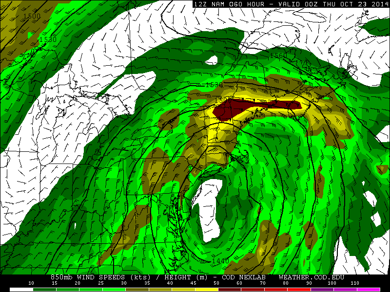
Impacts along the New York, New Jersey and Connecticut coastlines appear to be minimal. Winds won’t be very strong or damaging, due to lack of a strong pressure gradient in the Tri-State area. Some minor tidal flooding is possible on Wednesday morning with initially out of northeast. Then those winds should increase out the north than northwest in the afternoon and evening. Preventing anymore tidal flooding afterwards. Overall, this storm appears to be more of nuisance for local Tri-state area. However, this is likely to be full-blown nor’easter for Northern and Central parts of New England. A tight gradient with stronger high pressure over SE Canada, will cause a stronger easterly jet off the ocean in this area. Which will enhance moisture and warm-air advection for heavy rainfall totals of 2-4 inches and wind gusts in excess of 40mph or 50mph, along their coastlines.
This storm will be affecting many parts of Northern Mid-Atlantic and Northeast for two or three days this week. But another system coming out the Pacific, should help to kick this cut-off low out the area, in time for mostly sunny skies and seasonable temperatures over the weekend. For the next few days though, I will continue the monitor this storm, and give updates here or on twitter on any changes.
