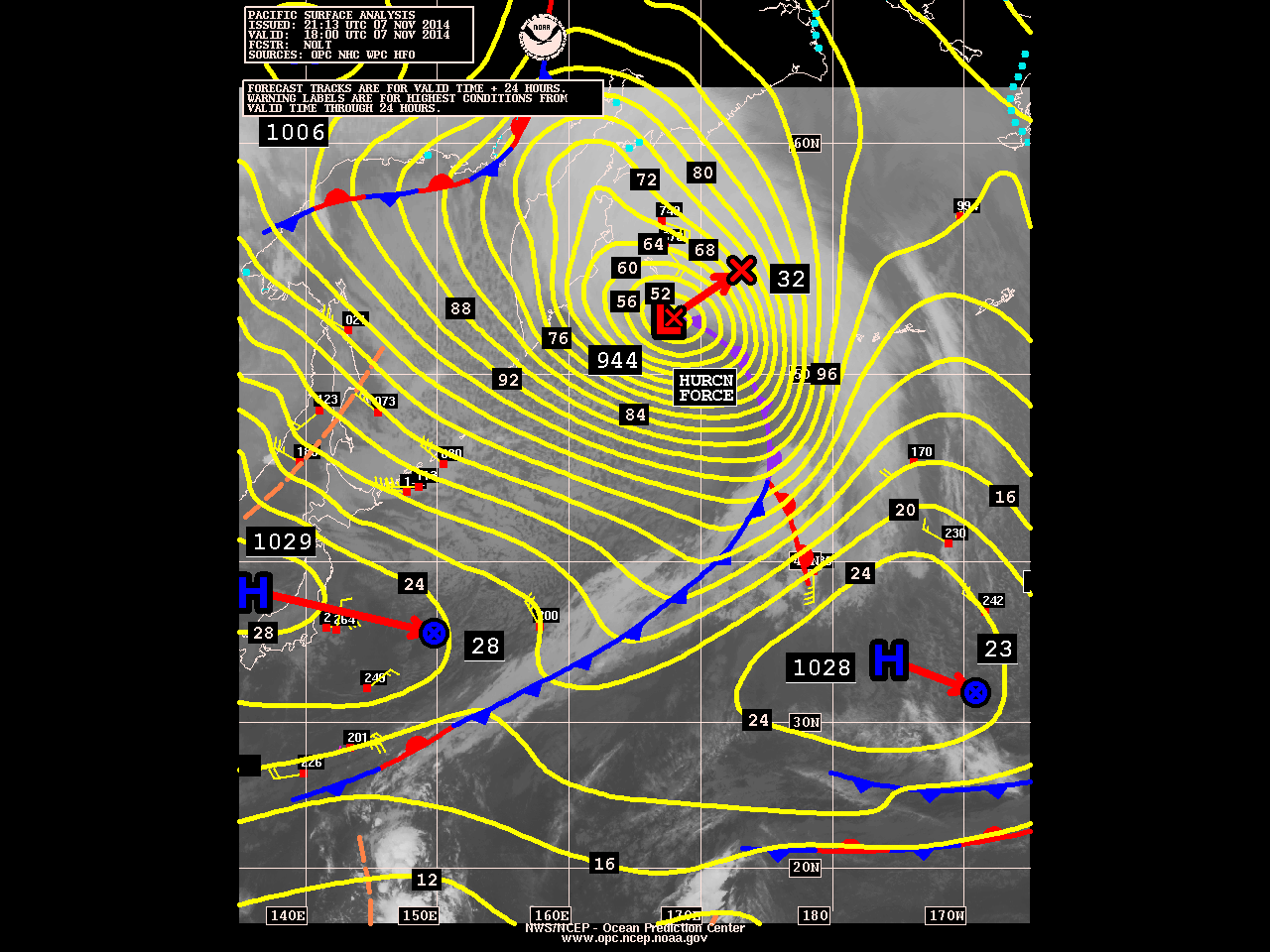
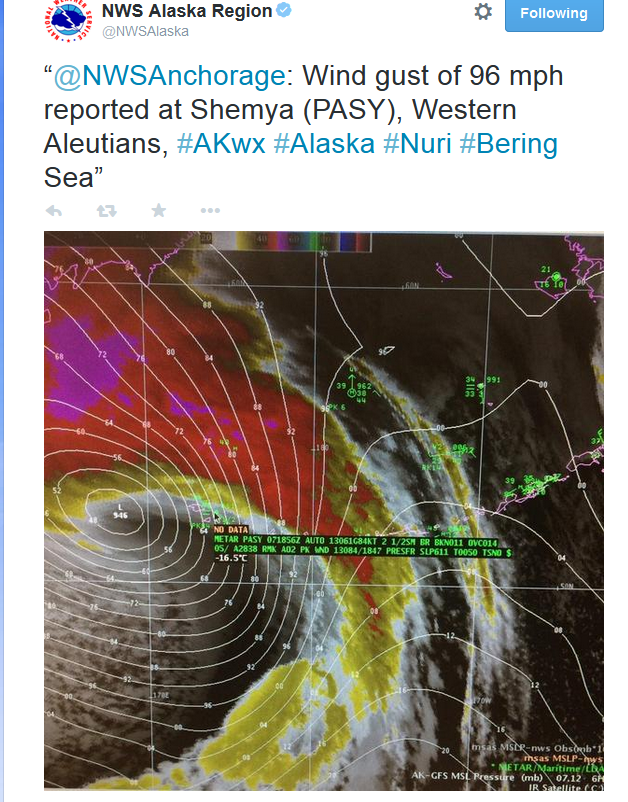
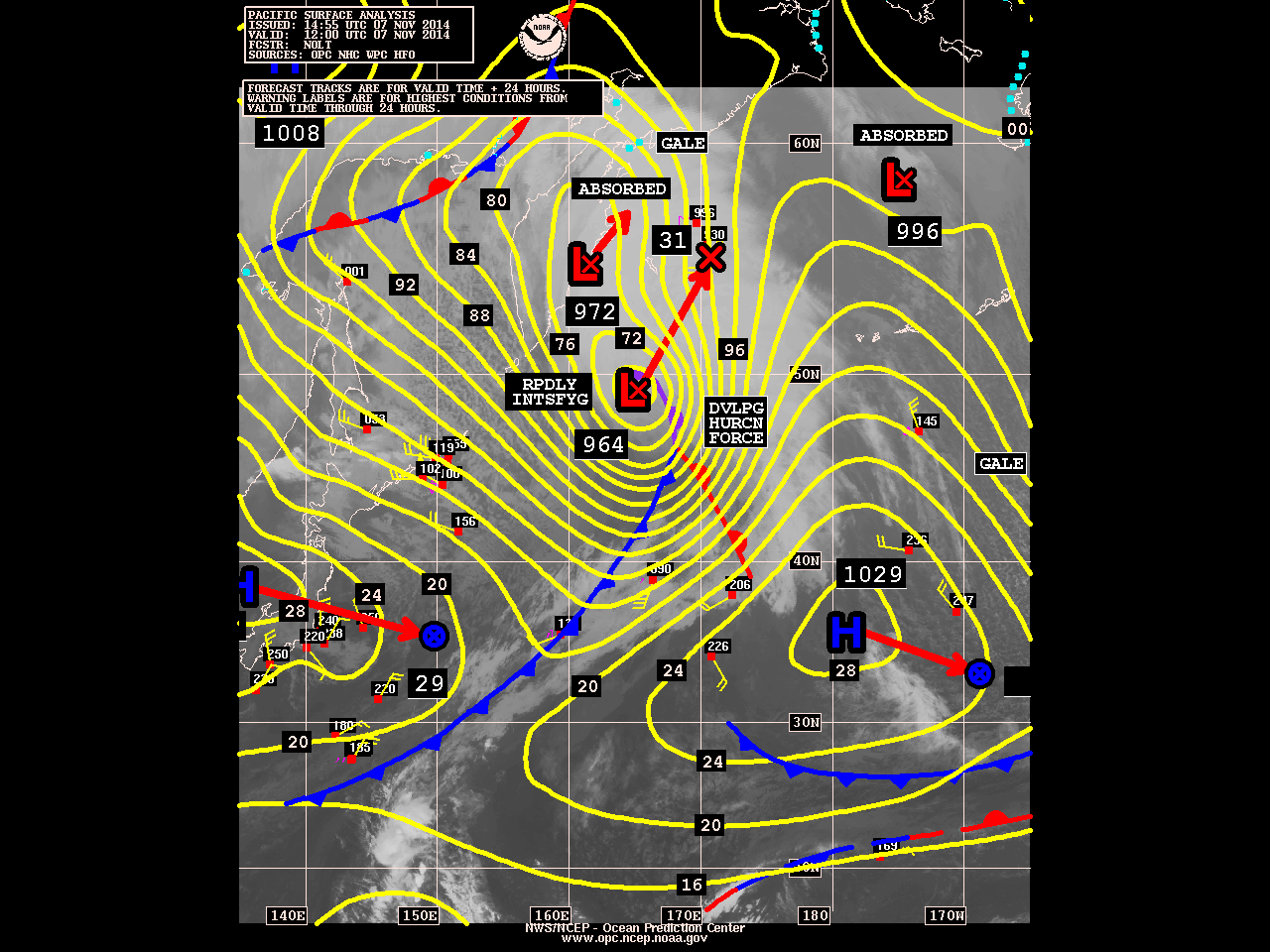
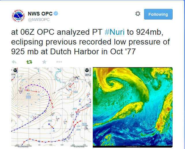
The remnants of former Super Typhoon Nuri are just south of Bering Sea and phasing with another low to west. The storm is now rapidly intensifying and it expected to bring hurricane-force winds and high waves to the Aleutian Islands. Some models have this storm deepening below 925mb pressure. That will make it strongest extratropical storm (non-tropical in structure) in that region ever. As it explained before, this storm will also help to change the pattern over North America to more wintry one starting next week. However, there apparently some misconceptions out there about this pattern evolution. Nuri will have no direct impact on the United States mainland and will not become the polar vortex. Nuri as powerful extratropical storm, will enhance a ridge already building into artic circle. Which cause the polar vortex in the troposphere, to split and then one large piece of it to dive down into Ontario and James Bay. This will transport an airmass of artic origin, into the United States from the Rockies to the East Coast. But it will not be brutally cold, because in November, airmass in the high latitudes are typically not as cold during the winter months. I will continue to posts updates here on pressure and impacts this storm will have over the Aleutian Islands and influence on pattern change.
10:15am Update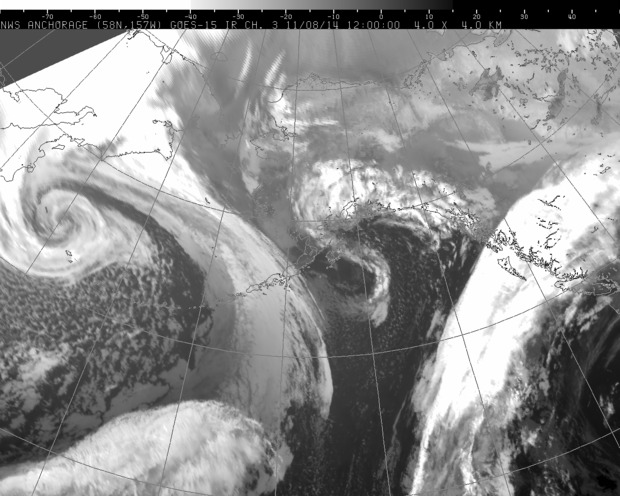
5:15am Saturday Update:
4:45pm Update: