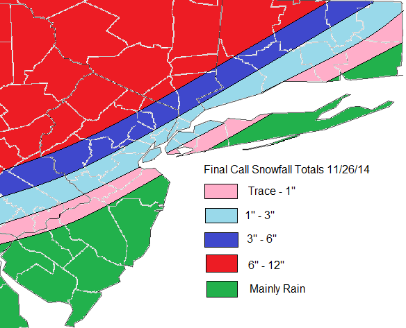
Latest models guidance has shifted track of this storm further west. Particularly the lows at 700mb, 850mb and surface levels. This will allow from more warm air-intrusion in mid-levels due a stronger southerly jet moving over more the area. Areas farther west farther west of I-95, will see rain or wintry mix change over to snow later this morning or early this afternoon. Which could fall heavy at times this afternoon or evening. Along I-95, include New York City metro area, rain should changeover to snow by early afternoon. But as this storm moves closer, warmer air intrudes aloft. This cause snow to change to sleet for several hours this afternoon. This will significant reduce snowfall totals. Further SE, warmer boundary layer temperatures will precipitation mainly in form rain with perhaps a little snow or sleet mixed in at times. Winds out of the northeast increase will also increase this afternoon to between 15mph to 25mph with gusts to 35mph or 40mph near the coast. Then turn more north at same speeds this evening. Some minor tidal flooding is possible at high tides this evening along the north facing shores.


