Mild Temperatures Through Wednesday, Artic Air Arrives By Friday

Today’s temperatures rose in the lower 60s. Tuesday and Wednesday high temperatures will also be in lower to middle 60s. As we remain in a mild airmass, in advance of artic blast later this week. We will be in between two systems Tuesday night and Wednesday. A low moving over the Great Lakes and coastal storm moving well southeast of the area. A surface trough extending from the offshore storm and cold front from the Great Lakes low could produce some scattered showers in the Tri-State area, during this time frame.

The NAM showing tempeatures in lower 60s and scattered showers  in parts of the area on Wednesday.
The NAM showing temperatures in lower 60s and scattered showers in parts of the area on Wednesday

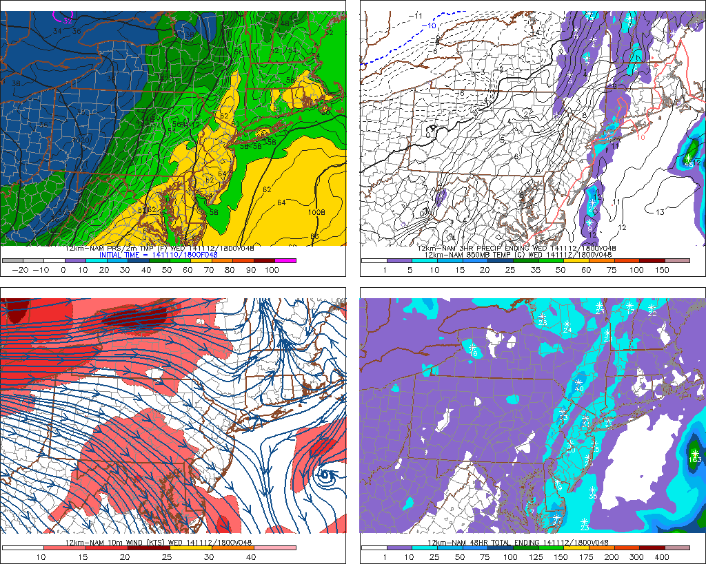
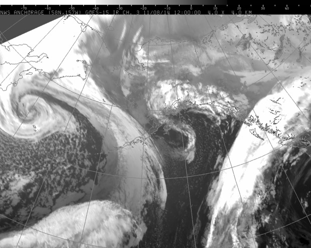
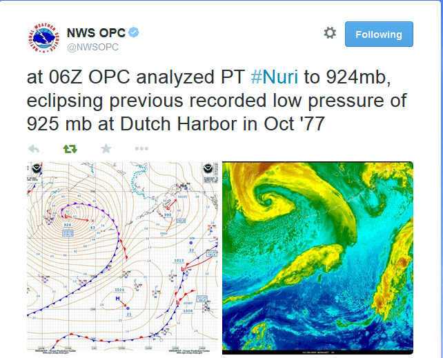
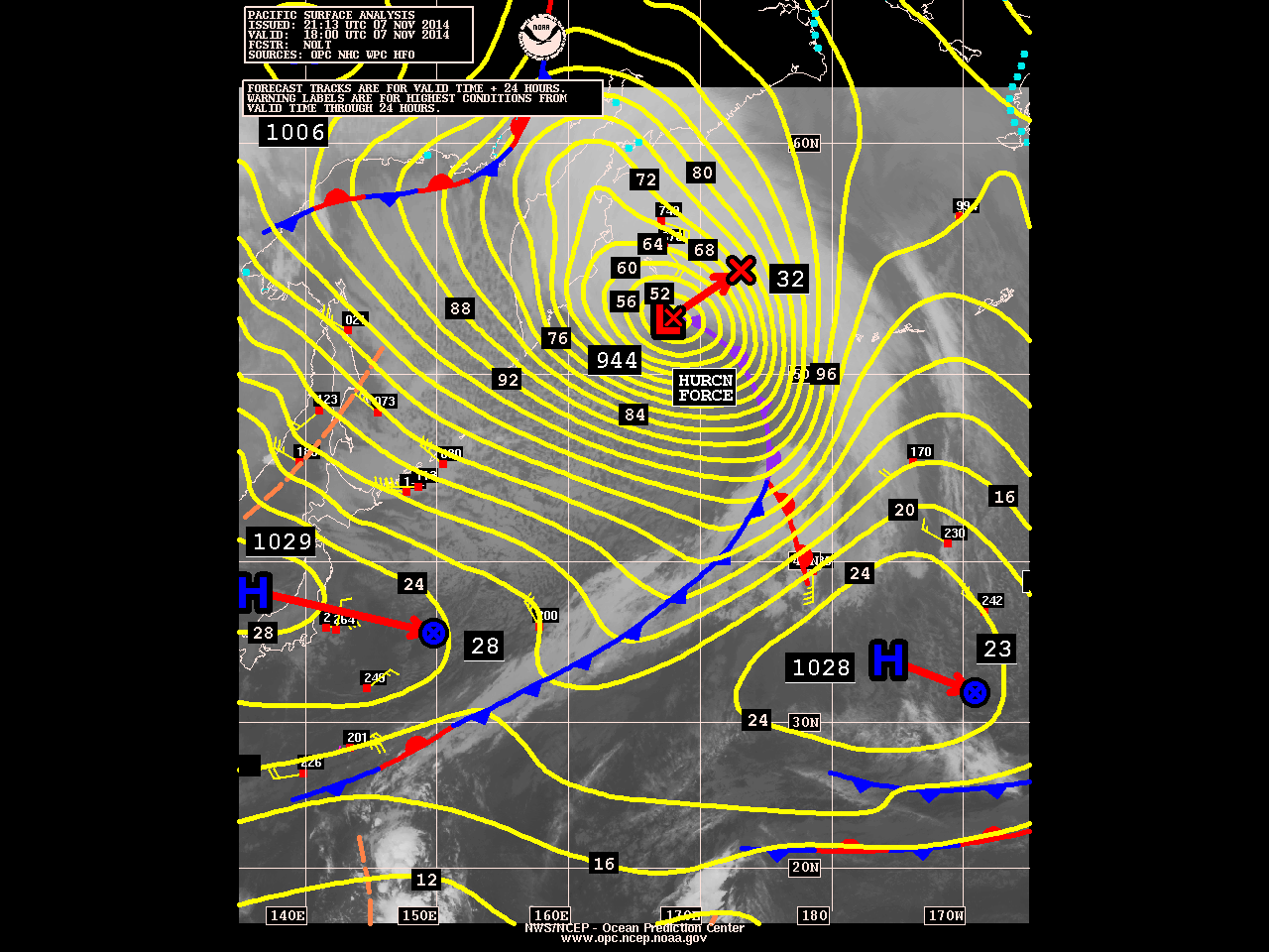
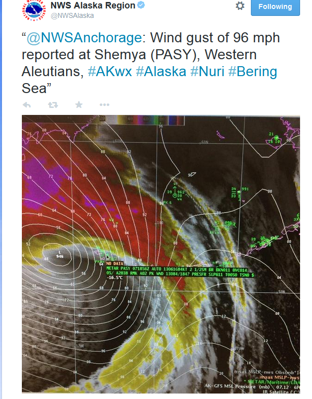
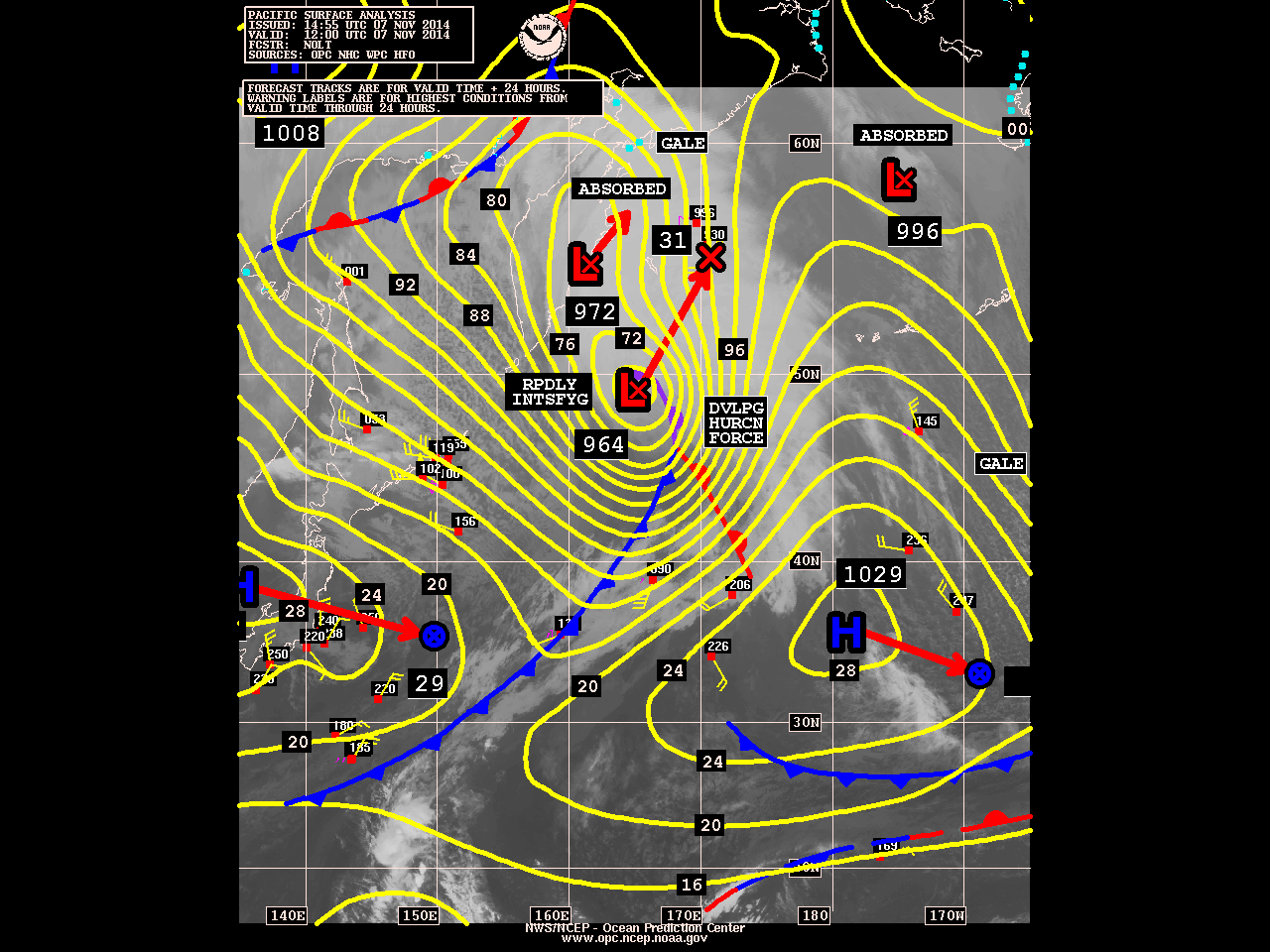
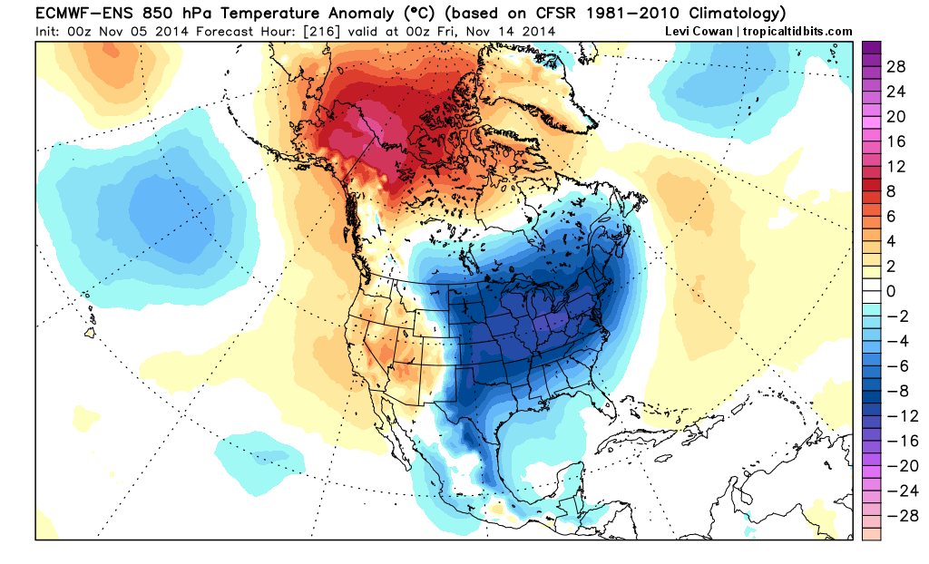
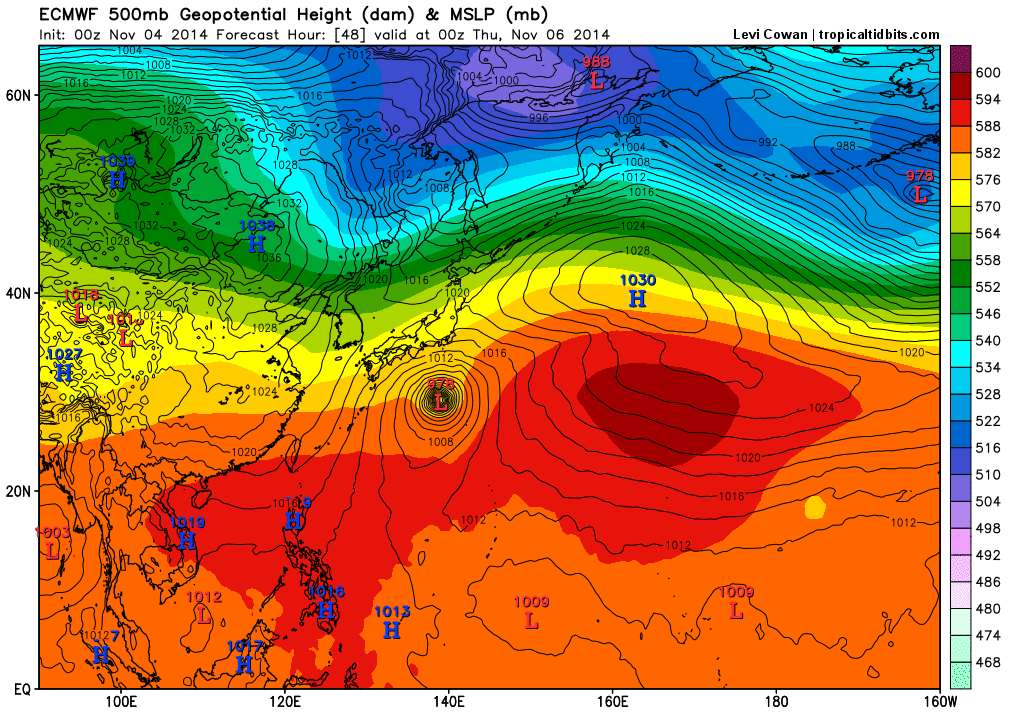
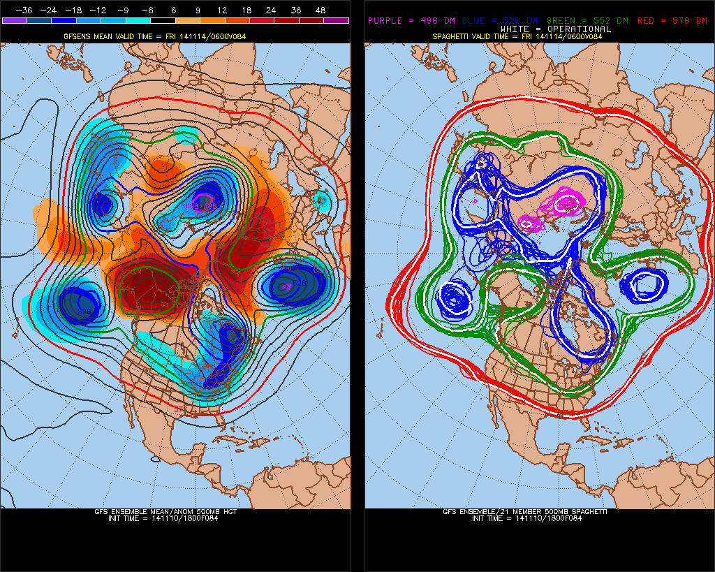
The models continue to show artic air pouring into the United States mainland this week. For the Tri-state area this will be a little delayed until the end of this week.  A huge blocking ridge developing over Alaska and NW Canada early this week, will the cause a trough with artic air to dump into Rockies and Midwest. This block was enhanced by the remnants of Supper Typhoon Nuri transitioning into the deepest extratropical storm, in the North Pacific, recorded. This trough will then move east, with strong cold front passing through Thursday night. Some light snow and rain is possible with front and upper-level disturbance. Surface temperatures will likely be too warm for any snowfall accumulations. Colder air will follow behind this front later Friday and Saturday.  Temperatures expected to be upper 30s to lower 40s for highs and morning lows in upper 20s to lower 30s. This is not brutal cold. But well below normal for mid-November.

The GEFS at 500mb. A blocking ridge over Alaska and Northwest Canada (known as -EPO). Positive height anomalies extending into Greenland and Iceland (known as an east-based -NAO)
The GEFS at 500mb. A blocking ridge over Alaska and Northwest Canada (known as -EPO). Also, positive height anomalies extending into Greenland and Iceland (known as an east-based -NAO)

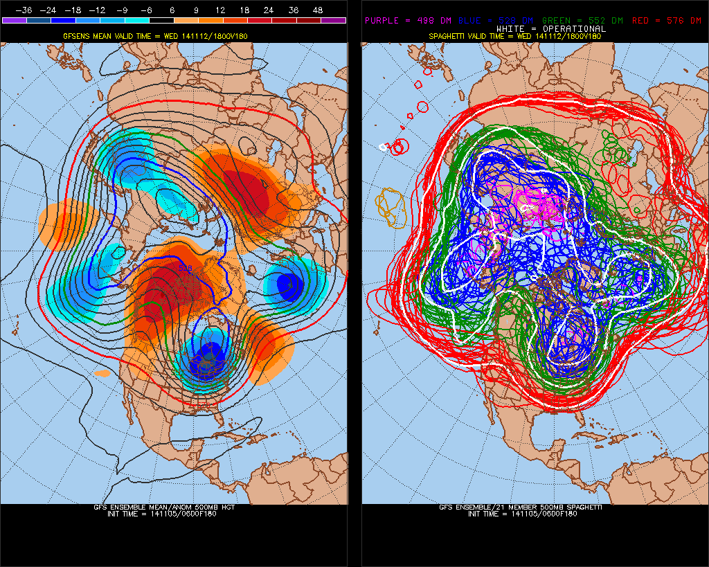
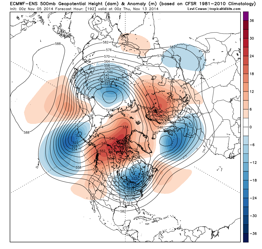
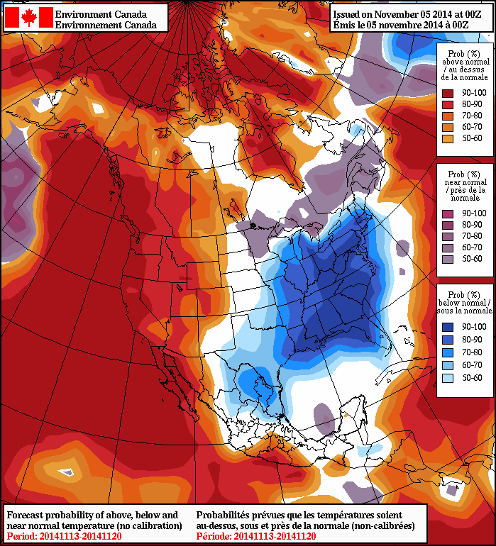
Another low over Great Lakes will be moving toward the east coast on Sunday. A secondary wave of low pressure will also be forming near Mid-Atlantic coast on Sunday. Some precipitation is likely for either or both systems sometime Sunday into next Monday. However, a southeasterly flow with a cold high moving offshore, will likely mean many areas will warm up enough for mostly rainfall.  Behind these systems is another anomalous cold airmass for this time of year. The -EPO ridge will also polar vortex drop over James Bay and an associated trough to dig into the Central and Eastern US. The east-based -NAO cause this trough to remain in place until the end of next week.

The GEFS showing the polar vortex over James Bay and trough over the Central and Eastern US.
The GEFS showing the polar vortex over James Bay and trough over the Central and Eastern US next Tuesday

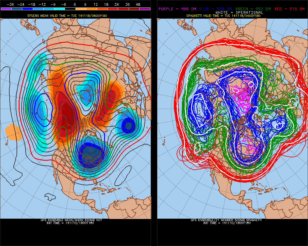
The polar vortex begins to lift out and elongate or split, at the end of next week. We will see temperatures moderate to back to normal. Meanwhile, subtropical disturbance will eject out Southwest US later next week. This disturbance could organize into a significant winter storm parts of the Northeast and Mid-Atlantic regions during the Nov. 20-23 period.  At this time, model or ensemble guidance is not going to resolve the details of this possible system. So I will watch for trends to develop on models through this week and beyond. But with such anomalous high-latitude blocking being forecast, going into late November, the chances for more wintry weather will likely increase.

Remnants of Former Super Typhoon Nuri Phasing into Very Deep Extratropical Low in the Bering Sea

The remnants of former Super Typhoon Nuri are just south of Bering Sea and phasing with another low to west. The storm is now rapidly intensifying and it expected to bring hurricane-force winds and high waves to the Aleutian Islands. Some models have this storm deepening below 925mb pressure. That will make it strongest extratropical storm (non-tropical in structure)  in that region ever. As it explained before, this storm will also help to change the pattern over North America to more wintry one starting next week.  However, there apparently some misconceptions out there about this pattern evolution.  Nuri will have no direct impact on the United States mainland and will not become the polar vortex. Nuri as powerful extratropical storm, will enhance a ridge already building into artic circle. Which cause the polar vortex in the troposphere, to split and then one large piece of it to dive down into Ontario and James Bay. This will transport an airmass of artic origin, into the United States from the Rockies to the East Coast. But it will not be brutally cold, because in November, airmass in the high latitudes are typically not as cold during the winter months. I will continue to posts updates here on pressure and impacts this storm will have over the Aleutian Islands and influence on pattern change.


10:15am Updates_4gvf

5:15am Saturday Update:

Tweet924mb


4:45pm Update:


18zpyba08ir

Tweet96mphgustpyba06ir

Cold Pattern Emerging For the Central & Eastern US Next Week

Enjoy the mild temperatures this week. There will be storm system tracking to west that will give us some rain on Thursday. But after that signficant pattern changes in northern hemispheric will begin to occur. Operational model and ensemble guidance showing a colder than normal pattern evolving for the second and third weeks of November. Starting this upcoming weekend, a ridge over Western North America cause more troughs to dig over the Eastern US. Then this ridge will build into the Artic circle and connect with the North Atlantic ridge over Greenland. This will cause the polar vortex to drop down into James Bay, next week. This will the cause AO and NAO to go negative as well.

6zGEFSf180

0zecmwf-ens_z500a_nhem_9In response to pattern changes, cold air will likely invade the CONUS next week. The 0z NAFES shows 50% or higher probabilities for below normal temperatures on average over the parts of the Central and Eastern US during the 11/13/14 to 11/20/14 period, at least. As well as 50% or higher probabilities for above normal temperatures over much of Western North America and Greenland. The ECMWF ensemble mean (courtesy of tropicaltidbits.com) also shows 850 temperature several degrees below normal across the Central and Eastern US later next week.

0zNAFES05

0zecmwf-ens_T850a_namer_10

The +PDO continues to be driver of this pattern. However, over the past several weeks, sea-surface temperatures over have cooled to below normal over parts of Northern Pacific. While sea-surface remain above normal over the Gulf of Alaska and near the West Coast of North America. This is now classic +PDO pattern. Which supports more troughiness over larger part of the Northern Pacific and ridge more inland over Western North America.  Meanwhile the sea-surface temperatures continue also warm over the ENSO regions in the Eastern Pacific. A weak el Nino is looking more likely later this month.

sst.daily.anom

Tyhoon Nuri in the Western Pacific will be recurving east of Japan (fortunately) then will phase into very deep extratropical bomb over the Bering Sea. Nuri will help empower the trough over Aleutians and force a stronger ridge to build over Western North Ameirca.This is a large mean trough center over Aleutian Islands, a strong ridge over Western North America and large trough that digs deep in the Eastern US.

ECNuriforecastA minor stratospheric warming event (moreso at 10mb) has also occurred over Siberia in late October. This warm anomaly has migrated into over into Artic Circle, Alaska and NW Canada this past weekend. This may be contributing to the block and ridge forming over Western North America, starting this weekend.

temp10anim

As far winter storm threats, we’ll just see how timing works out. Right now, there isn’t an ideal setup on the guidance for a winter storm in the tri-state area.  Such issues for the next two weeks. that come up, is that any -NAO looks transient, the west coast ridge axis is too far west, or the polar vortex is too intense.  The first few threats the models show often don’t materialize. Even if we had ideal setup, typically in November, interior areas are favored for snowfall and a northeast wind direction off warm ocean will keep coastal areas warmer with a wintry mix or just rain.