Severe Wx Outbreak to the West Today and Tomorrow

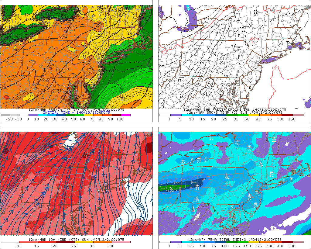
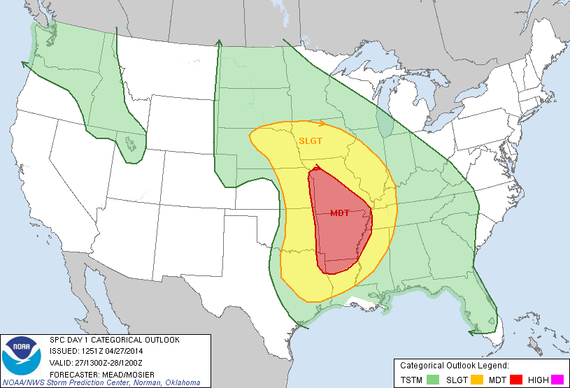
A strong storm and upper-level low taking a negative tilt will cause severe t-storms with potential of producing straight-line damaging winds, large hail and tornadoes are parts Central Plains and Mississippi River Valley. At this time, the storm prediction center in Norman, Oklahoma, has place much the area in moderate risk. However an upgrade to a high risk is possible later today:

day1otlk_1300
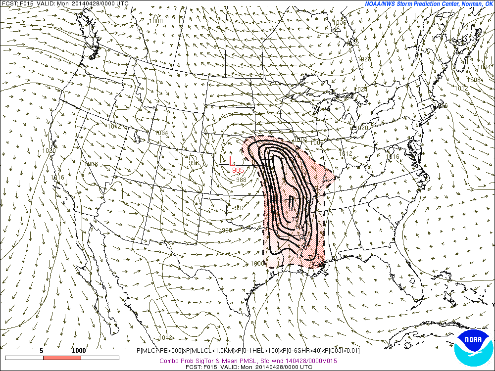
Curved low-level and mid-level jet streaks at over 50kts, will be providing directional shear and forcing. Surface dewpoints in the 60s and 70s, steepening lapse rates and high CAPE (convective available potential energy), will provide ample moisture and instability. Large, curved hodographs on the forecast models, also show potential for some strong tornadoes to form. Latest SREF at 9z today, has moderate and to high probabilities for ingredients for signficant tornadoes over large parts of Central and Lower Mississippi Valleys

SREF_prob_combined_sigtor__f015This severe wx outbreak like spread east into parts Ohio Valley and Tennessee Valley, later tonight and tomorrow. As this storm system and upper-level low begins to slowly move east. The threat for strong tornadoes will continue to exist. Slight risk and moderate risk have been issued by SPC:

day2otlk_0600

Potential for 70 Degree Warmth 4/11 – 4/14

A weakening cold front move through the day tomorrow. It will be accompanied by some some clouds and scattered showers. If there’s enough sunshine between the clouds tomorrow temperatures, may soar to near 70 degrees with westerly down slope winds tomorrow. A weak wave of low pressure will form along this cold tomorrow, with a period of steady rain tomorrow night. At this time, dynamics don’t appear to be supportive for heavy rainfall totals greater than .50″. This wave should move out the area by Saturday morning. Leading to skies to mostly sunny skies on Saturday afternoon, with light west or northwest winds causing temperatures to rise into the upper 60s to around 70 degrees over NE NJ and NYC. Sea-breezes developing tomorrow afternoon will keep the south shore of LI and the NJ shore in middle to upper 60s for highs tomorrow.

On Sunday, a warm front will attempt move across the area. However, most of guidance shows high pressure develops over the Atlantic, causing more SSE winds ahead of the front. Which will bring a marine airmass of the ocean. This may force the warm front to slow down or stall just southwest of NYC on Sunday afternoon. The south shore of NYC and Long Island may be stuck 40s or 50s with some low clouds and drizzle on Sunday. While inland areas sees more sunshine and temperatures rising into 60s or 70s.

18z NAM showing 70+ temps over Western NJ and 50s with drizzle over NYC, LI and the NJ and CT coasts.

On Monday,  the warm front is more likely to push northward over NE NJ and NYC. As stronger flow out the south-southwest develops, ahead a deep trough and strong cold front, approaching from the west. Temperatures in the 70s, should be more widespread across the Northeast NJ and NYC than on Sunday. Although sea-breeze developing along the coast, may push inland during middle and late afternoon hours. Dropping temperatures back into 60s or 50s.

On Tuesday, the cold front moves closer to the area. Precipitable water values increase to over 1.00″, with strong LLJ ahead of this front. Some heavy rainfall from showers and possible thunderstorms may occur.. This should keep high temperatures in the 60s, for most of the area. Behind this is cold front, are much colder temperatures. Highs may not get out 40s for Wednesday or Thursday. With possibility for record low temperatures in 30s or 20s. So while you maybe wearing shorts on Monday. You might not want to pack away the winter coats yet.


Suprise Snows after Heavy Weekend Rains

A narrow, band, behind a a cut-off low brought surprise snowfall 2″ – 6″ for parts of Central Long Island and Central Connecticut, this morning. Even thundersnow was reported over at Islip, NY, with snowfall rates up 3″ per hour and visibility down to 1/8th  of a mile. The rest of the area saw rain mix or change to some wet snow and sleet, when more intense rates of precipitation  at times. This was due to colder air aloft, being dragged down to the surface. But little or no accumulation occurred.

OKX radar showing narrow frontogentic band over Central LI and CT
OKX radar from wunderground.com showing narrow frontogentic band over Central LI and CT

So what caused this heavy snow band? One cause for this some frontogenetic forcing occurring behind the cut-off low.  Another cause was instability.  The OKX sounding was unstable with mid-lapse rates over 7.0 C/km. This produced convective banding with thunder over Central LI and CT :

OKX sounding at 12 UTC time. Showing steep mid-level lapes rates
OKX sounding at 7am time, showing 3-6km agl and 700-500mb lapse rates 7.0 C/km and higher

Models showed this the last 3 days, showed that this band would form. But they were less consistent, on the timing, and placement. As well amount of dynamic cooling that would need to occur for snow to accumulate. Add on that it’s end of March, when it’s typically more difficult to get boundary temperatures to support snow. Especially along the coast. So considering those factors, it just wasn’t a likelyhood and a good move beforehand to forecast 2″-6″ for any specific area. Despite the outcome. However, we can use what we  learned from it, to improve forecasts in the future.

This cut-off low also gave us heavy rains and thunderstorms, this past weekend. Many received between 1.50″ to 3.00″ of rain.  As discussed in the previous blog post, a 50-60kt low-level jet move through area with pwats over 1.00″. This enhanced deep moist convergence, along a warm front over eastern parts of LI and CT most early Sunday morning. Causing elevated convection to train over these areas and increase rainfall totals to 3.50″ – 5.50″

dlcp_14033004