Nor’easter Mostly A Miss

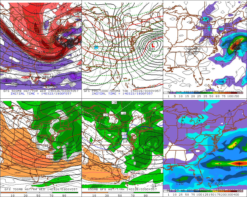
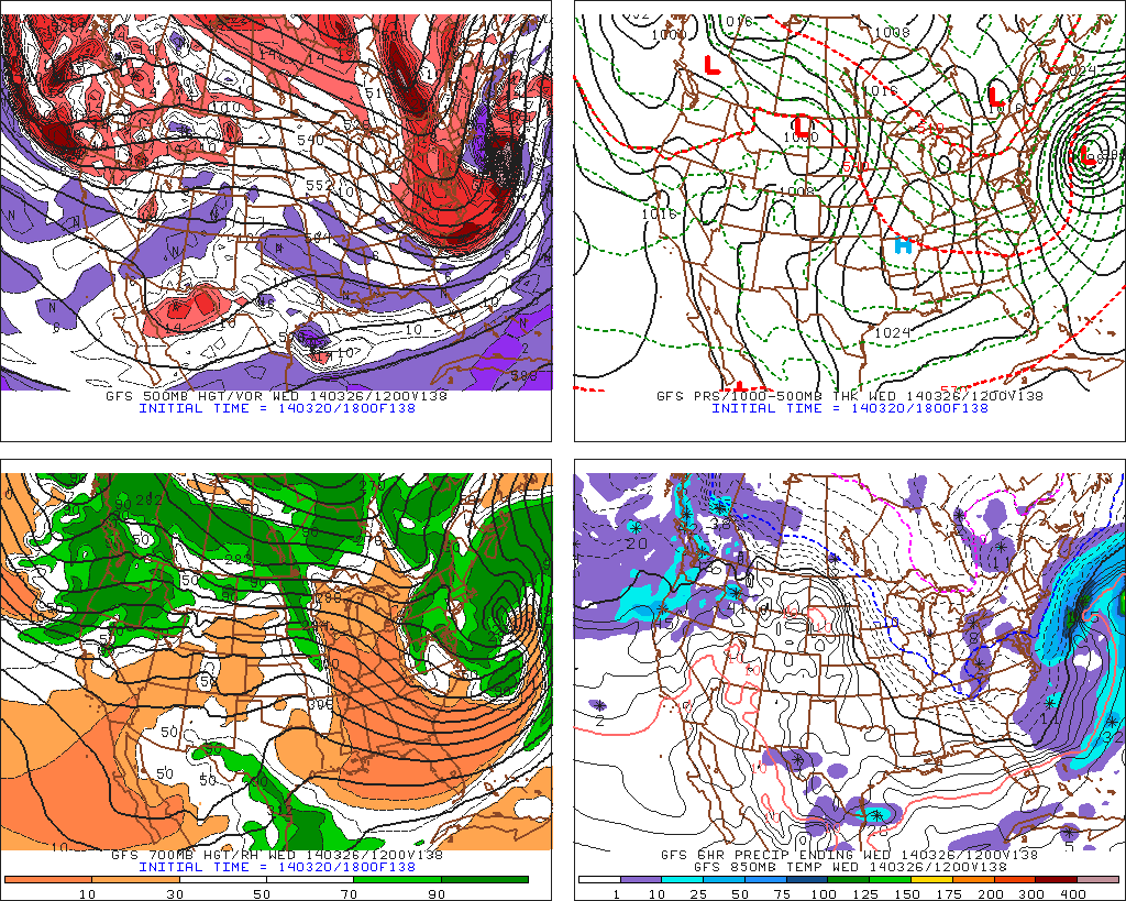
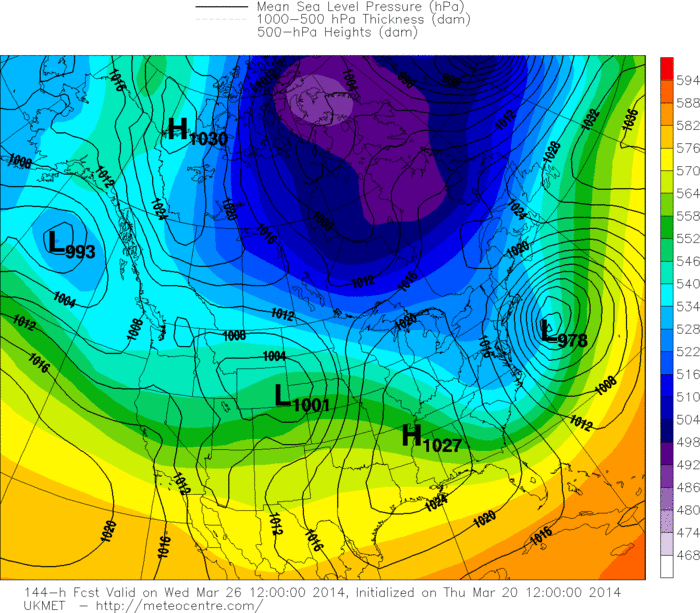
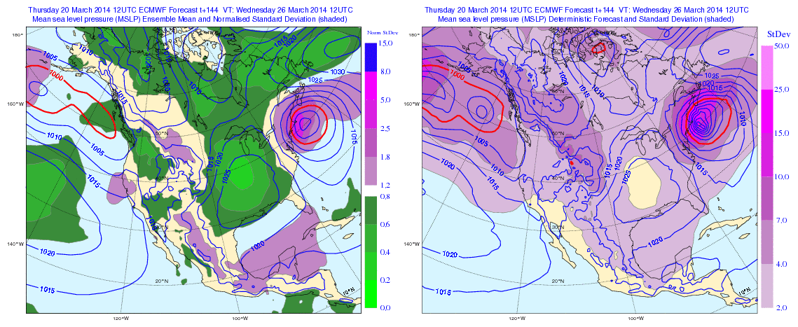
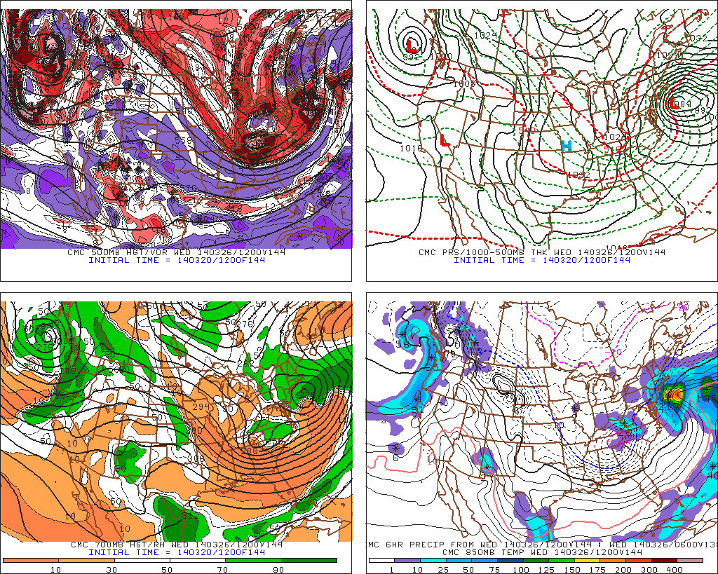
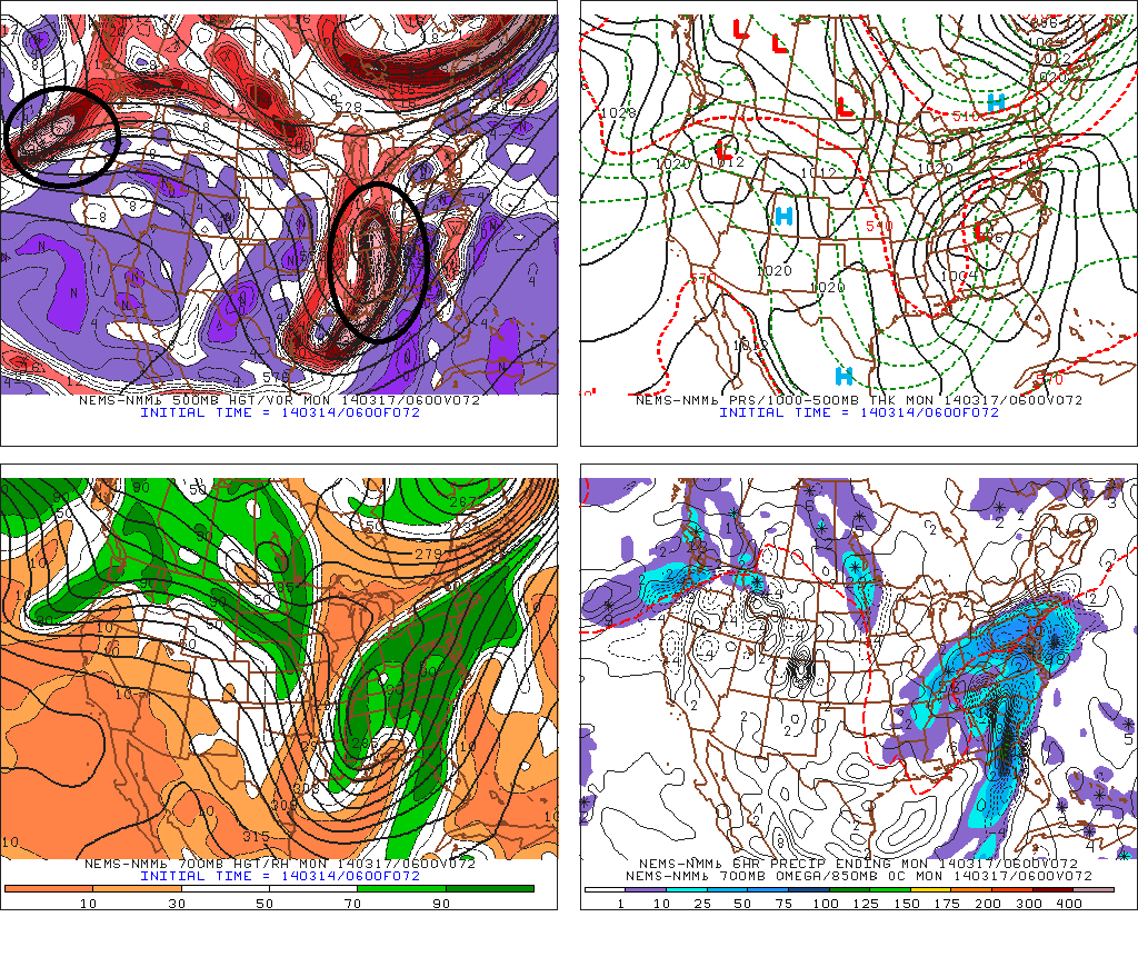
A powerful nor’easter will form off the East Coast, on Tuesday night and Wednesday. But model guidance have consensus that this storm will stay far enough east of our area. Sparing the tri-state area of major snowfall and strong winds. As I previous discussed in the last blog post, there were  number factors that had to be resolved for this storm to come together. All guidance is now in consistent agreement, that the Pacific upper-level low will open up into smaller systems and the coming into West Coast faster. Another lobe of polar vortex coming down from Central Canada, will also aid breaking down ridge further.  This causes a broader trough over the Eastern US and later, sloppy phasing of northern and southern stream disturbances.  The end result a storm slower to organize off Mid-Atlantic coast. By the time this consolidates into one very deep storm, it’s more than 200 miles east of New Jersey.

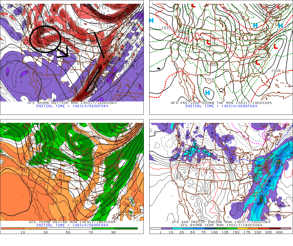
A lighter snowfall is still possible for parts of the area Tuesday late afternoon and night. The guidance has been showing an inverted trough extending from the storm offshore. However, this placement and intensity of this feature is often difficult for models to handle. The 18z NAM today shows  inverted trough with a moderate band of snow reach the NJ shore. While the 18z GFS just shows scattered snow showers with the inverted trough. Both model notably keep the 500mb vort max and PVA well south of the area. Which leads me to believe this feature will not be very impressive for region. I will still monitor this storm for any changes. But at this time it’s not looking like big deal for our area.

18zNAMf57

18zGFSf57

Nor’easter Possible Tuesday into Wednesday

Models and ensembles are staring to converge powerful nor’easter form off the East coast for Tuesday into Wednesday. However, some of the guidance keeps this storm far enough east, for just a glancing blow or close miss. While other guidance brings this storm farther west, giving us more heavy precipitation and strong winds. It is too early to say, which solutions are most likely are correct. The number one thing to keep in mind, is the lack of any Greenland Block. So this storm having a major impact on our area, will be dependent on phasing occurring at the right time. The main features to watch over the next several days are:

1. Pacific upper-level low and West Coast Ridge placement. A strong West Coast ridge with be initially supported by the deep ULL over the NE Pacific. However if that low moves east over NW coast faster, the West coast ridge will collapse east. This will give energy along the trough far less time to amplify and phase.

2. 50/50 low development. This low forcing the flow and heights to buckle along East Coast and cause phasing.  Some of the guidance shows storm intensifying near Newfoundland, that could act a 50/50 low. However, this feature seems overall weak and progressive, with the lack of blocking in the Atlantic.

3. Timing  of northern and southern stream energy. With the lack the blocking, the southern stream energy will try to escape further east. The northern stream beeds to catch up with this energy and phase sooner, for a storm track closer to the coast. The UKMET, GFS and it’s ensembles are slower in phasing the two streams than the ECMWF and it’s ensembles. Which result in low farther east.

18zGFSf13812zUKMET144hr12zMSLP_North32America_144

4. PV lobe dropping from Canada. If this feature were to dig into south into Midwest, this would pull trough back west and capture the southern stream low. Resulting a major phasing. Right now, only the GGEM and it’s ensembles shows this scenario.

12zGGEMf1445. High pressure moving out into the Atlantic. Unlike March last week, this will not prevent a more amplifed/phased storm from coming north. The guidance is actually more in agreement here.

These features and more will have an influence on final track and intensity of this storm. So trends with the features on the models, need to be monitored over next few days. Once these are are found, then we can discuss more details. Stay tuned for more blog posts and more frequent updates in the 7-day forecasts.

Winter Storm Possible Sunday Night into Monday

Fri evening update: Latest guidance now keeps accumulating snow south of NYC. Due the less interaction between northern and southern streams. As well as a stronger high pressure over the Great Lakes/Northeast. My confidence is increasing that this will occur. But will continue to monitor for any changes. Look at 7-day forecast for updates.

Guidance shows another winter storm possibly for late Sunday night into Monday. What complicates this winter storm threat, are models handling of another system coming into Pacific NW and flattening heights over the Western US. Each model has slight differently 500mb pattern that results in different impacts in our area.

The 0z ECMWF and 6z GFS hangs back more southern stream energy over Gulf coast. While also showing a little northern stream interaction. This more strung out area of low pressure with two waves that remain weak and farther east. The reason for this because Pacific system has already moving into Northern Rockies.  These solutions would keeper is colder and drier.give a light to moderate snowfall for the tri-state area:

0zEC96hr

6zGFS84hrThe 0z CMC model is showing  more southern stream energy coming out and interacting with northern stream energy. This results in a stronger first wave and the second wave coming further north. The reason this can happen here, is that Pacific system is little slower coming into the Northern Rockies. Strong high pressure will also be supply us with cold air and enhance a thermal gradient just to our south.. This solution would result in moderate to significant snowfall for much of the tri-state area.

0zCMC84hrThe 6z NAM has more phasing between northern and southern streams. Therefore has more consolidated storm, tracking further west. The reason it is able to do this, is because Pacific system is much slower coming into NW coast and heights remain stronger over Northern Rockies. This solution would actually cause more warmer air to surge aloft, changing many of us over from heavy snow to sleet or freezing rain:

6zNAMf786zNAMf84 ECMWF,GFS, GGEM all have support form their ensemble means. The ECMWF and GFS , have a little more support from the current progressive pattern, as well. However, the GGEM has been most consistent with ejection of more southern stream energy. So it’s solutions should be strongly weighed here. The NAM at this range is unreliable for winter storms. So I would be wary of it, without any other model support. Models will get a better on all this energy as it comes onshore the next few days. I will have another update this evening, with new set of models runs.