Heavy Rain & Gusty Winds This Evening, Very Cold Air Arrives Late Tonight &Tomorrow

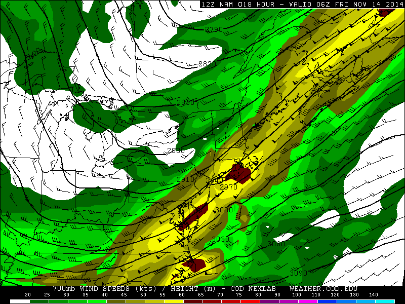
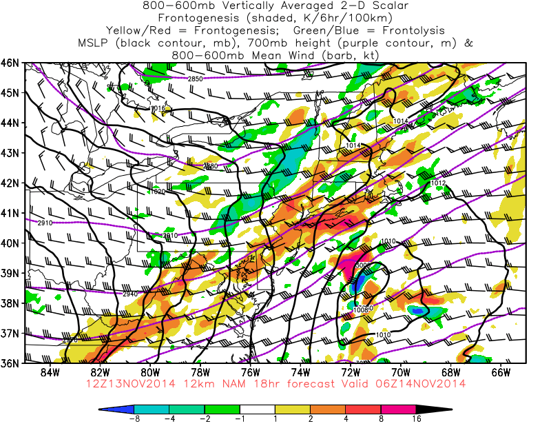
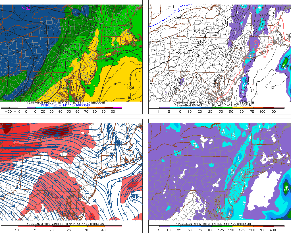
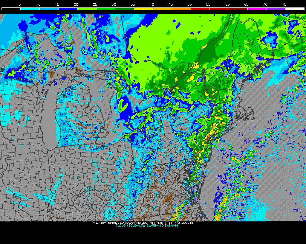
First batch of steady rain is moving through early this morning.  Rain will become lighter and intermittent late this morning and early this afternoon. Before another batch of steadier and heavier rain arrives later this afternoon with a weak triple-point low passing just northwest of the area. The warm front with low, to push from SE to NW this afternoon, causing temperatures to rising through 40s and into 50s this afternoon. Some parts of Long Island and New Jersey Shore may briefly get into the warm sector with temperatures in the lower 60s.  Before a strong cold front from west approaches this evening. A strong southwesterly LLJ, will be passing overhead this evening. This will enhance lift and moisture along the cold front coming and cause more rain, heavy at times over the Tri-State area.

6z NAM showing 925mb winds 50-70kts for the coastal areas

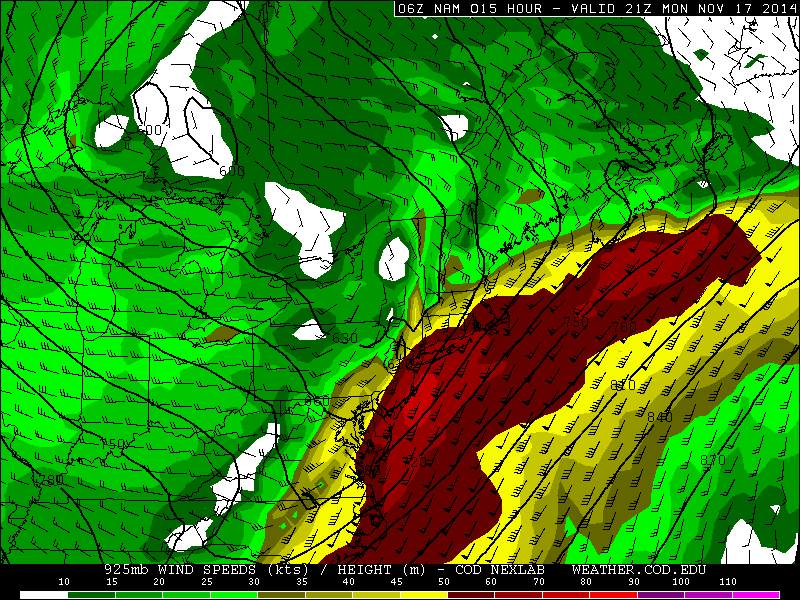
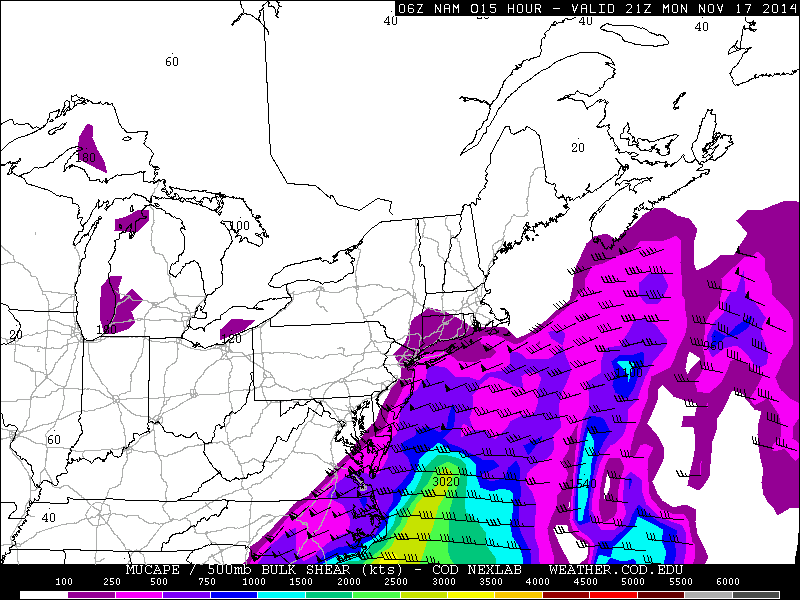
Winds late this afternoon and evening will increase to 15mph to 25mph with higher gusts up to 35mph, near the coast. An inversion layer around 925mb is forecast to keep much stronger winds will the low-level jet from mixing down to surface. However, elevated instability will be on the increase tonight in the warm sector. This can produce some isolated thunderstorms that may contain wind gusts over 50mph. Especially over parts of Long Island and the New Jersey coast. Rain and isolated thunderstorms should end, after the cold front passage later tonight.

6z NAM showing elevated instability
6z NAM showing MUCAPE values increasing 250-500 J/kg over Long Island and New Jersey shore by 5pm
6z 4km WRF showing convection with heavy rainfall in the NYC Metro this evening

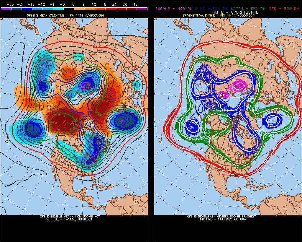
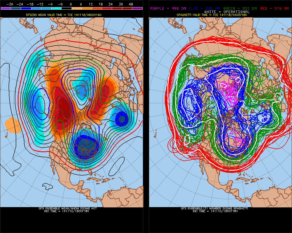
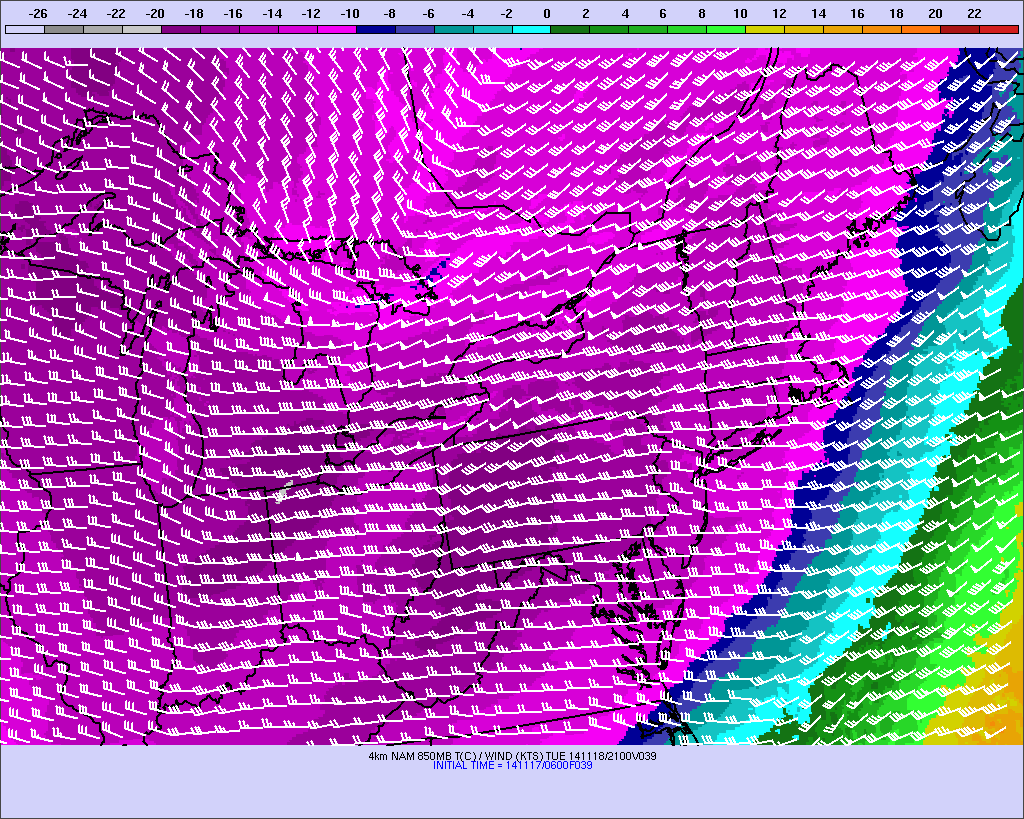
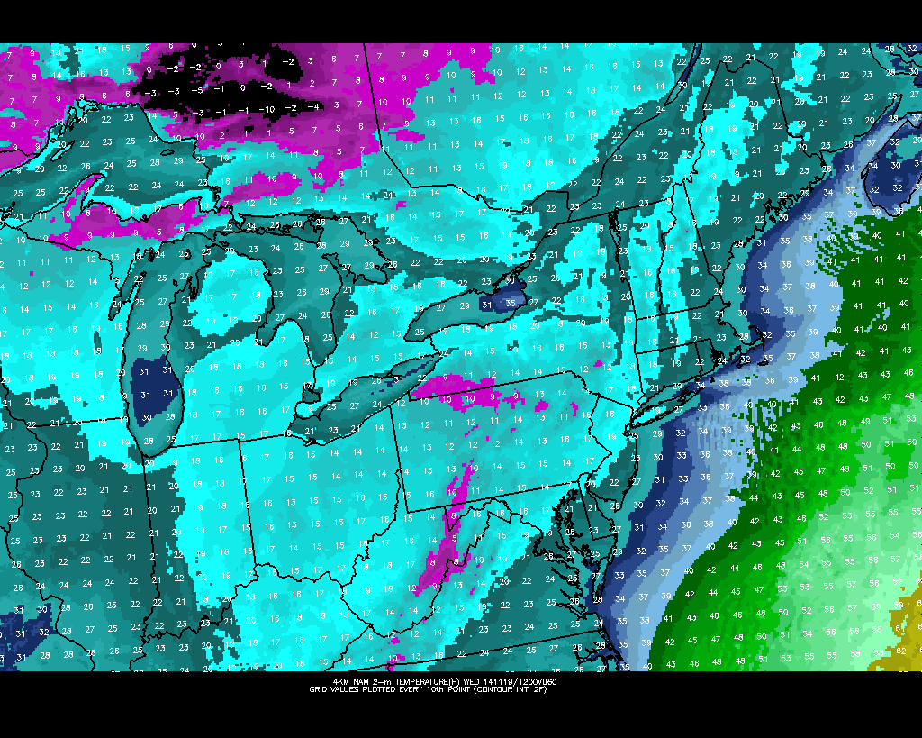
Coldest air of the fall season will arrive later tonight. This is some unusually cold air for the middle of November. This type of airmass is more what you expect in late December or January.  Despite lots of sunshine, 850mb temperatures decreasing to -16C will keep temperatures mostly in middle 20s to lower 30s tomorrow.  Wednesday morning temperatures may in the lower 20s or even the teens in across over much of the area.  Temperatures on Tuesday and Wednesday may as much as 20 degrees below normal for this time of year.

6z NAM 850mb temperatures dropping to near -16C tomorrow
6z NAM 850mb temperatures dropping to near -16C tomorrow afternoon
6z 4km NAM showing temperatures in the teens on Wednesday morning
6z 4km NAM showing 2-meter temperatures in the teens on Wednesday morning

Southwest winds will allow temperatures to rise back into 40s on Thursday. Before another cold shot of air arrives on Friday and last into Saturday. High temperatures will likely be upper 30s to lower 40s. However, it also looks mainly dry. As the flow becomes too progressive for trough amplification or northern and southern streams to phase along the east coast.A moderating trend will begin Sunday again, as trough start dig over Central US and ridge start build over the East Coast. Temperatures may once again to return near or above normal going into early next week. The next storm system during this period will likely track to well to our west and bring only rainfall to our region.

First Snowflakes Likely Tonight for the Tri-State Area

Many of us, especially if we are up past midnight, we’ll likely see our first snowflakes tonight for the upcoming winter season An upper-level disturbance (shortwave trough) and wave low pressure form well off the coast will produce some light precipitation area tonight and early tomorrow morning. The low offshore will develop to late for our area to have more significant impacts. But this low will help transport some moisture off the Atlantic into region.  Lifting ahead of shortwave trough with be increasing, due to a strengthening mid-level jet streak and mid-level frontogenesis, will cause light rain and snow throughout the area tonight.

12z NAM strengthen 700mb jet sreak
12z NAM showing a strengthening  jet streak at 700mb (10,000 ft)
12z NAM showing moderate frontogenesis over the Tri-State area from 600mb to 800mb

Precipitation will start as wet snow or a brief mix of snow and rain for the inland areas north and west of New York City this evening. For coastal locations, temperatures aloft at 925 mb (2,500 ft) will be initially be warm enough for rain. Then as colder air will continue filtering into region overnight that rain should mix and change to wet snow before tapering off around daybreak. As temperatures drop into lower or middle 30s. Inland areas north and west of New York City, could start see snow accumulate on untreated roads, car tops, grassy areas, and other colder surfaces. A coating to 1″ is possible for these areas. For New York City and other coastal locations, surface temperatures will only drop into middle to upper 30s, before precipitation ends. So very little if any accumulation is expected, for these areas.

High resolution models 4km NMM and ARW showing snow
High resolution models the NMM and ARW showing rain changing to snow for a few hours after midnight down in the tri-state region

This entire system move out early tomorrow morning. Expect skies to clear for sunshine. But with a cold airmass in place, high temperatures will only get into lower to mid 40s in the afternoon. Saturday looks to be mostly sunny and cold as with high temperatures only in the upper 30s to lower 40s.

Mild Temperatures Through Wednesday, Artic Air Arrives By Friday

Today’s temperatures rose in the lower 60s. Tuesday and Wednesday high temperatures will also be in lower to middle 60s. As we remain in a mild airmass, in advance of artic blast later this week. We will be in between two systems Tuesday night and Wednesday. A low moving over the Great Lakes and coastal storm moving well southeast of the area. A surface trough extending from the offshore storm and cold front from the Great Lakes low could produce some scattered showers in the Tri-State area, during this time frame.

The NAM showing tempeatures in lower 60s and scattered showers  in parts of the area on Wednesday.
The NAM showing temperatures in lower 60s and scattered showers in parts of the area on Wednesday

The models continue to show artic air pouring into the United States mainland this week. For the Tri-state area this will be a little delayed until the end of this week.  A huge blocking ridge developing over Alaska and NW Canada early this week, will the cause a trough with artic air to dump into Rockies and Midwest. This block was enhanced by the remnants of Supper Typhoon Nuri transitioning into the deepest extratropical storm, in the North Pacific, recorded. This trough will then move east, with strong cold front passing through Thursday night. Some light snow and rain is possible with front and upper-level disturbance. Surface temperatures will likely be too warm for any snowfall accumulations. Colder air will follow behind this front later Friday and Saturday.  Temperatures expected to be upper 30s to lower 40s for highs and morning lows in upper 20s to lower 30s. This is not brutal cold. But well below normal for mid-November.

The GEFS at 500mb. A blocking ridge over Alaska and Northwest Canada (known as -EPO). Positive height anomalies extending into Greenland and Iceland (known as an east-based -NAO)
The GEFS at 500mb. A blocking ridge over Alaska and Northwest Canada (known as -EPO). Also, positive height anomalies extending into Greenland and Iceland (known as an east-based -NAO)

Another low over Great Lakes will be moving toward the east coast on Sunday. A secondary wave of low pressure will also be forming near Mid-Atlantic coast on Sunday. Some precipitation is likely for either or both systems sometime Sunday into next Monday. However, a southeasterly flow with a cold high moving offshore, will likely mean many areas will warm up enough for mostly rainfall.  Behind these systems is another anomalous cold airmass for this time of year. The -EPO ridge will also polar vortex drop over James Bay and an associated trough to dig into the Central and Eastern US. The east-based -NAO cause this trough to remain in place until the end of next week.

The GEFS showing the polar vortex over James Bay and trough over the Central and Eastern US.
The GEFS showing the polar vortex over James Bay and trough over the Central and Eastern US next Tuesday

The polar vortex begins to lift out and elongate or split, at the end of next week. We will see temperatures moderate to back to normal. Meanwhile, subtropical disturbance will eject out Southwest US later next week. This disturbance could organize into a significant winter storm parts of the Northeast and Mid-Atlantic regions during the Nov. 20-23 period.  At this time, model or ensemble guidance is not going to resolve the details of this possible system. So I will watch for trends to develop on models through this week and beyond. But with such anomalous high-latitude blocking being forecast, going into late November, the chances for more wintry weather will likely increase.