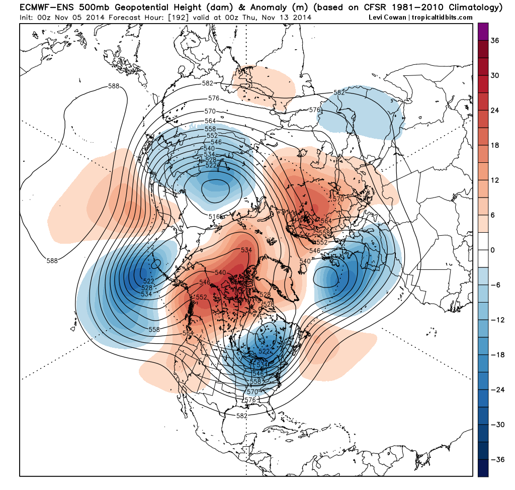
Enjoy the mild temperatures this week. There will be storm system tracking to west that will give us some rain on Thursday. But after that signficant pattern changes in northern hemispheric will begin to occur. Operational model and ensemble guidance showing a colder than normal pattern evolving for the second and third weeks of November. Starting this upcoming weekend, a ridge over Western North America cause more troughs to dig over the Eastern US. Then this ridge will build into the Artic circle and connect with the North Atlantic ridge over Greenland. This will cause the polar vortex to drop down into James Bay, next week. This will the cause AO and NAO to go negative as well.

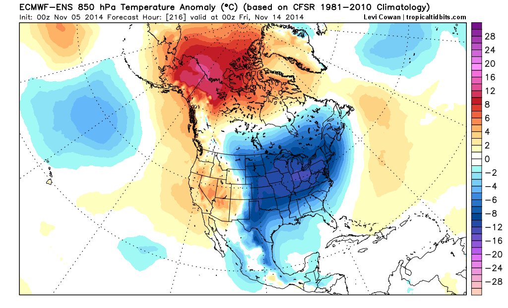
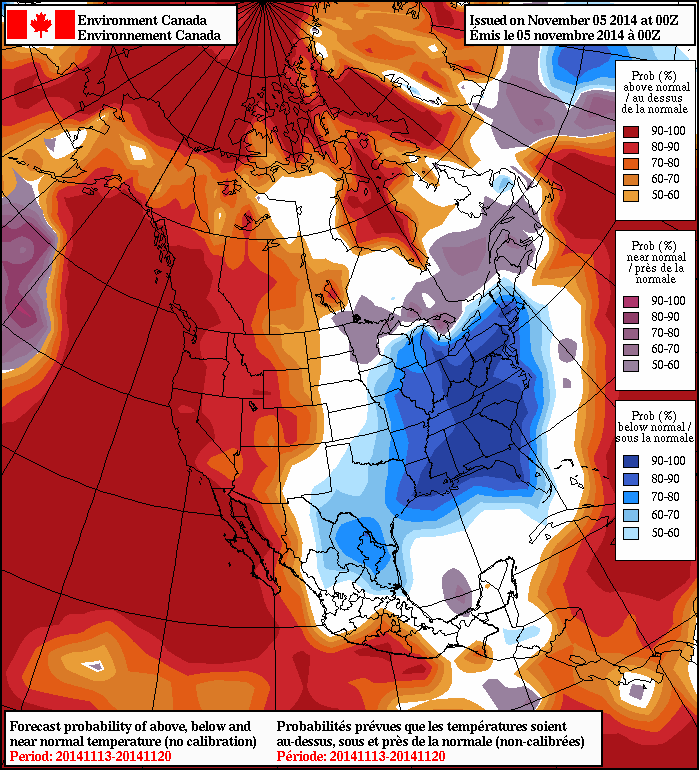
 In response to pattern changes, cold air will likely invade the CONUS next week. The 0z NAFES shows 50% or higher probabilities for below normal temperatures on average over the parts of the Central and Eastern US during the 11/13/14 to 11/20/14 period, at least. As well as 50% or higher probabilities for above normal temperatures over much of Western North America and Greenland. The ECMWF ensemble mean (courtesy of tropicaltidbits.com) also shows 850 temperature several degrees below normal across the Central and Eastern US later next week.

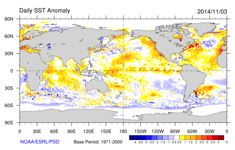
The +PDO continues to be driver of this pattern. However, over the past several weeks, sea-surface temperatures over have cooled to below normal over parts of Northern Pacific. While sea-surface remain above normal over the Gulf of Alaska and near the West Coast of North America. This is now classic +PDO pattern. Which supports more troughiness over larger part of the Northern Pacific and ridge more inland over Western North America. Meanwhile the sea-surface temperatures continue also warm over the ENSO regions in the Eastern Pacific. A weak el Nino is looking more likely later this month.

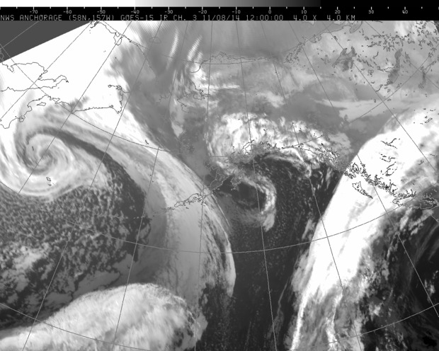
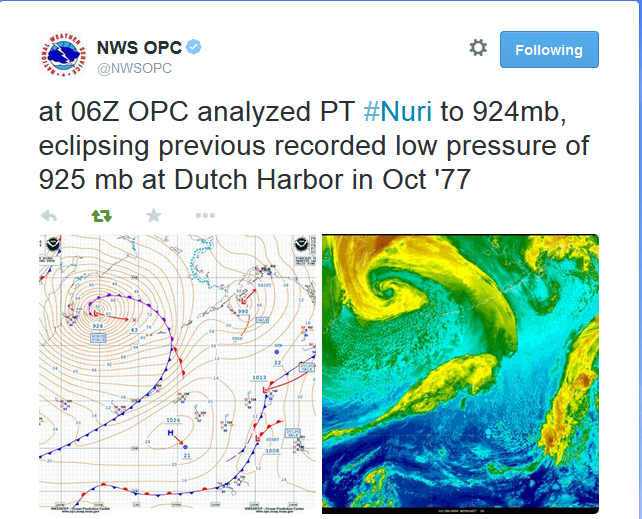
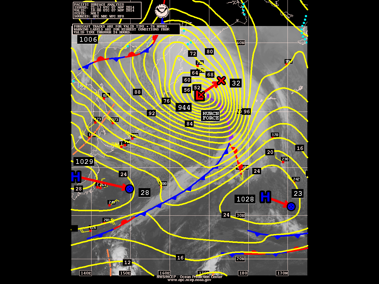
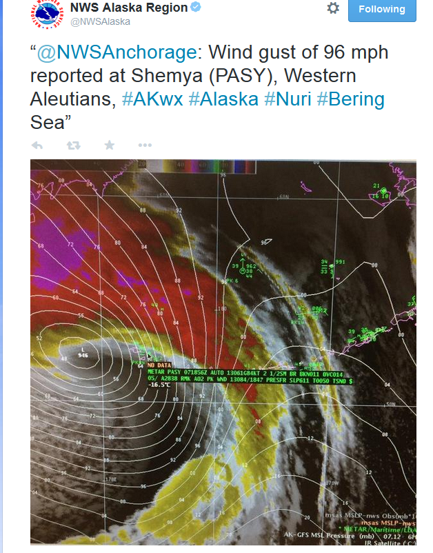
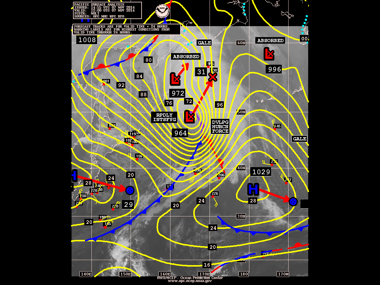
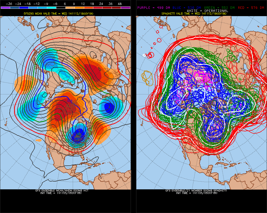
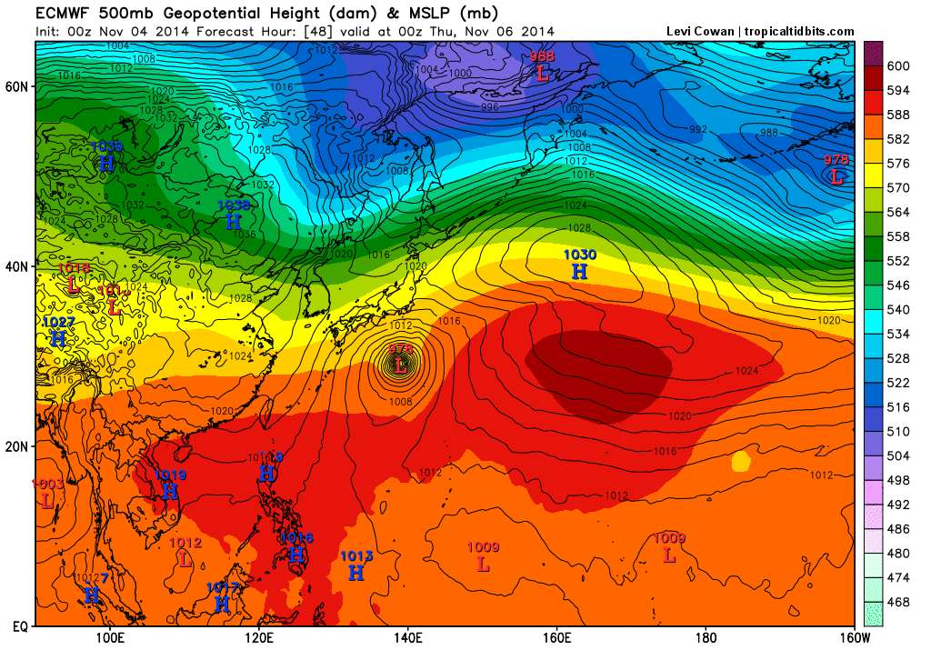
Tyhoon Nuri in the Western Pacific will be recurving east of Japan (fortunately) then will phase into very deep extratropical bomb over the Bering Sea. Nuri will help empower the trough over Aleutians and force a stronger ridge to build over Western North Ameirca.This is a large mean trough center over Aleutian Islands, a strong ridge over Western North America and large trough that digs deep in the Eastern US.
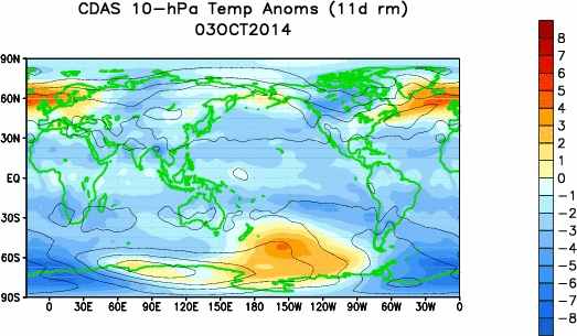
 A minor stratospheric warming event (moreso at 10mb) has also occurred over Siberia in late October. This warm anomaly has migrated into over into Artic Circle, Alaska and NW Canada this past weekend. This may be contributing to the block and ridge forming over Western North America, starting this weekend.

As far winter storm threats, we’ll just see how timing works out. Right now, there isn’t an ideal setup on the guidance for a winter storm in the tri-state area. Such issues for the next two weeks. that come up, is that any -NAO looks transient, the west coast ridge axis is too far west, or the polar vortex is too intense. The first few threats the models show often don’t materialize. Even if we had ideal setup, typically in November, interior areas are favored for snowfall and a northeast wind direction off warm ocean will keep coastal areas warmer with a wintry mix or just rain.