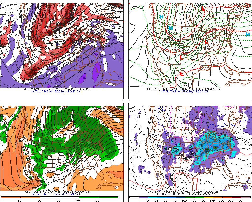
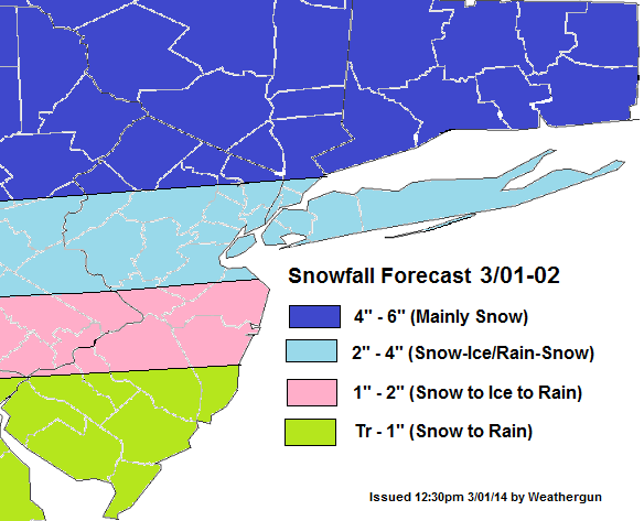
The latest models appear to becoming together on colder and wetter solution for the Tri-state on Sunday afternoon and night. The shortwave trough will cause weak low to from just off the New Jersey or Delaware shores. This will transport more moisture into area and cause the warm front to lift more slowly through region. A strong 700mb-850mb west-southwest jet will also enhance a thermal gradient that will enhancing lifting. At this time, appears most likely over NE NJ, NYC and LI. Models soundings show a warm layer near 900mb that will cause change over to freezing rain for a few hours Sunday evening, in these areas. Before ending as some light snow around daybreak Monday.Just north of this gradient is where precipitation is likely to fall mainly in the form of snow. Although, it’s not of the question some parts of there is brief mix with sleet/freezing rain.

The forecast below a blend of American and Canadian models. Leaning more toward NAM thermal profiles and leaning more towards RGEM/GGEM and GFS liquid forecasts. So this forecast may be update later tonight, after viewing more guidance:
The storm late Tuesday and Wednesday still appears to track over Ohio Valley and Great Lakes. This will cause any frozen precipitation to quickly changeover to rain in our area. However, latest models are indication that this storm’s cold front may slow down with more waves forming along it Wednesday night and Thursday. The outcome comes to the placement of the frontal boundary, the timing of waves moving up the front and whether the upper-level trough can take a more neutral or negative tilt. I will keep an eye on it and hopefully have another update later.