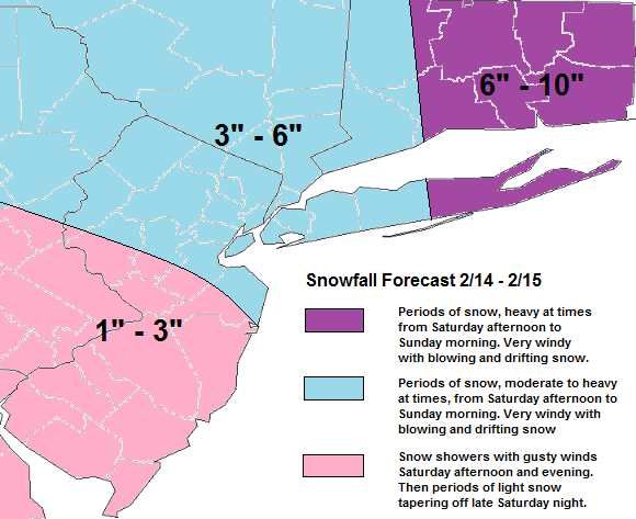
A polar shortwave at 500mb and clipper low at the surface will dive south towards the Northern Mid-Atlantic coast this weekend. Then close off at 500mb and rapidly intensifisy as it heads offshore. The snowfall forecast below is my guess how much snow will fall in general. How this forecast is not easy, as there several areas of lift on models on focusing of banding. Some of these band can produce heavier snowfall in some areas. While time same creating subsidence for other areas. So snowfall may seem to be as uniform as portrayed here. As storm explodes offshore, the pressure gradient with tighten and high winds become an issue. There is potential for damaging wind gusts over 60mph. Saturday night and Sunday morning. Stay tuned for more details and updates on this storm, as necessary tonight and tomorrow.