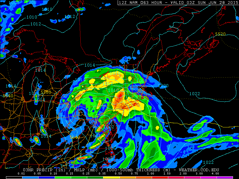
High pressure will gradually shift to the northeast Friday night and Saturday. Clouds will increase on Friday night. An amplifying ridge over the Western United States, will cause shortwave energy to dig and form into closed upper-level low over the Ohio Valley/Great Lakes. This will cause a double-barbell surface low-pressure system to organize over the Eastern US on Saturday. A deep southerly flow will transport a plume of moisture from the Gulf of Mexico and the Atlantic into our area. Most of the model guidance agrees on a widespread heavy rainfall throughout the area starting during on Saturday and continue into Saturday night. Saturday will feature mostly cloudy and skies with some intermittent rain and drizzle breaking out from southwest to northwest across the region, during the morning and early afternoon hours on Saturday. A strengthening southerly low-level jet and precipitable water values approaching two inches will cause rain to become steadier and heavier at times, late in the afternoon and early Saturday night for the region. Some of the model guidance shows some elevated instability. So there will there could also be isolated thunderstorm as well. Rainfall totals in excess of 1 or 2 inches are possible and could be enough to cause some flooding in poor drainage or low-lying areas. As surface low pressure and dynamics shift north of the area, rain will begin taper off to lighter showers late Saturday night.
Basically, Saturday is not looking like a nice day overall for outdoor activities. Especially during the afternoon and nighttime hours. However, Sunday is now looking better with clouds breaking for some sunshine, during the day. Some isolated or widely-scattered showers can’t be ruled out with the closed upper-level low hanging around the Northeast. This is more likely away from the coast. But most of the day, will be rain-free, with drier air entering the region. So if you planning a BBQ or going to the beach, Sunday is best day too do it. We will have updates here with our blog posts or forecasts, if there are any significant changes. Have a great weekend!
