As expected the heat has returned over the last two days with a vengeance. Temperatures been in the middle 90s. Humidity hasn’t been too high though with a relatively weak flow, not able to transport more moisture into atmosphere. So for some it hasn’t been too bad. While this heat isn’t breaking records, today was warmest day for parts of the area since Sept 2013. These are some highs across the area for today:
Month: July 2015
Heat & Humidity Returning with Chances of T-Storms
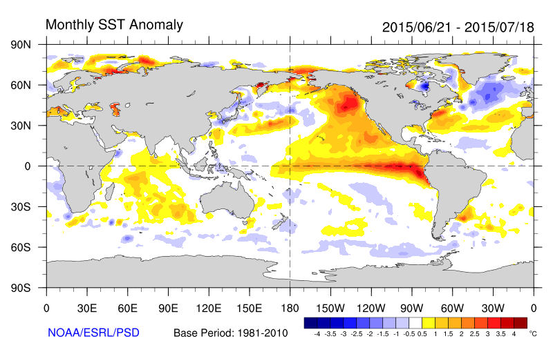
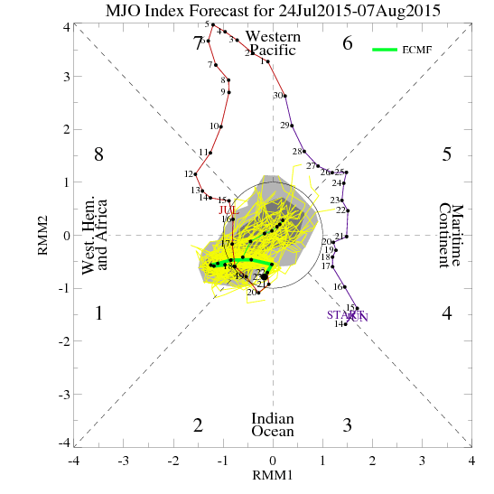
The weather over the last several days has been good as it gets here in late July. Crystal blue skies, some patchy clouds, high temperatures in the 80s, and very low humidity. Climatology records show that these temperatures this actually normal for this time of year. But we are accustomed to seeing more heat and humidity during summer. So far, this summer has seen too much of that. This mainly due the warm pool anomaly in the Northeast Pacific Ocean and a strong MJO in phases 7 and 8 supporting a -AO/NAO, Western US ridge and deeper troughiness over Northeast US over for the late June and early July. The MJO weakening will allow for ridge build in the east again, with more heat and humidity coming for next week.
