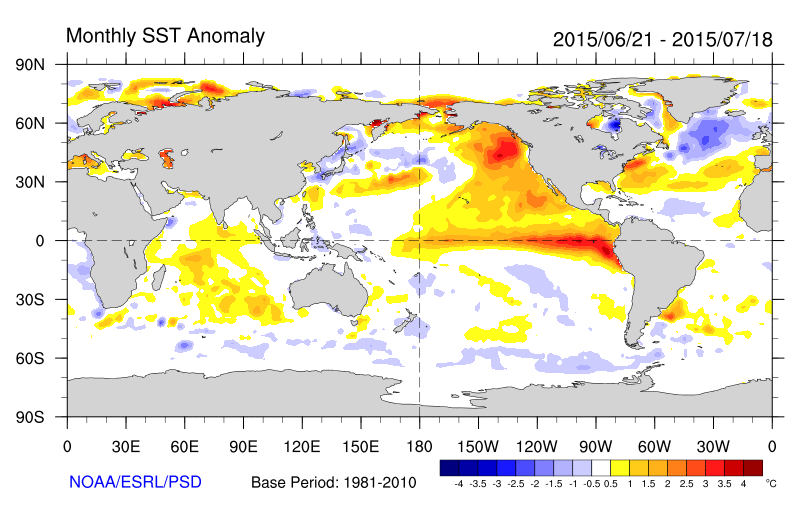
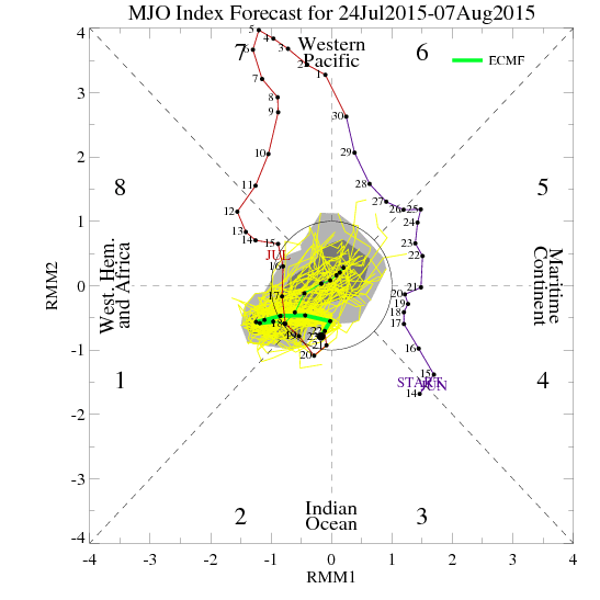
The weather over the last several days has been good as it gets here in late July. Crystal blue skies, some patchy clouds, high temperatures in the 80s, and very low humidity. Climatology records show that these temperatures this actually normal for this time of year. But we are accustomed to seeing more heat and humidity during summer. So far, this summer has seen too much of that. This mainly due the warm pool anomaly in the Northeast Pacific Ocean and a strong MJO in phases 7 and 8 supporting a -AO/NAO, Western US ridge and deeper troughiness over Northeast US over for the late June and early July. The MJO weakening will allow for ridge build in the east again, with more heat and humidity coming for next week.
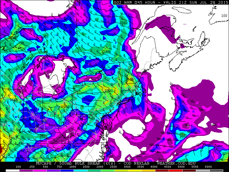
Before that though, this weekend still looks like it will start with the same pleasant weather we’ve been experiencing. Mostly sunny skies are expected during the day today. This will help temperatures rise into middle to upper 80s again with low humidity. Some clouds may increase this evening, ahead of an weak upper-level disturbance and warm front passing by the area. This may trigger a few scattered showers during the overnight hours or early morning Sunday. Some sunshine is expected later tomorrow morning into the afternoon, with temperatures into middle to upper 80s, away from the shores. The biggest difference on Sunday will be an increase in humidity. So it will not be as pleasant. A weakening cold front approach from northwest will also support a threat for some widely scattered showers and thunderstorms during the mid- late afternoon and early evening hours. The best chance of this activity occurring will be over Northern New Jersey and the Lower Hudson Any thunderstorm that forms will be capable of producing heavy rainfall and frequent lightning. Low speed shear doesn’t support organized severe thunderstorms. However, with moderate instability, pulse severe thunderstorms with large hail and damaging winds are possible.
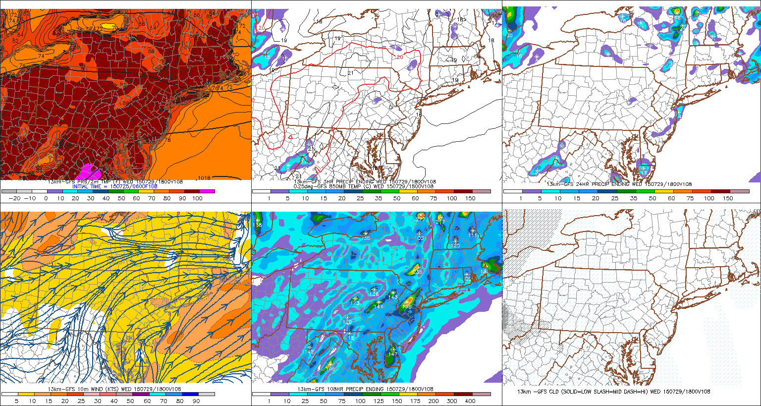
Next week will be watching for another potential heat wave. A deeper southwesterly flow will start to bring more heat and humidity early next week. High temperatures are likely to be in upper 80s to lower 90s both Monday and Tuesday away from the coast with partly sunny skies. Isolated or pulse thunderstorms are possible with some type of surface trough or boundary forming each afternoon. For Wednesday, the latest model guidance shows a 500mb ridge with 588dm+ heights and 850mb temperatures near 20C with west-southwest winds. With enough sunshine, this will support high temperatures in the middle to upper 90s across much of the region with lots of sunshine. Central Park,NY hasn’t recorded an official heat wave since July 2013. So this will be another chance for that site, to record a heat wave, next week. The heat and humidity will continue into Thursday. An upper-level trough and cold front with scattered showers and thunderstorms may arrive late Thursday afternoon or night. Somewhat less heat and humidity will behind it this front for Friday.
As this going on, models are showing an area of low pressure developing along the tail end of decaying frontal boundary off the Southeast US coast. Upper-level winds could become more favorable for this low to acquire sub-tropical or tropical storm characteristics over the warm waters. However any future development and impacts over US mainland from this system are highly uncertain at this time. A possible scenario is that this system gets involved with upper-level trough late next week or next weekend. But models are inconsistent or in disagreement with the evolution of the trough.
One note about hurricane season. Tropical activity typically starts picking up in late July and August. But this season has been expected to be less active this year, due to the strengthening El Nino in the Tropical Pacific. El Nino conditions often come with more westerly upper-level shear over the Tropical Atlantic. As a result, the atmospheric environment is more hostile for tropical systems to form or become very intense. However, it only takes one storm to do major damage. In El Nino years, tropical development is more homegrown–where the shear is not as strong. Either over the Gulf of Mexico or just off the Southeast US Coast.
