As expected the heat has returned over the last two days with a vengeance. Temperatures been in the middle 90s. Humidity hasn’t been too high though with a relatively weak flow, not able to transport more moisture into atmosphere. So for some it hasn’t been too bad. While this heat isn’t breaking records, today was warmest day for parts of the area since Sept 2013. These are some highs across the area for today:
Central Park,NY 96
Laguardia Airport,NY 95
JFK Airport,NY 95
Newark,NY 96
Islip,NY 92
Bridgeport, CT 92
Tomorrow, a stronger south-southwest flow will bring more humidity into area. A shortwave trough and cold front will be moving through the area. These systems cause more clouds to mix with sunshine and some scattered showers and thunderstorms to develop during tomorrow afternoon and evening. With less sunshine, high temperatures will likely be in the upper 80s to lower 90s. So an official heat wave prove to be elusive for parts of the area again–including Central Park.
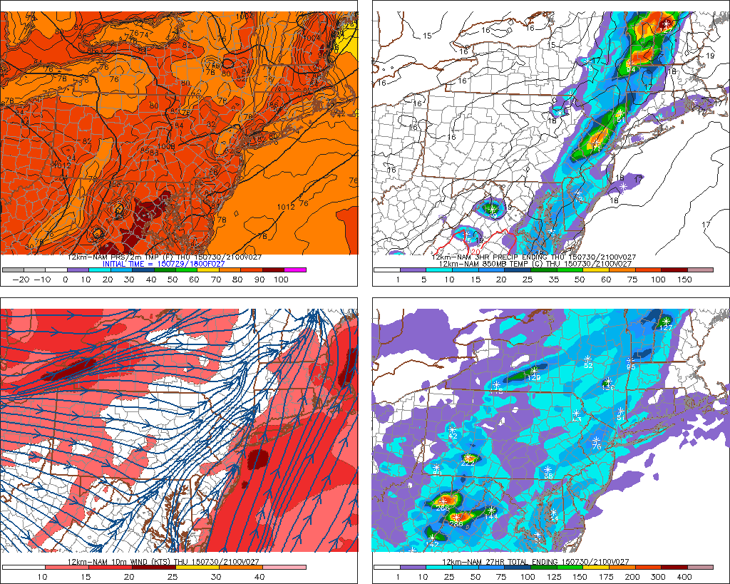
Moderate instability is forecast; MLCAPE 1000 – 2500 J/kg, for parts of the region tomorrow. This could support a few stronger thunderstorms with heavy rainfall, gusty winds, and frequent lightning. But a widespread or significant severe event is not anticipated due to 20-30kts 0-6km shear and mid-level lapse rates less than 6.0 C/km. Stronger shear is needed to sustain and organized thunderstorm updrafts. Steeper mid-level rates support stronger updrafts that produce large hail and damaging winds.
Behind this system, Friday will be only be slightly cooler and less humid with mostly sunny skies. Temperatures are expected to reach upper 80s to lower 90s. Another shortwave trough and weak cold front will approach the area Saturday, with a threat of more scattered showers and thunderstorms. More heat with low humidity could return on Sunday and Monday. Before stronger cold front comes middle of next week.
Meanwhile, an area of low off pressure has developed off Southeast US coast. As models indicated from last week. However, convection with this system is currently disorganized. Upper-level winds remain unfavorable for further development. This low is expected stay well offshore and merge with the cold front moving through area on Friday.
