Good evening! Any lingering showers or storms will taper off early this evening, as the cold front responsible shifts east of the region. Later this evening skies will clear, and humidity levels will decrease. Temperatures will fall into the upper 50 to lower 60s throughout the region late tonight. Dewpoints will in fall into the middle 50s and it will feel refreshing by dawn.
Tuesday through Friday
Mostly dry conditions are expected for the mid-late week period, as high pressure builds into the Northeast. Tuesday will be mostly sunny with light northwest winds and low humidity, which will make for a gorgeous day! A cooler airmass behind the cold front will keep high temperatures in the upper 70s to lower 80s throughout the region.

A weak cold front associated with an upper-level trough will approach the region on Wednesday. More clouds will mix with sunshine, but moisture will be limited for any showers. Thus, Wednesday will likely be decent day. A light southerly flow ahead of the front will help temperatures rise into in the middle 80s, except near south-facing shore areas.
On Thursday and Friday upper-level ridging builds into Northeast and high pressure at the surface begins set up near Bermuda. This will result in more west-southwest flow and temperatures rising into the upper 80s to lower 90s with mostly sunny skies through the region. Humidity will also begin increasing by Friday.
July 4th Weekend
Very warm and humid conditions are likely start of the holiday weekend on Saturday. But an upper-level low swinging over SE Canada will cause a stronger cold front to approach the region from the northwest. This front will likely trigger some showers and thunderstorms, especially the afternoon and evening hours. Somewhat stronger wind fields and instability could support at least a marginal risk for strong to severe thunderstorms. Although a washout is not expected on Saturday, these storms could create issues for any outdoor plans or fireworks activities.
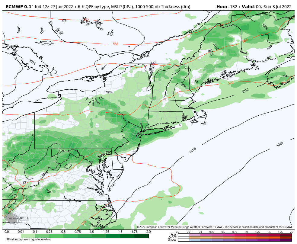
Sunday’s weather forecast has the most uncertainty. At this time, the front appears to push south of the region. Any leftover showers early in the morning, will give to clearing skies for rest of day. High temperatures will likely reach the low to mid 80s. However, if the front is slower to push south, we could see another round of showers and thunderstorms develop in the afternoon. So this forecast may be fined tuned as we move closer.
Monday July 4th Independence Day currently looks like the best day of the holiday weekend. Mostly sunny, skies low humidity and high temperatures in low to mid 80s are expected with the cold front forecast to be farther south of the region. It will be good day for the beach, park, or barbeque in the backyard.
That’s it for now. There will be another update on the forecast for the July 4th holiday weekend around Thursday.
