New Winter Storm to Affect the Area Tonight and Wednesday

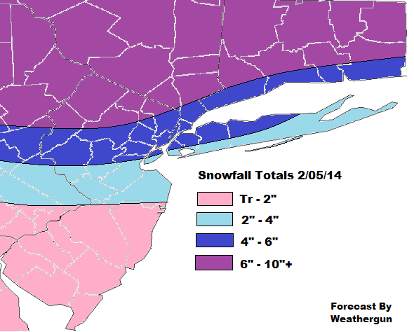
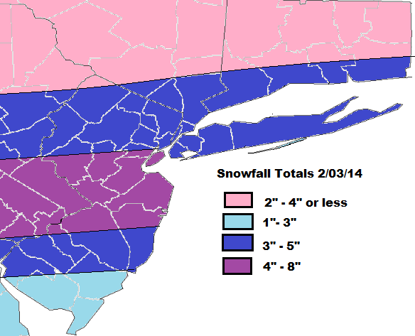
Active pattern continues. Unlike Monday’s storm, this bring more of a mix of wintry precipitation. Snow and ice forecast is below this discussion.

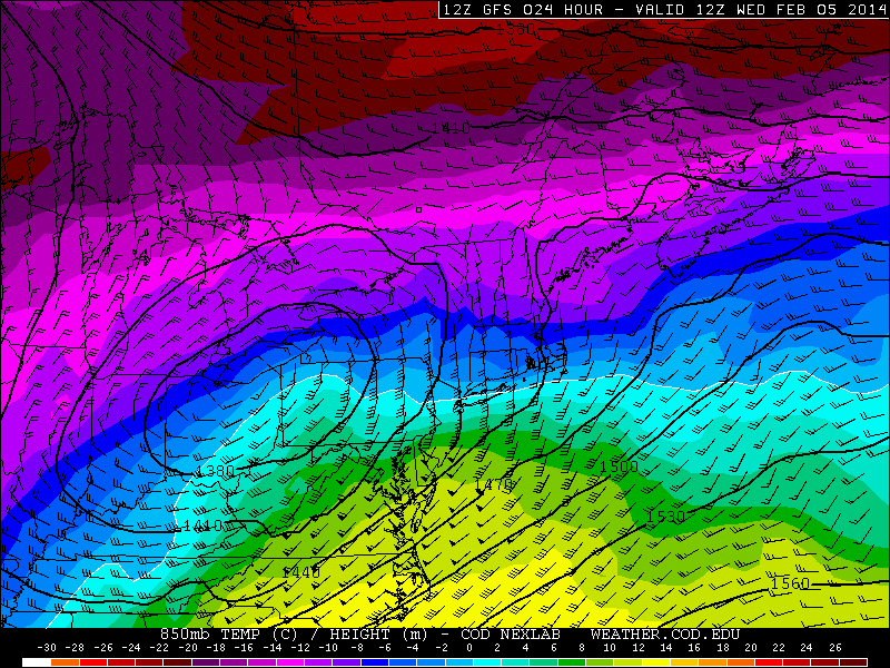
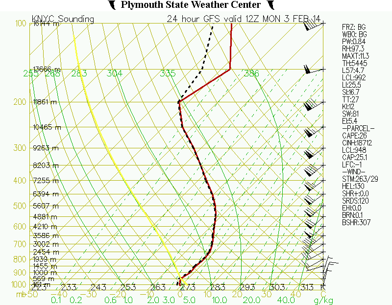
Low pressure will track into Ohio Valley tonight. Strong, cold high pressure over Queebec, will force this low weaken and transfer south of Long Island. With cold air place tonight, everyone will see snow at the onset. However, enough warm air is expected to surge aloft, for a mix or changeover to sleet and freezing rain by sunrise. During the day tomorrow, sleet and freezing rain should to rain for all coastal sections. While inland areas could see more snow, sleet and freezing continuing throughout the day.

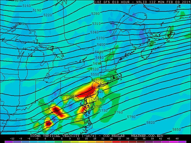
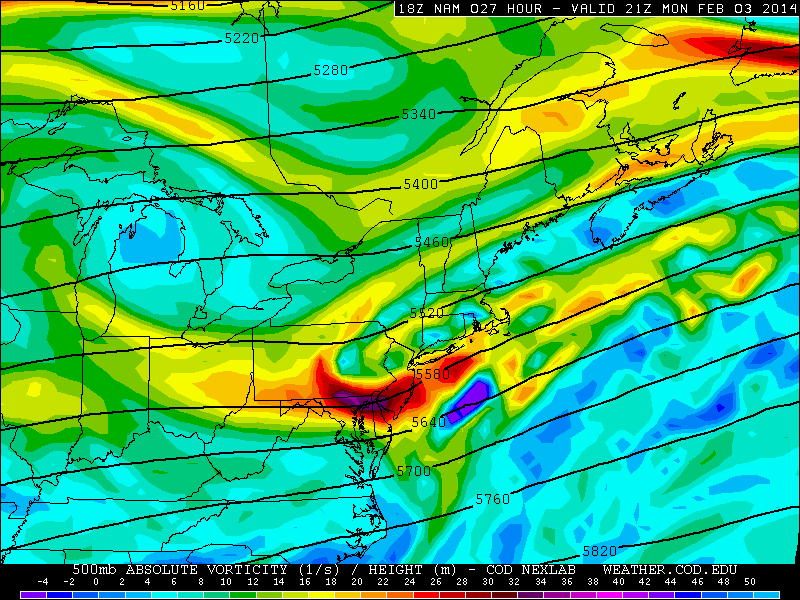
Despite strong high pressure and cold-air damming, the 850mb and 925mb lows are tracking near the OH/PA border. This forces warm to eventually surge into mid-levels. At the same time, we seeing more where more frontogenetic forcing  The models show strong 500-700mb vertical velocities, entering the tri-state area tonight. This will enhance snowfall rates to 1 inch per hour and keeping the column cooler, for several hours. Any delay in the changeover, will result in higher snowfall totals for that area.

gfsNE_500_vvel_024gfsNE_850_temp_024

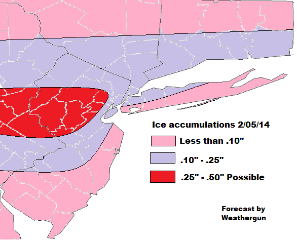
Snow will mix with sleet than changeover to sleet and freezing rain for NYC and coastal sections between 4am – 7am.  Inland areas the changeover will take longer. Icing will significant for inland areas. This will to treacherous driving and might be enough bring down tree branches and power lines. I will update these forecasts if guidance or observations warrant: But a severe, widespread damaging ice storm is not expected.

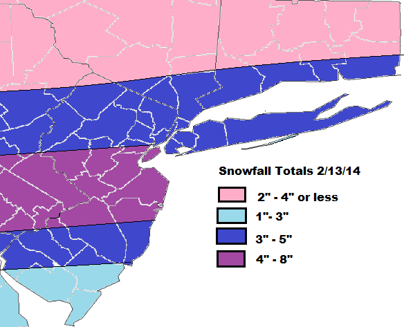
I will update this maps, tonight or tomorrow. If new guidance or observations warrant.  There’s also another storm  brewing for this weekend or early next week. I will discuss that more as we get closer.

Snowfallmap

Icemap2414

Winter Storm for the Tri-State Area 2/03/14

This is a forecast discussion is for the NYC-PHL Tri-State area.

A cold front will move across the region tonight, with some rain showers. Then a wave of low pressure will track up front offshore. As it turns it colder rain showers will change over to snow showers and become steadier and heavier tomorrow morning. Snowfall could be falling at the 1″-2″ per hr. Especially over Parts of NJ, NYC and LI. Snow should begin to taper off and end late Monday afternoon.

Models have the best UVVs going over parts of SE PA and CNJ tomorrow. This where I’m predicting highest snowfall total  Extreme SNJ/DE will have more warm to overcome tomorrow morning.
18zgfsNE_500_vvel_018QPF totals on the models and ensembles range anywhere from .50″ to 1.00″ the area, expect farthest northern suburbs. It’s possible these totals too high, due progressive moving on the storm. But this system unlike past system, this system in picking more moisture out the Gulf.

The main concern here is with temperatures. Especially in the boundary layer. Today many places around NYC where in low and mid 50s. Several degrees higher than guidance suggested. If the column doesn’t cool off as fast as modeled, early tomorrow morning, than snowfall totals will be less than predicted.

12zGFSNYCsoundingOn the other hand, if this farther north with stronger forcing, we could see higher totals, more dynamic cooling and heavier precip. We are right-rear exit region of a 250mb  upper-level streak. 500mb vorticity has all trending stronger today on all the models. So this isn’t out of the question.

18zgfsUS_250_spd_021namNE_500_avort_027

Here’s is the snowfall total forecast:


Snowfallmap2