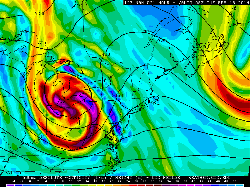
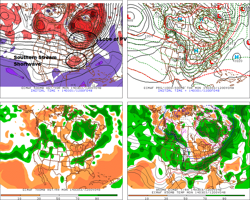
 Latest guidance over the past couple days has trended farther south with this storm for Sunday and Monday. Models now show stronger confluence, behind a lobe of the polar vortex, swinging over the Great Lakes. This is shearing and suppressing the southern stream disturbance to the south and creating a sharp cut-off of northern fringe of area of overrunning precipitation with this system. There will be heavier banding just north of the thermal gradient. Where it stronger frontogenesis will be occurring. Which currently appears to be over Southern New Jersey and DE and SE PA.
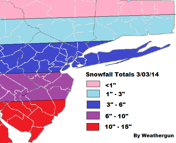
 The NAM is also slowest push the artic boundary to the south of the area tomorrow. So there may be some light rain,sleet, and/or wet snow at the onset. Especially for the coastal sections. But this should quickly changeover to snow tomorrow night. With surface temperatures falling through the 20s and teens. Liquid totals are expected between .25″ to .50″ over NYC/LI/NNJ. Less to north. As much as 1″ of liquid in SNJ. The column with warmer air aloft, support snow ratios to average between 12 and 15 to 1 for much the area. Strong upward vertical motion by might support higher ratios south of NYC.
Check back for more updates. If they are any changes handling the lobe of the polar vortex or the southern stream disturbance, there could be some north or south adjustment to snowfall totals tonight or tomorrow.