Record Lows Followed By Rainy Weekend

Record low temperatures were set this morning in the following locations:

LGA 23 Old Record 24 in 1975
JFK 23 Old Record 24 in 2001
ISP 22 Old Record 22 in 2001
EWR 22 Old Record 23 in 2001

We recovered nicely into to lower and middle 40s this afternoon. Which is still 10 degrees below normal. Party cloudy skies are expected tonight. Then it will mostly cloudy tomorrow morning. A cold front will move through the region tomorrow evening. Ahead of is 50kt-60kt low-level jet and precipitable water values (pwats) around .75″. This could some showers to develop tomorrow afternoon and evening. Heavy rainfall is not expected however. Amounts .25″ at best likely.

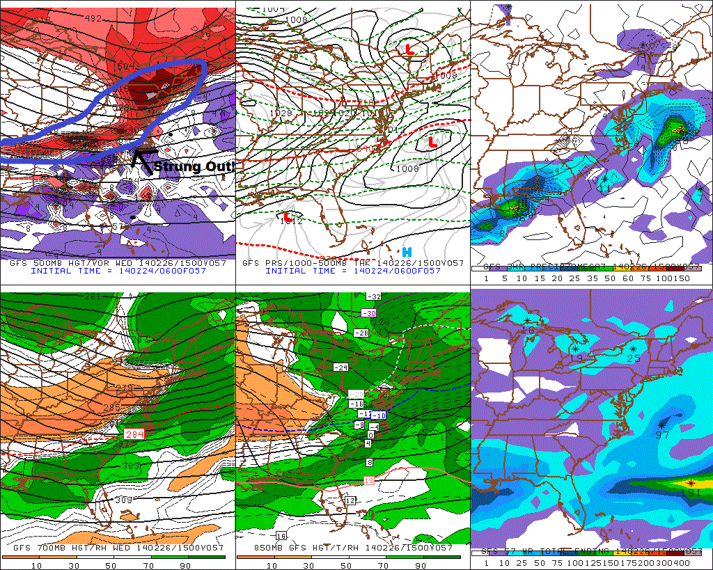
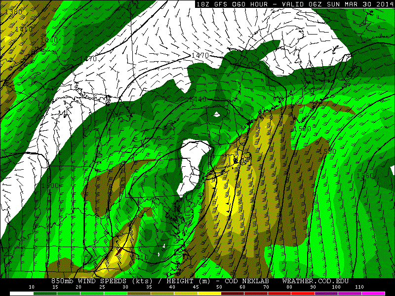
Shortwave energy will cut-off to our southwest on Saturday. As this system approaches our area, rain moving in from south to north. Rain is likely fall heavy times Saturday night into perhaps Sunday. 200mb-500mb jet streaks are positioned favorably for upper-level divergence (forcing). The cut-off low intensifies and takes negative tilt over Ohio Valley. This causes surface low pressure to form along the coast. Warmer, moist air will be transported with developing low-level jet. The heaviest rainfall is likely to occur with the best moisture convergence setup near the low-level jet and pwat axis. As the 18z run of the GFS shows for Long Island and Connecticut:

18zgfsNE_850_spd_06018zgfsNE_con_pwat_060Overall it seems most areas are likely to receive at least 1-2″ of rain from this storm. With parts of the area receiving up to 3 or 4 inches of rain. Winds may also gust between 35mph to 45mph, near the coast on Sunday, with low-level lapse rates steepening and low-level jet in the area.The pattern will remain progressive overall with a parade of Pacific systems coming into Western and Central US. This will force this storm to move out of the region by Monday. With fair weather returning for much of next week. Temperatures will also be closer to normal in the 50s and 60s for highs.

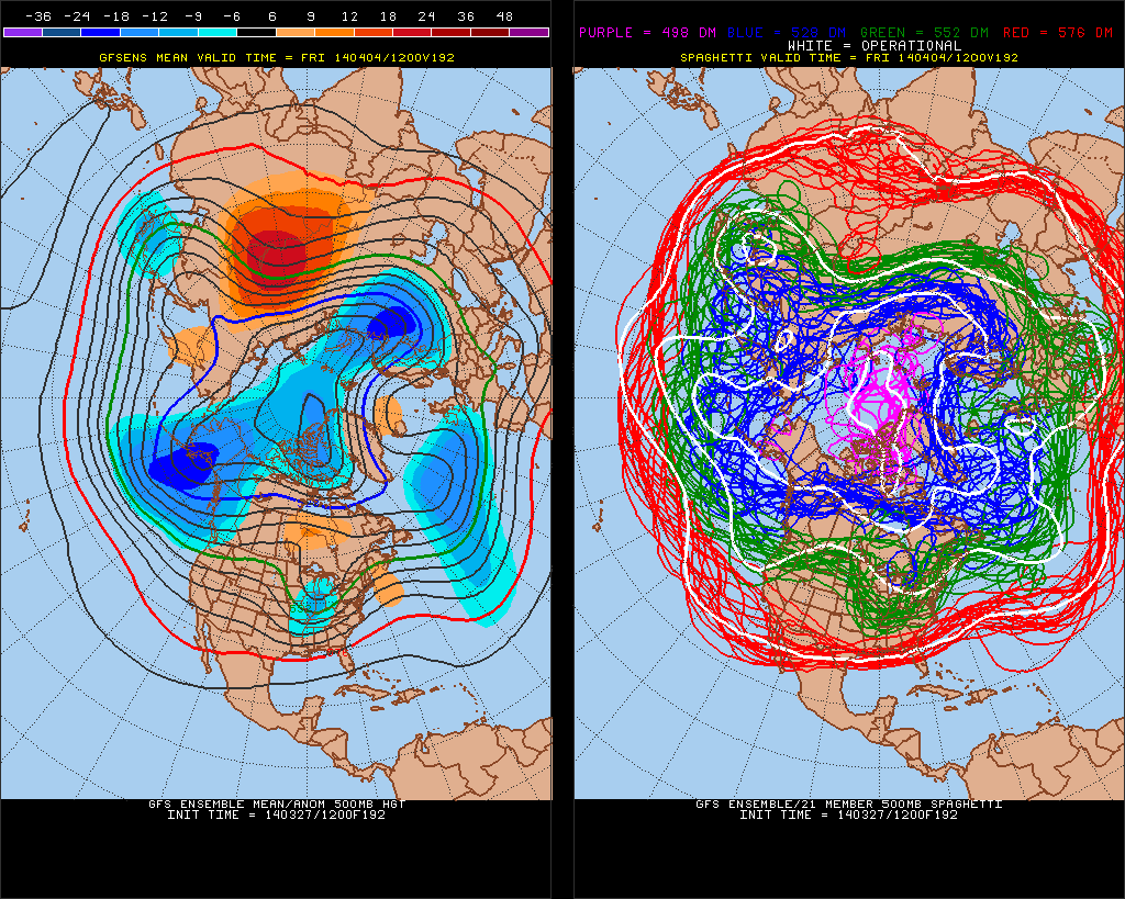
The 12z GEFS hints another large storm system over Eastern US, about a week from now. However, with the polar vortex retreating into North Pole, artic/polar air source, will likely be shutoff next week.  We may see Pacific shortwave energy to cut-off again and bring more heavy rain to the area. Still very far out for any details: 12zGEFSf192


Cold Pattern Arrives, Storms to Follow

The cold pattern that has been discussed for this week, has arrived. An artic front pass through overnight with some showers. As colder continues filter into region,  temperatures may fall back in the lower 30s and upper 20s. Before rising back into middle 30s this early this afternoon. Tonight will be much colder, with temperatures dropping into lower 20s in NYC and the teens for most of the suburbs. Tomorrow will be mostly sunny with temperatures rising into upper 20s or lower 30s for highs.

The storm for Wednesday, now appears will far enough south, it will just give us a light snowfall at best. We have seen storms this season trend stronger or farther NW, just inside 24-48hr. However, latest model trends show the shortwave energy along trough, that will responsible for spawning this storm, is more strung out Without this energy being more consolidated, the trough can’t sharpen, to tighten the baroclinic zone farther NW. There is also other polar jet disturbances, keep the height flatter ahead and behind this system. This results in weaker low developing along Mid-Atlantic coast and tracking well south and east of the 40/70 benchmark. I will still monitor this for any significant changes in handling shortwave energy and other features. But right now I don’t expect no more than a couple of inches of snow accumulation.

6zGFS57

Thursday and Friday will be high pressure will be control resulting in cold and dry weather. Then pattern will be more active, starting this weekend. The Polar Vortex will slowly begin to retrograde and with the MJO entering phase 8, the sub-tropical jet will become active with disturbances moving across the southern CONUS. There will also be high-amplitude ridge along the West Coast of North America. So anyone of these disturbance has potential to interact or phase with northern stream disturbances, and produce a significant storm for the Eastern US.

However details vary with each prognostication of every disturbance on the models from run to run. It’s important for everyone to not get infatuated with model solutions, at this point. Instead use pattern recognition, ensembles and trends to determine the probability of that solution occurring, without getting into specifics.  I will have more posts here this week about these storm threats.

Cold & Stormy Late February into Early March

After some moderation with temperatures this week, the ECWMF, GFS and CMC ensembles are showing +PNA/West Coast Ridge for the last week of February. This will produce a mean trough over the Eastern US again with colder temperatures. Also note the Polar Vortex centered over Baffin Island:

12zECENS500mb12zGEFSf20412zCMCENS500mbf240The 8-14 day NAEFS shows 80-100% probabilities for below normal tempartures, for the Eastern half of the US:

NAEFS8-14dayPersistent warmer than normal sea-surface temperatures, have resulted in a resurgence of the ridge over Northeast Pacific region, since the fall. As of Feb 15th, the warm SST anomaly remains:

215sst.daily.anomThe latest ECMWF and GFS ensemble forecasts have the MJO going into phases 7 and 8 at end of this month. Which support the +PNA at end of this month into March.

ECMF_phase_MANOM_51m_fullNCPE_phase_21m_full

Currently analysis of 200mb vector wind anomalies show strong easterly jet over the Tropical Pacific. Which support the MJO propagation into phases 7 and 8.

current_anom_200windEvery time we’ve seen the -EPO/+PNA pattern reload, we seen a winter storm of at least moderate size. Models do show storms off and on, beginning next week. But the one that has most interested in is on Feb. 26-27th. The GFS and it ensembles have featuring this threat for possibly a Nor’easter. Several members show amplifying trough or closed low over the Eastern US, with a big ridge over the Northern Rockies.

12zGEFS500mbf276

12zGEFSslpf276To conclude, I think we are seeing the pattern cycle repeat itself, every few weeks, since November. However, the ensembles keep the Polar Vortex near Baffin Island. So while temps will average below normal, I don’t expect to see the extreme cold we saw back in January. There will be winter storms between the end of February and into first 10 days of March. But how large each of them will be for the area, will depend on the position +PNA/West Coast Ridge axis or the amount (if any) blocking on the Atlantic side.