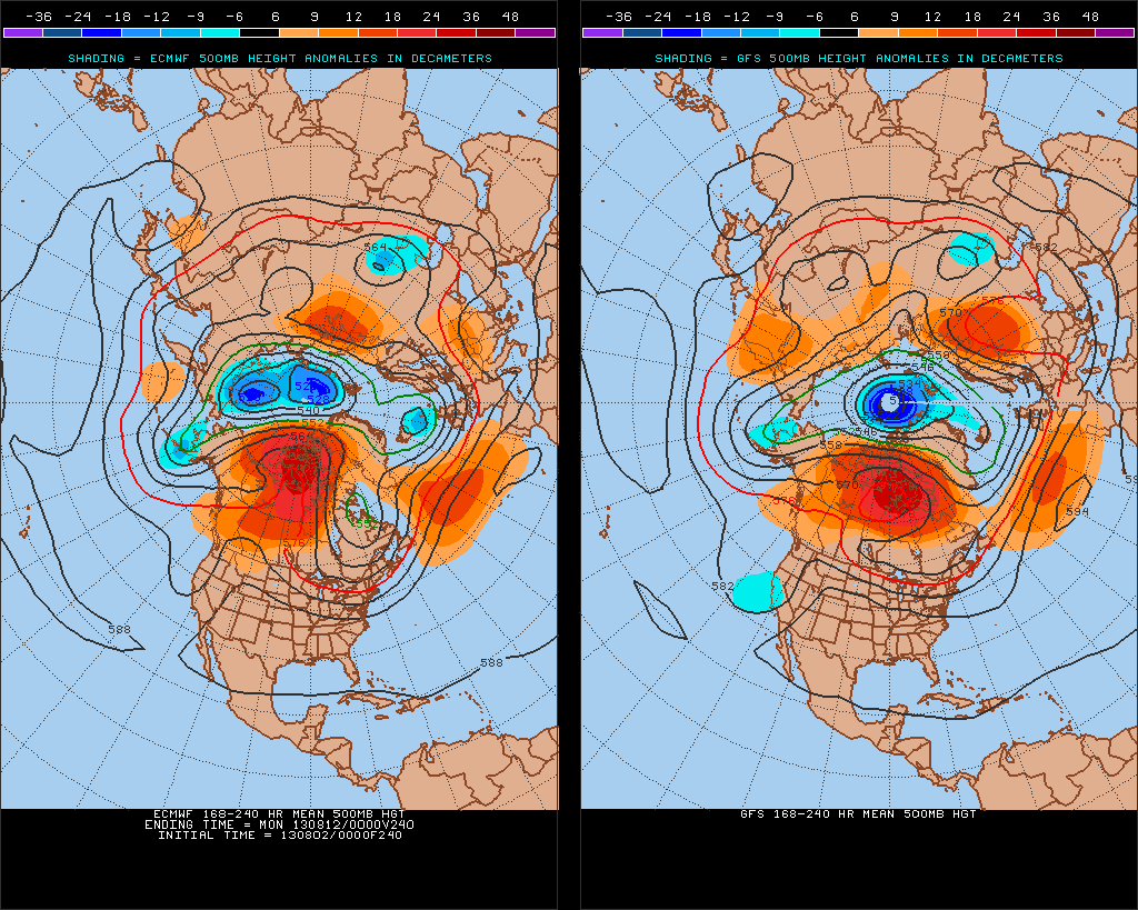
Both the GFS and ECMWF have a huge Canadian ridge, with long-wave mean trough over the Northeast CONUS in the 8-10 day period. Their ensembles also agree. These means will see enough cold fronts here to prevent the West Atlantic Ridge from building west again. As it did in July, when we saw two heat waves. Near or below temps should prevail.
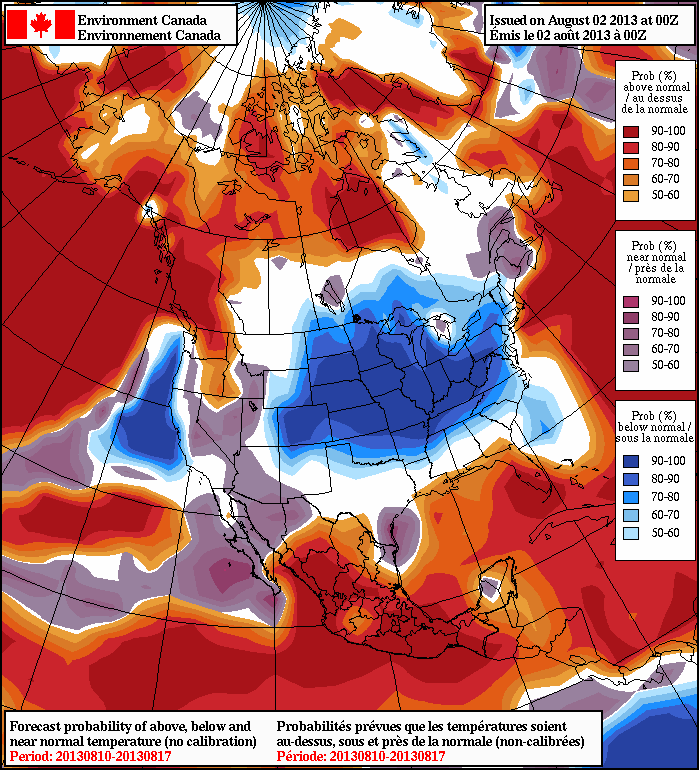
 This pattern will likely continue for next few weeks. The NAFES shows less than 50% chance of above normal temps in the 8-14 day range:
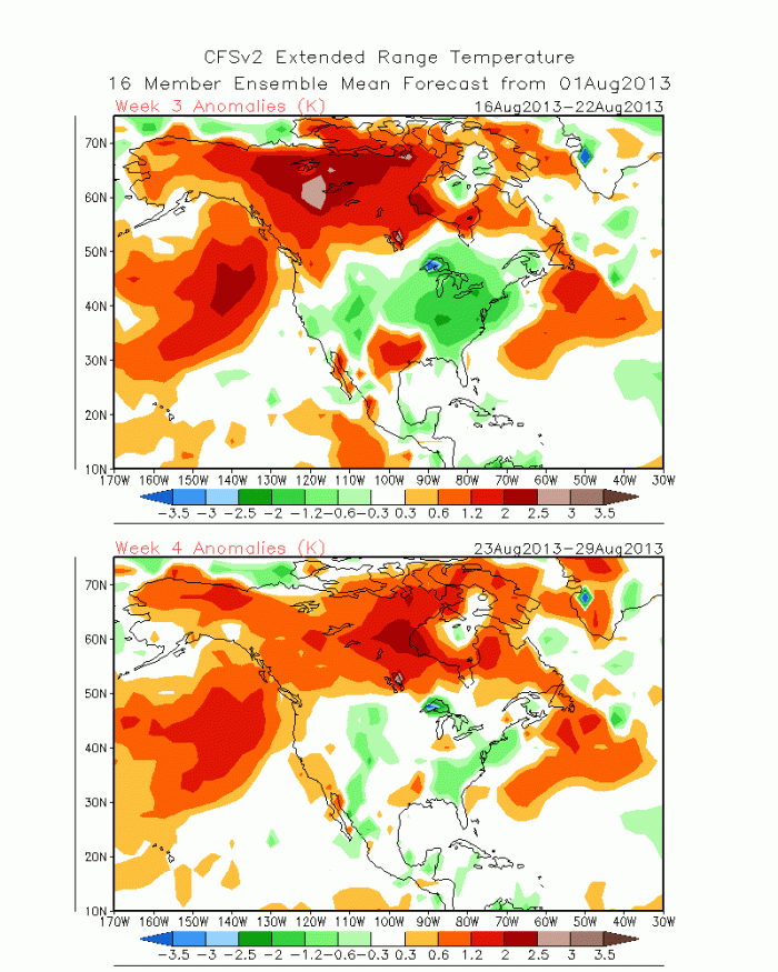
The latest CFSv2 shows below normal temps into the third week of August: