Why Models Show Less T-Storms Late Today

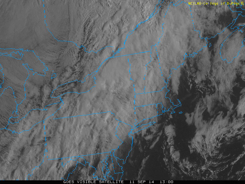
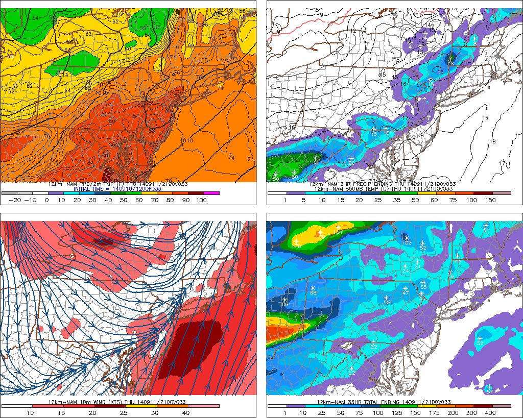
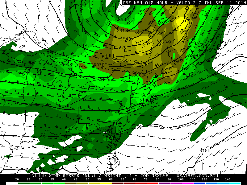
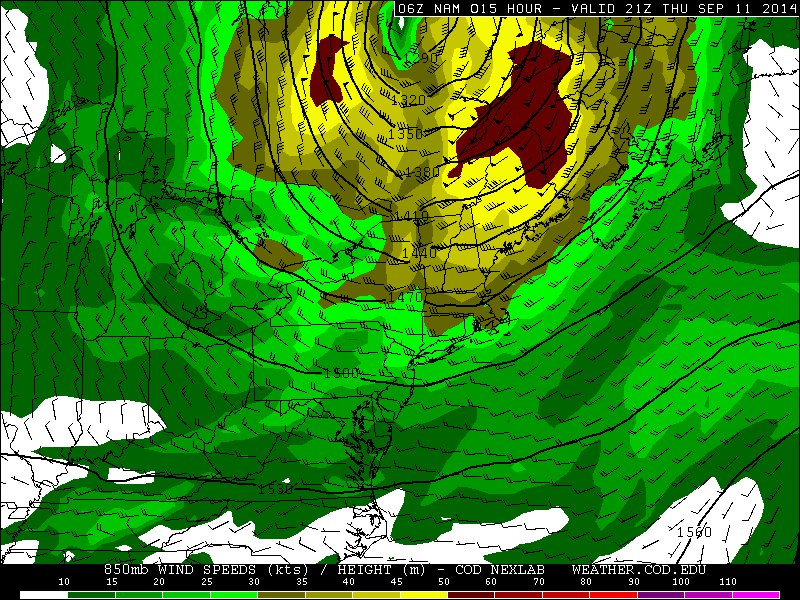
If you are looking the qpf or simulated radar models this morning, you will notice the lack of t-storms today for the tri-state area. There a number of reasons why. First the NAM (as well as other models)show the core of 700-850mb jet streak over Northern parts of New England. On the left-rear side are westerly winds causing the air to dry and sink at the level, over the tri-state area. This will tend to suppress more thunderstorm development late this afternoon:

6znamNE_700_spd_015

6znamNE_850_spd_015

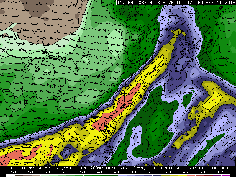
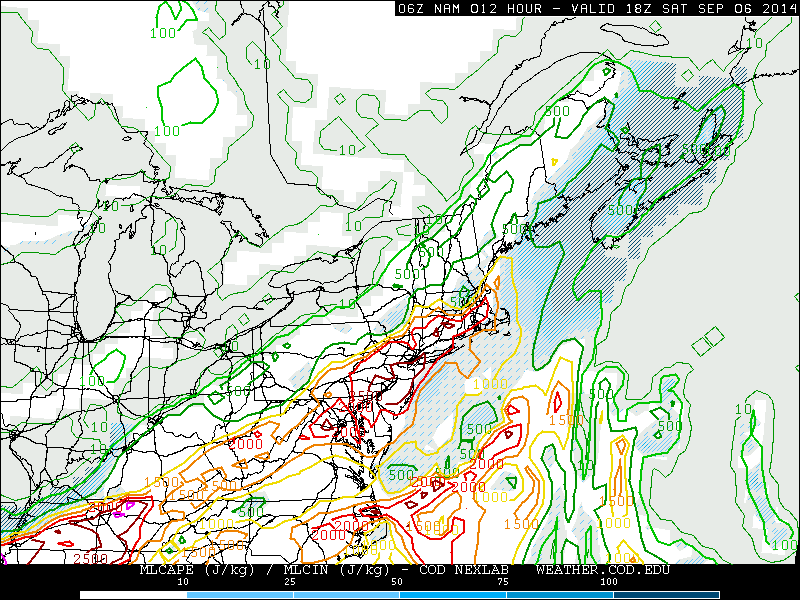
Models also show more instability, particularly CAPE over the Lower Mid-Atlantic region. Which is why the models like the NAM show more showers and thunderstorm forming along the cold front to the south of tri-state area. From experience, thunderstorm tend congregate in areas where more parameters, such as lift and instability are supportive. I still expect some showers and t-storms this afternoon. But over the tri-state area, there will be likely be more widely scattered with perhaps some isolated strong wind gusts. The chance of thunderstorms to reach severe levels are still very low. Latest guidance shows 0-6km shear increasing to 30kts to 40kts with a 50-60kt 500mb jet streak approach from north and west this afternoon. Which is not enough CAPE to support many tall or strong updrafts.  Poor lapse rates and some cloud cover and onshore winds for the coast, will likely limit the amount of the instability this afternoon. As well reduce the ability for thunderstorms to produce damaging wind gusts. Pwats are still very high over 2.00″. So any thunderstorm is still capable of produce heavy rainfall and flash flooding poor drainage areas:

6znamNE_con_sbcape_015NY.vis

Warmer & Humid Tomorrow with PM T-Storms

A warm front move through the area tomorrow morning with some clouds. Winds turn more southwesterly south of this front, transporting a much warmer and humid airmass.  Temperatures over New York City and much of New Jersey will rise into the middle to upper 80s. However, this will be short-lived as a cold front will moving through the area tomorrow evening with some scattered showers and thunderstorms.

The 12z NAM models showing 80s for highs over much of NJ and NYC, with southwest winds. Then some showers or thunderstorms for the northwest.

The Storm Prediction Center had issued a slight risk early this morning for these t-storms tomorrow. This was mainly in the warm sector, when instability is more likely to support severe thunderstorms. However, this afternoon look as removed the slight risk entirely. Regardless of what SPC issues, there are some factors going against widespread severe weather. Mid-level lapse rates are poor with a mostly west to southwest flow aloft. While 0-3km helicity values are in 150 m2/s2 to 200 ms/s2 late tomorrow, 0-6km bulk shear is between 25kt to 30kts with 500mb winds a little weak in the area. Clouds in the warm sector also an issue with getting more extreme CAPE values. Some models show SBCAPE near 1000 J/kg over Central and Northern New Jersey. But MLCAPE and NCAPE values are lower. This suggests CAPE will be skinny and will not support very tall updrafts. Southeast winds or sea-brezzes ahead of the warm may also keeps parts of Long Island and NJ shore, in more stable airmass. Which supports thunderstorms to weaken in this area. All this considered, I think will any severe weather will be very low and isolated. Some t-storms might strong enough produce wind gusts near 40mph. There is also very small possibility of very weak spinups (tornadoes) along the warm front nearby). But without more instability, this threat is not heightened here. Models do show very high precipitable water values over 2.20″. So any thunderstorm will be capable produce some very heavy rainfall with flash flooding in poor drainage areas.

12z NAM today precipitable water values over 2.20"+
12z NAM today precipitable water values over 2.20″+

Showers and thunderstorms will taper off later tomorrow night and clearing will take place late. A cooler and less humid airmass is in store starting on Friday. High temperatures will only reach the lower to middle 70s, despite alot of sun. Some uncertainty continues over the weekend as models stall this cold just off the Mid-Atlantic coast on Sunday. Then move a number of waves north up this frontal boundary through early next week. Details will be fine tuned as we get closer.

Hot & Humid With Strong Thunderstorms Possible Today

Yesterday south to southeast winds, transported a very muggy airmass into region. However, these winds off ocean, cause marine inversion with low clouds to develop. This kept atmosphere from mixing and less stable. Temperatures in the 80s across most of the Tri-state area. Today will be hot and humid as we much deeper westerly to southwesterly flow with 850mb temperatures near 18C this afternoon. This will likely allow for deeper mixing and temperatures to rise into the lower 90s, across much of New Jersey and into New York City. The only caveat here is that some convective debris from decaying showers and thunderstorms Western New York and Pennsylvania early this morning, works it east today.  This could possibly keep high temperatures in the upper 80s.  Closer to coast sea-breezes will develop this afternoon and keep high temperatures in middle to upper 80s.

temp13

A pre-frontal trough developing over the area, will trigger some scattered showers and thunderstorms this afternoon and early this evening. These will form over interior areas for first then move southeast towards the coast. Latest NAM model guidance is showing 2000 – 3000 J/kg of MLCAPE, 20-25kts unidirectional 0-6km bulk shear, precipitable water values 1.5″ – 2.0″ ahead of this activity this afternoon, away from the shore. This is enough instability and moisture for thunderstorms to become strong or severe and produce very heavy rainfall in a short period of time. But shear is insufficient for thunderstorms to sustain their updrafts and organize into bow lines. At this time, I expect scattered thunderstorms to be pulsing up and down in intensity. Isolated damaging wind gusts and flash flooding in poor drainage areas will be the main threats. The Storm Prediction Center has already included much of the area in a 15% slight risk. So stay tuned for any severe thunderstorm watches this afternoon or evening.

namNE_con_mlcape_012A cold front passing through the area, may trigger more showers and thunderstorms early tonight. However with the sun going down, instability will diminish. So these thunderstorms will be less capable of becoming severe. Behind this front is cooler and less humid airmass. Sunday will mostly sunny with high temperatures in the upper 70s to lower 80s. Monday and Tuesday will looking more questionable some model guidance showing a coastal low impacting the area with some rain and wind. Another post here will come later today on this system with new model data. 9/7 Update (that post will be delayed for model data today..)