Warmer Wednesday and Watching Coastal Storm for Thursday/Friday

For early this week, the weather changed much from what was discussed in previous post . After some sunshine this morning, upper-level disturbance swing through the area, will cause more clouds mix in during the afternoon hours, with some widely-scattered showers popping up. Temperatures should rise in the lower 60s this afternoon. Skies should clear this evening for the Yankees vs Rays game at Yankee Stadium.  Tuesday should be dry, with high temperatures in the middle 60s. Wednesday could be warmest day of the week, with W/NW winds and 850mb temperatures near 8C, causing high temperatures in the lower to middle 70s around the New York City area.

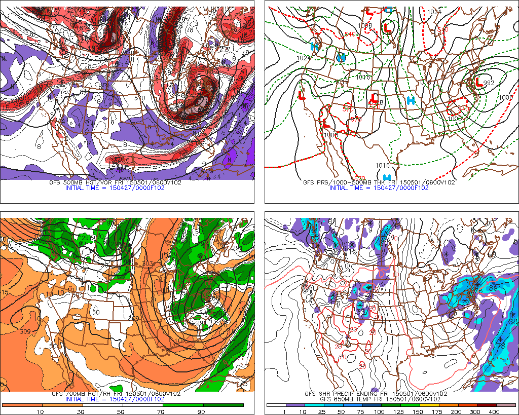
Latest runs the GFS model have trend closer with the coastal storm Thursday into Friday. If correct, some heavy rain and strong winds will be occur for parts of the area. However, all other models  keeping this storm farther south. The GFS shows a blocking pattern over Southeast Canada causing the northern and southern streams disturbances to phase along the East Coast. While the other models show more progression with a fast pacific jet. At this time, I’m leaning towards the further south and east solutions. But I will still monitor it carefully this week.. Even if this storm does miss us, there could still be some scattered showers with the upper-level low or northern stream disturbance moving over the region.

The 0z GFS showing coastal storm close to the area bring rain and wind on Thursday
The 0z GFS showing coastal storm close to the area bring rain and wind on Thursday/Friday
The 0z ECMWF model showing less phasing and coastal storm farther offshore Thursday and Friday

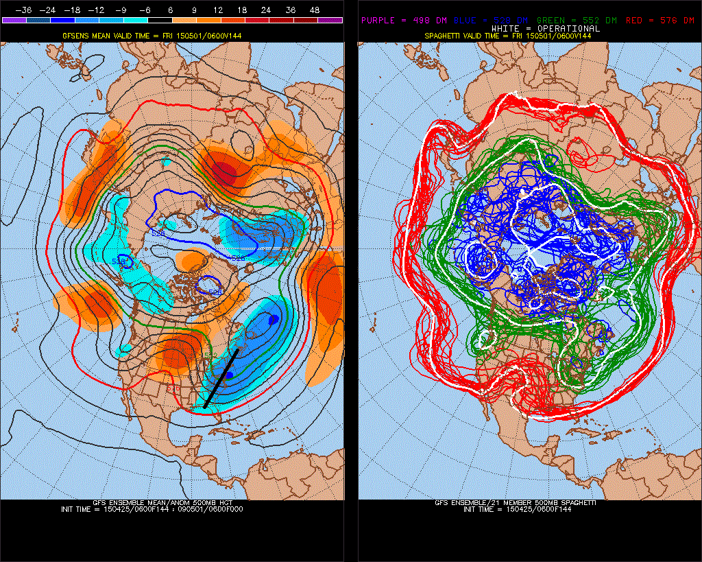
Model guidance showing a ridge building over the East, next weekend or next week If this correct, we could been for longer stretch of warm, dry weather. Temperatures could be well into 70s or lower 80s during this period. Fingers crossed.

Cold Temperatures This Morning Giveway to A Gradual Warming Trend

Overnight skies cleared and winds calmed lightened. This allowed temperatures to drop into upper 20s and lower 30s in the suburbs and a freeze to occur. Closer to New York City, temperatures dropped into middle to upper 30s. This cold airmass is impressive for this time of year. However, it’s not unprecedented. We were several degrees above most record low temperatures for this period. The only exception is new a record low this at Islip, NY. Which records only go back to 1982.

RECORD EVENT REPORT
NATIONAL WEATHER SERVICE NEW YORK NY
0747 AM EDT SAT APR 25 2015

…RECORD LOW TEMPERATURE SET AT ISLIP NY THIS MORNING…

A RECORD LOW TEMPERATURE OF 32 DEGREES WAS SET AT ISLIP NY AT
344 AM. THIS BREAKS THE PREVIOUS RECORD OF 36 SET IN 2012.

Low temperatures overnight in the Tri-State area
Temperatures(F) early this morning in the Tri-State area

Temperatures are expected in to climb into upper 50s to lower 60s with mostly sunny skies this afternoon. Which is still several degrees below normal for this time of year. But warmer than then the past two days. A low-pressure system tracking well to our south may be bring more clouds tonight. Especially over Central and Southern New Jersey. However any rainfall is expected stay south of the Tri-State area. Any clouds around early tomorrow morning should break for some sunshine. High temperatures on Sunday afternoon are expected be in upper 50s to lower 60s again. A gradual warming trend should continue into middle of next week with closer to normal temperatures. A couple of disturbances with a cold pool aloft, might cause some widely-scattered showers during the afternoon hours on Monday. Otherwise, fair weather is expected with highs further into 60s on Monday and Tuesday. On Wednesday, increasing mid-level heights and downsloping winds could cause temperatures to rising into upper 60s to around 70 on Wednesday with plenty of sunshine. These temperatures are closer to normal this time of year.

The GFS showing temperatures in the middle to upper 60s on Wednesday with wsw winds and sunshine
The GFS model showing temperatures in the middle to upper 60s on Wednesday with west-southwest winds winds and partly sunny skies

Later in the week, the weather looks little more muddled with possibly another upper-level low over region causing some widely scattered showers. Temperatures are still likely to reach the 60s. There was some concern that storm developing over Southeast United States, would come up further up the coast and impact the Tri-State region late this week. This was due to the some high-latitude blocking and ridge amplification over Western US. causing the northern and southern streams to phase. Current model trend now show this storm going out into Atlantic, well south and east of region. The blocking pattern is weaker and the ridge shifts east more into Central US. The result is a more positively-tilted trough over the Eastern and less phasing. However, I will still monitor this storm. Stay tuned for more updates over the next several, in case there are any major changes.


6z GEFS showing the ridge over Central US with positive-tilted trough over East Coast. This keeps the storm over Southeast US from coming further north.
This morning’s GFS ensemble showing the ridge over the Central US with a positively-tilted trough over the East Coast.This keeps the storm over Southeast US from coming further north.

Tri-State Area Snowfall Forecast for 11/26/14 Nor’easter

Latest models guidance has shifted track of this storm further west. Particularly the lows at 700mb, 850mb and surface levels. This will allow from more warm air-intrusion in mid-levels due a stronger southerly jet moving over more the area. Areas farther west farther west of I-95, will see rain or wintry mix change over to snow later this morning or early this afternoon. Which could fall heavy at times this afternoon or evening. Along I-95, include New York City metro area, rain should changeover to snow by early afternoon. But as this storm moves closer,  warmer air intrudes aloft. This cause snow to change to sleet for several hours this afternoon. This will significant reduce snowfall totals. Further SE, warmer boundary layer temperatures will precipitation mainly in form rain with perhaps a little snow or sleet mixed in at times. Winds out of the northeast increase will also increase this afternoon to between 15mph to 25mph with gusts to 35mph or 40mph near the coast. Then turn more north at same speeds this evening. Some minor tidal flooding is possible at high tides this evening along the north facing shores.

6z NAM showing closed 700mb with 60kt+ southwest winds over the coastal plain
6z NAM showing the 700mb closed to the west and 60kt+ southwest winds over the coastal plain
6z NAM sounding in the Bufkit at LaGuardia Airport, NY, at 1pm today
6z NAM forecast sounding 1pm today at LaGuardia Airport, NY
Final Call Snowfall map issued at 7am.
Mu Final Call for Snowfall total issued at 7am EST