Coastal Storm Wednesday Evening Update

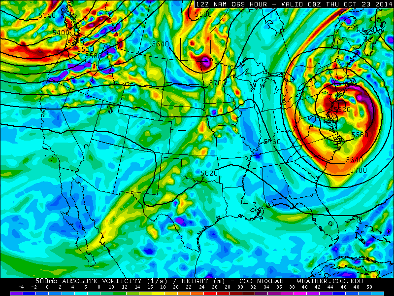
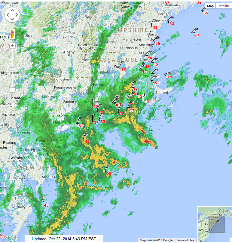
This morning an inverted trough from coastal storm developing, gave New York City, Western Long Island and parts of New Jersey, some heavy rain and thunderstorms. A lull activity occuring for most of tri-state earlier this afternoon. But the coastal storm deepening and moving slower back to the coast this evening. Bands of rain with some embedded convection is now rotating back into Tri-State area.  Winds have been increasing has well, a little more than expected. Some coastal locations have sustained winds 20-30mph with gusts 30-40mph. Just east of the area, Block Island and Buzzard Bay have reported wind gust up to 45mph. Buoy south of LI have gusts to 49mph and 51mph. The highest winds are likely being brought down from aloft by thunderstorms, currently offshore. A cold pool aloft with this storm and as well warmer than normal sea-surface temperatures is enhancing instability near and off the coast. Radar has also detected rotation some of these thunderstorms today. Helicity along with instability may some waterspouts to form. But as these storm move closer to land, they have weakened somewhat, as they enter less unstable airmass.

Surface wind, temps with radar overlaped at 6:43pm EDT

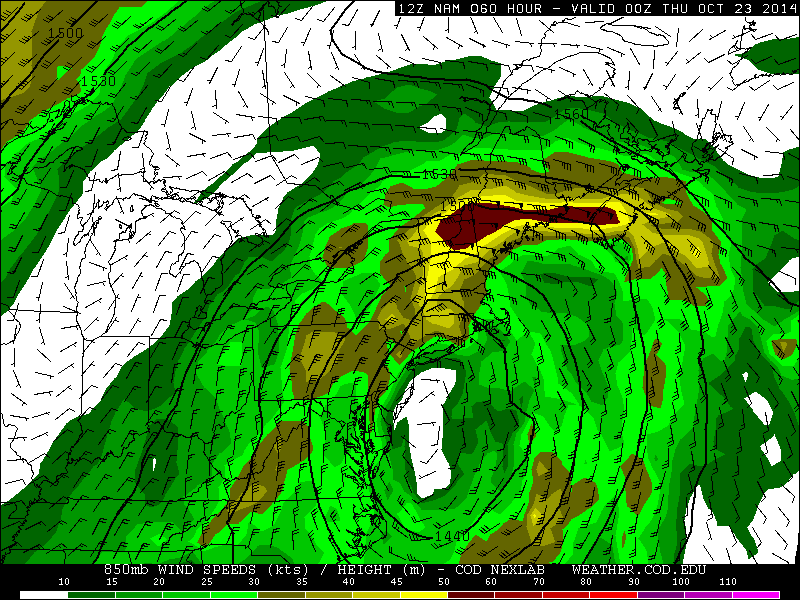
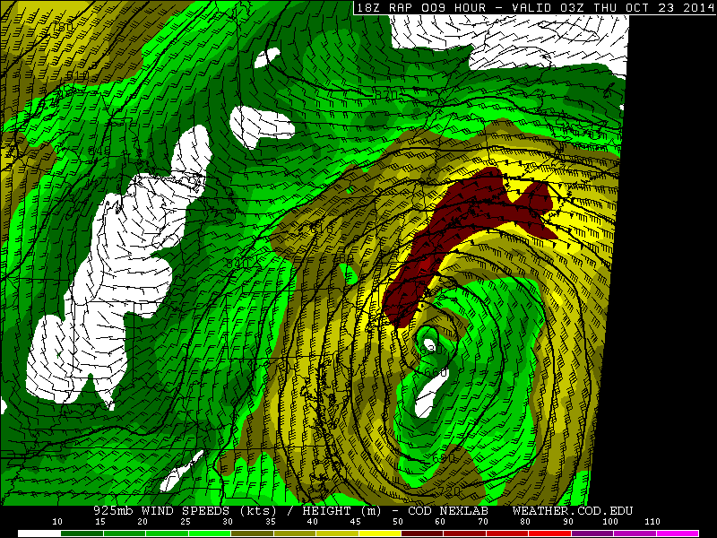
I expect bands of rain to continue to work their way inland from the ocean tonight and tomorrow. Some thunderstorms are still possible tonight. The 21z RAP shows 925mb winds at 40-50kt+ across coastal areas tonight. Heavy showers or thunderstorm could bring some of these winds down to surface, near the coast. Otherwise still not this storm, to much more than nuisance across the area. Tidal flooding should no be a\ issue along most coastal locations as winds are switching to the north and northwest. The only exception may be over parts of the north shore of Long Island or other north-facing shorelines.

21z RAP from College Dupage Site
21z RAP from College Dupage Site show 40-50kt winds from New York City, Long Island northward

This storm will be weaken pull away from Thursday night and Friday. With slow clearing taking place. This weekend still appears to be mostly dry.

Cut-off Coastal Storm Impacts This Week

We had the chillest morning of the season so far. Temperatures got down into the lower 40s over New York City. While most of the suburbs dropped into 30s. Many part of the interior also saw their first frost or freeze of season. With a mixture of sunshine and clouds temperatures still rose into the upper 50s to near 60 this afternoon areawide, However, the weather will more unsettled after today. A cut-off low in upper-level of atmosphere will develop over the Northeast and  Mid-Atlantic regions on Tuesday. At the surface, an area of low pressure of Great Lakes will move southeast towards the northern Mid-Atlantic region and then merge with another area of low pressure developing south of Long Island on Wednesday. This low will begin slowly deepen, as it moves north into New England on Thursday.

Closed/Cut-off Low over the East coast
Closed/Cut-off Low over the Mid-Atlantic coast n on the 12z NAM Model

Disturbances rotating around this low will trigger intermittent periods of rain in Tri-state area. On Tuesday some periods of rain and drizzle could start developing across the region by the late afternoon or evening hours and continue into the night. On Wednesday, more periods of rain are likely as this storm begins to consolidate and organize more south of Long Island. Some of the rain could heavy at times. But rain is likely to intermittent enough over next few days, to not cause any serious flooding issues. Rainfall totals will generally be somewhere between .50″ to 1.50″ for the entire area. But some spots may get less and more, depending on the banding. Winds will begin to increase from the north to northwest at 15mph to 25mph with gusts to 30mph near the coast on Wednesday. Periods of rain will likely continue into Thursday, as this storm will be close enough to impact the area.

12z NAM model showing a 850mb 50kt+ easterly jet over parts of Northern New England.
12z NAM model showing a 850mb 50kt+ easterly jet over parts of Northern New England by Wednesday evening

Impacts along the New York, New Jersey and Connecticut coastlines appear to be minimal. Winds won’t be very strong or damaging, due to lack of a strong pressure gradient in the Tri-State area. Some minor tidal flooding is possible on Wednesday morning with initially out of northeast. Then those winds should increase out the north than northwest in the afternoon and evening. Preventing anymore tidal flooding afterwards. Overall, this storm appears to be more of nuisance for local Tri-state area. However, this is likely to be full-blown nor’easter for Northern and Central parts of New England. A tight gradient with stronger high pressure over SE Canada, will cause a stronger easterly jet off the ocean in this area. Which will enhance moisture and warm-air advection for heavy rainfall totals of 2-4 inches and wind gusts in excess of 40mph or 50mph, along their coastlines.

This storm will be affecting many parts of Northern Mid-Atlantic and Northeast for two or three days this week.  But another system coming out the Pacific, should help to kick this cut-off low out the area, in time for mostly sunny skies and seasonable temperatures over the weekend. For the next few days though, I will continue the monitor this storm, and give updates here or on twitter on any changes.

Heavy Rains Tonight for NY Tri-State Area, Hurricane Gonzalo A Threat to Bermuda

Rain has held off for the tri-state most of the day. Warm and breezy conditions remained, and clouds even broke for some sunshine. But that looking at radar now, that is quickly changing.

A large cut-off area of low pressure moving east from the Ohio River Valley will continue to cause rain to spread east over the Tri-state area tonight with some heavy downpours and embedded  thunderstorms. Associated cold front and a strong southeasterly flow with this storm system, will bring an abundant amount of moisture, lift, and some elevated instability. Rainfall totals of 1″ – 2″ are expected for much of the area.  However some training of heavy rains or thunderstorms may also occur and produce heavier rainfall totals, in some spots. Precipitate water values support 1.50″ to 2.00″ suggests very heavy rainfall is possible in a short period of time. The main threat from this system is flash flooding in poor-drainage and low-lying areas. Some heavier showers or thunderstorms may bring down stronger winds aloft, in the form of wind gusts up to 40mph.  But southeast winds off the ocean, will keep surface-based instability on low side. So severe weather is not anticipated in the Tri-state area.

18z HRRR today showing band of heavy rain or thunderstorms  moving into the Tri-State area overnight
18z HRRR today showing band of heavy rain or thunderstorms moving into the Tri-State area overnight

As the cold front moves slowly across the region, rain with heavy downpours will be begin to taper from west to east during the day  Parts of Long Island and Connecticut may however see steady and heavy rain into the afternoon hours.   Cooler and drier weather should arrive on Friday and Saturday with temperatures seasonable. An even cooler airmass from Canada, will arrive behind another cold front on Sunday. High temperatures on Sunday and early next week, may only be in the lower to middle 50s, even with alot of sunshine. Temperatures on Sunday night may also be fall into the lower 40s or 30s. Some parts of the area may see their first frost or freeze. Especially over Northwest New Jersey and Lower Hudson Valley:


12z GFS showing temperatures in the 30s over the tri-state area Sunday night.
12z GFS today showing temperatures in the 30s over the tri-state area Sunday night.


Meanwhile Hurricane Gonzalo  became a category 4 hurricane today winds of 130mph as it moves northwest over the Southwest Atlantic. The storm is expected to turn northeast into the open North Atlantic this weekend. However, it may pass very close to Bermuda as major hurricane, before doing that, on Friday.  As of 5pm EDT, the National Hurricane Center has issued a hurricane watch for Bermuda. Gonzalo weakened slightly to catergory 3 hurricane with 125mph winds. But is forecast to be category 3 hurricane very close to Bermuda at 2pm Friday. High swells, possibly up to 10ft, from Gonzalo will also reach the New Jersey and Long Island shores by Friday night and Saturday. Stay tuned more updates here on this storm through Saturday.


Visible image late this afternoon of Hurricane Gonzalo