The weather over the last several days has been good as it gets here in late July. Crystal blue skies, some patchy clouds, high temperatures in the 80s, and very low humidity. Climatology records show that these temperatures this actually normal for this time of year. But we are accustomed to seeing more heat and humidity during summer. So far, this summer has seen too much of that. This mainly due the warm pool anomaly in the Northeast Pacific Ocean and a strong MJO in phases 7 and 8 supporting a -AO/NAO, Western US ridge and deeper troughiness over Northeast US over for the late June and early July. The MJO weakening will allow for ridge build in the east again, with more heat and humidity coming for next week.
Tropics
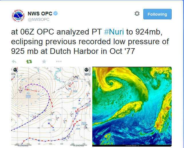
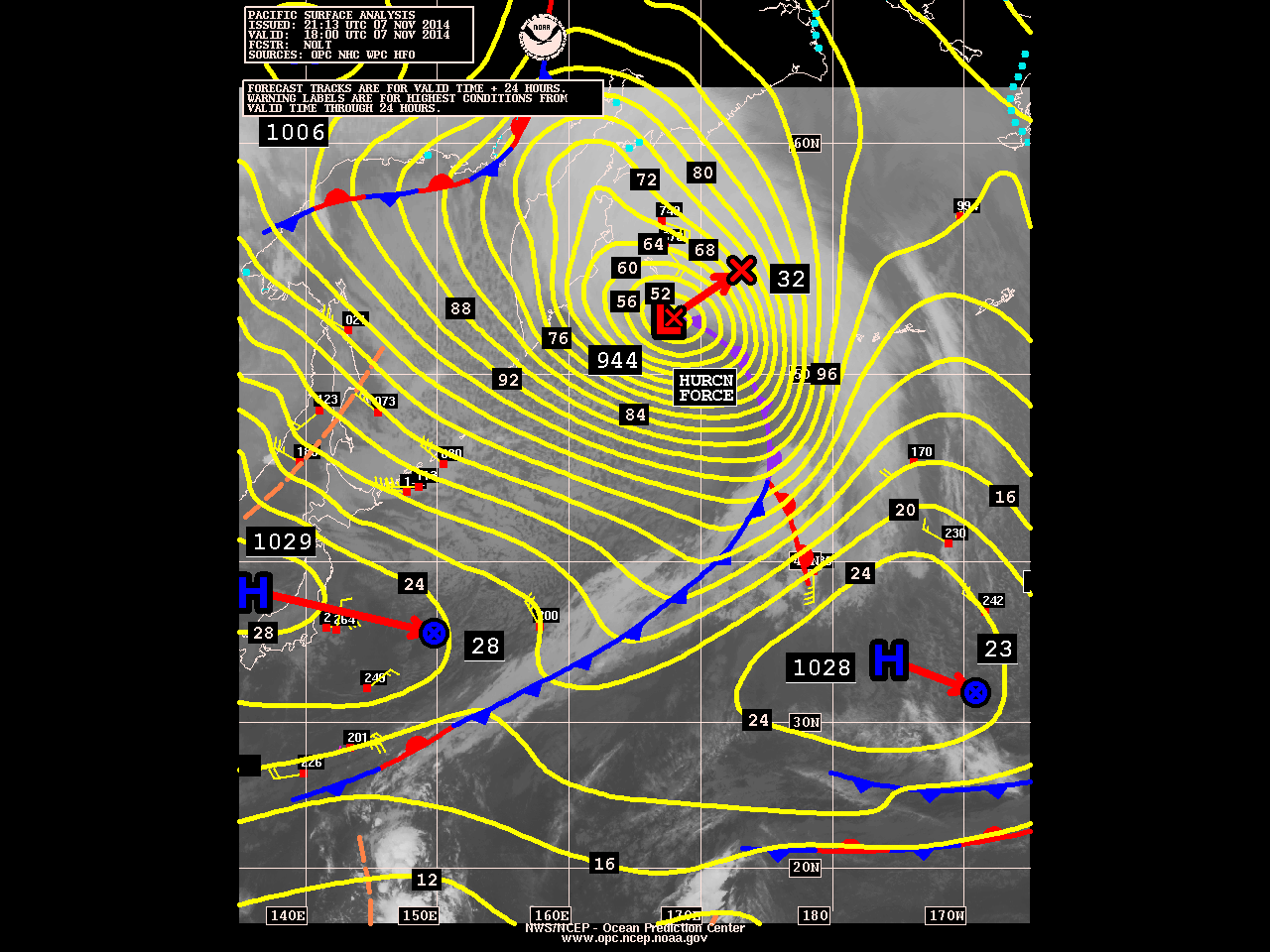
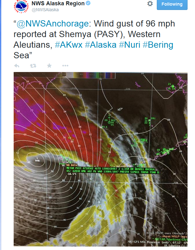
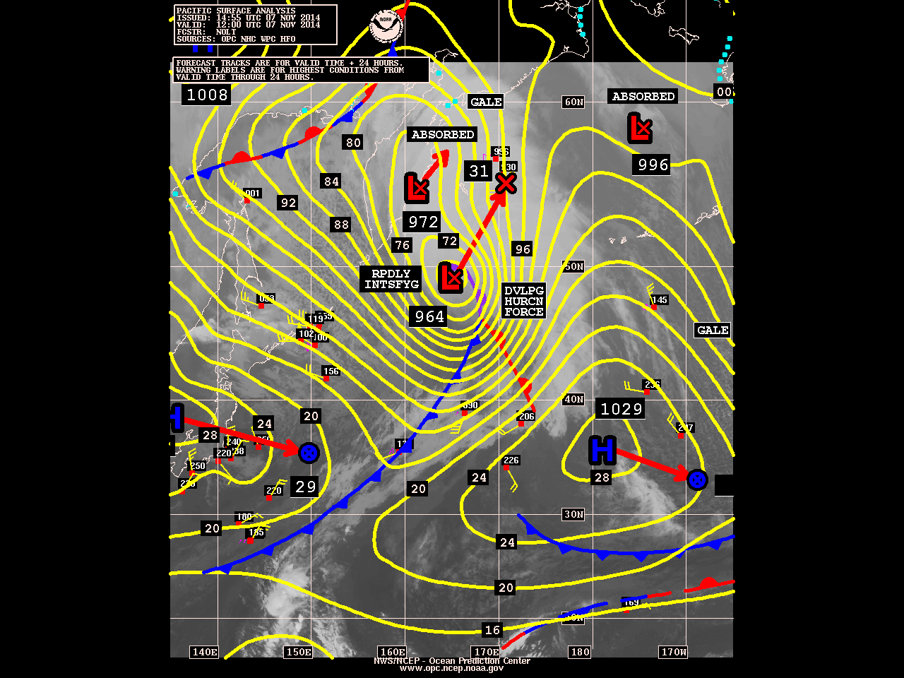
Remnants of Former Super Typhoon Nuri Phasing into Very Deep Extratropical Low in the Bering Sea
The remnants of former Super Typhoon Nuri are just south of Bering Sea and phasing with another low to west. The storm is now rapidly intensifying and it expected to bring hurricane-force winds and high waves to the Aleutian Islands. Some models have this storm deepening below 925mb pressure. That will make it strongest extratropical storm (non-tropical in structure) in that region ever. As it explained before, this storm will also help to change the pattern over North America to more wintry one starting next week. However, there apparently some misconceptions out there about this pattern evolution. Nuri will have no direct impact on the United States mainland and will not become the polar vortex. Nuri as powerful extratropical storm, will enhance a ridge already building into artic circle. Which cause the polar vortex in the troposphere, to split and then one large piece of it to dive down into Ontario and James Bay. This will transport an airmass of artic origin, into the United States from the Rockies to the East Coast. But it will not be brutally cold, because in November, airmass in the high latitudes are typically not as cold during the winter months. I will continue to posts updates here on pressure and impacts this storm will have over the Aleutian Islands and influence on pattern change.
10:15am Update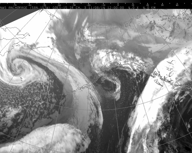
5:15am Saturday Update:
4:45pm Update:
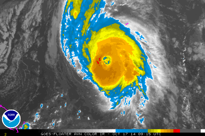
Major Hurricane Gonzalo Bears Down on Bermuda
Hurricane warning remains in effect for Bermuda, as the island expects severe impacts from Hurricane Gonzalo. On Thursday, the storm restrengthened to category 4 hurricane with maximum sustained winds of 145mph. Then turned to north-northeast on a track towards Bermuda. This morning, Gonzalo is still a category 4 storm with maximum sustained winds decreased to 130mph. Over the past 12 hours, the hurricane has being undergoing an eyewall replacement cycle. This is where an outer eyewall forms and begins to replace the inner eyewall. During this cycle, some weakening typically occurs, until it’s complete.
Gonzalo will be moving over cooler sea-surface temperatures later today. Upper-level shear is also increasing from a upper-level trough moving off the East Coast of the US. So some further weakening is possible today and tonight. But Gonzalo still expected to remain a major and dangerous hurricane, while passing over or near the island of Bermuda this evening. Gonzalo is expected to bring heavy rains and winds over 100mph to Bermuda. According to the National Hurricane Center Gonzalo’s current forecast track will also create a significant storm surge for the island, that could rival the 10-foot surge produced by major Hurricane Fabian in 2003.
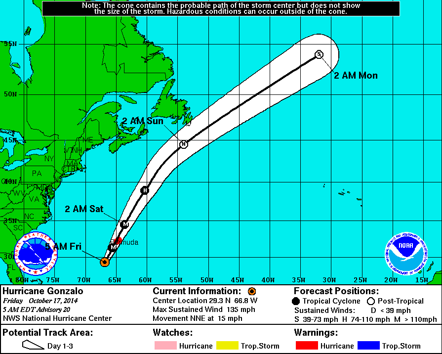
Gonzalo will produce some swells along the East Coast through this weekend. As it moves by Bermuda then tracks more northeast into the North Atlantic. For the local area, Wave Watch model 6-12″ feet waves over the New Jersey and Long Island coastal waters on Saturday morning. Gonzalo will weaken further then transition to a post-tropical system by Sunday. Stay tuned for more updates here on this storm. Residents of Bermuda, should follow updates the National Hurricane Center for more updates system through tonight
