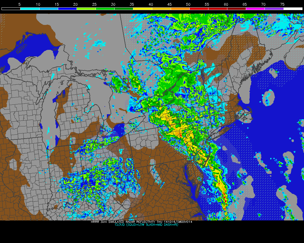
Rain has held off for the tri-state most of the day. Warm and breezy conditions remained, and clouds even broke for some sunshine. But that looking at radar now, that is quickly changing.
A large cut-off area of low pressure moving east from the Ohio River Valley will continue to cause rain to spread east over the Tri-state area tonight with some heavy downpours and embedded thunderstorms. Associated cold front and a strong southeasterly flow with this storm system, will bring an abundant amount of moisture, lift, and some elevated instability. Rainfall totals of 1″ – 2″ are expected for much of the area. However some training of heavy rains or thunderstorms may also occur and produce heavier rainfall totals, in some spots. Precipitate water values support 1.50″ to 2.00″ suggests very heavy rainfall is possible in a short period of time. The main threat from this system is flash flooding in poor-drainage and low-lying areas. Some heavier showers or thunderstorms may bring down stronger winds aloft, in the form of wind gusts up to 40mph. But southeast winds off the ocean, will keep surface-based instability on low side. So severe weather is not anticipated in the Tri-state area.
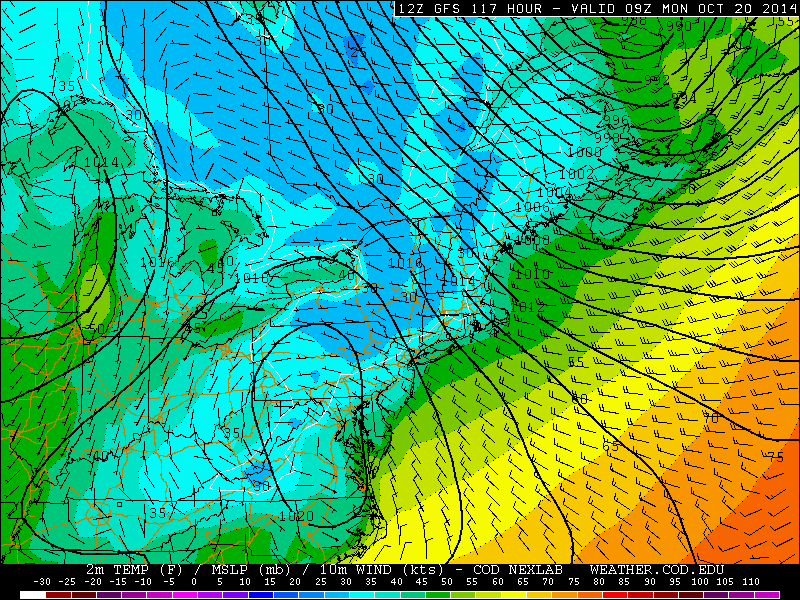
As the cold front moves slowly across the region, rain with heavy downpours will be begin to taper from west to east during the day Parts of Long Island and Connecticut may however see steady and heavy rain into the afternoon hours. Cooler and drier weather should arrive on Friday and Saturday with temperatures seasonable. An even cooler airmass from Canada, will arrive behind another cold front on Sunday. High temperatures on Sunday and early next week, may only be in the lower to middle 50s, even with alot of sunshine. Temperatures on Sunday night may also be fall into the lower 40s or 30s. Some parts of the area may see their first frost or freeze. Especially over Northwest New Jersey and Lower Hudson Valley:
Meanwhile Hurricane Gonzalo became a category 4 hurricane today winds of 130mph as it moves northwest over the Southwest Atlantic. The storm is expected to turn northeast into the open North Atlantic this weekend. However, it may pass very close to Bermuda as major hurricane, before doing that, on Friday. As of 5pm EDT, the National Hurricane Center has issued a hurricane watch for Bermuda. Gonzalo weakened slightly to catergory 3 hurricane with 125mph winds. But is forecast to be category 3 hurricane very close to Bermuda at 2pm Friday. High swells, possibly up to 10ft, from Gonzalo will also reach the New Jersey and Long Island shores by Friday night and Saturday. Stay tuned more updates here on this storm through Saturday.


