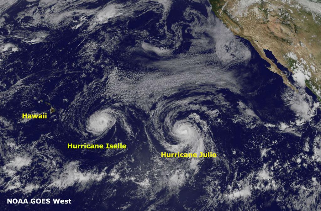
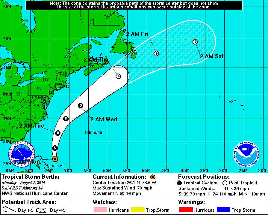
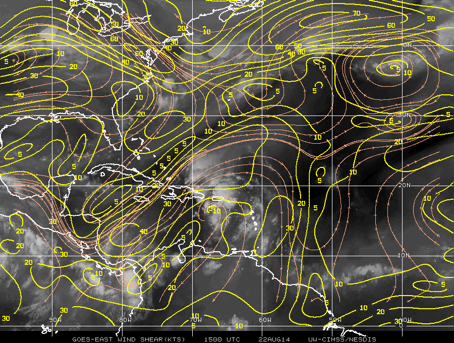
Tropical wave 96L is currently moving west-northwest over Puerto Rico this morning. Another reconnaissance flight is scheduled to fly into the system this afternoon. But it is difficult to discern a closed surface circulation with surface observations and satellite imagery this morning. Strong shear from upper-level trough over the Western Atlantic is enhancing a large area of convection that stretches from the Northeast Carribean Sea to the Southwest Atlantic. This shear along with some land interaction with Puerto Rico and Hispaniola, will likely inhibit further development into a tropical storm through the day tomorrow.
 On Sunday this system will steered northward into a weakness in ridge over Western Atlantic. At this point, the environment may become more favorable for further development. It will be over warmer waters and the current trough may lift out enough for shear to relax. After this period, the track becomes more uncertain. Another trough will be digging over the Western Atlantic. Some models show this trough fully capturing 96L and quickly recurve it out to sea. Other models show this trough leaving behind 96L and turn it back towards the west or northwest again. However, this would likely be temporary as most models also show a strong ridge building over the Eastern US next week, that would block further movement west or northwest from 96L.
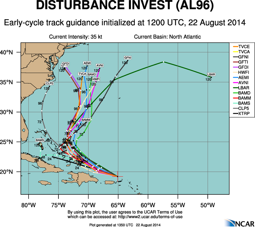
Overall in my opinion, the pattern doesn’t look favorable 96L to make landfall along the East coast as significant tropical system. Tropical storms and hurricanes often take the path of least resistance. Which appears to be over the Western Atlantic next week, between stronger blocking ridge over portions of the Eastern United States and over the Central Atlantic. However, if next week’s trough to be not as deep or more progressive, this could more allow high pressure to build over the Northwest Atlantic, forcing a track closer to East Coast. Assuming the environment becomes favorable enough for tropical storm to form. At this time, this scenario has a very small chance of happening. But everyone along East Coast, particularly from the Carolinas to New England still need to monitor this storm. Whether not this system threatens the US, large swell from this storm could impact East Coast next week. Another update, will come if they are any major changes or upgrade to tropical storm.