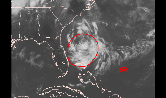
First tropical storm of the Atlantic Hurricane Season, Arthur was born today, from a disturbance that was previously discussed off the Southeast US coast. Weaker northerly shear allowed thunderstorms organized more over the center. As of the 11pm advisory from the National Hurricane Center, Arthur has maximum sustained winds of 50mph and is pm;u drifting northward. However, very cold cloud tops near the center, seen on satellite imagery this evening, indicate that Arthur continues to get better organized and might start intensification trend soon.
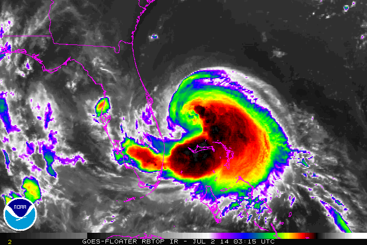
Most model guidance shows Arthur strengthening to a hurricane as it moves north-northeast near or over the outer banks of North Carolina. That area could some heavy rain and strong winds. Although, since this is lop-sided system with drier air to northwest, hurricane force wind will likely be in southeast quadrant. Then the storm will track out into the open Atlantic, well southeast of the Tri-State Area. However, Arthur will be in right-entrance region of strong upper-level jet streak, enhancing an band of rainfall over local tri-state area during day on Friday (July 4th). Some rough surf may occur at the beaches. The rain start moving out by Friday evening. Perhaps just in time for fireworks festivities. This weekend is look beautiful with mostly sunny skies and temperatures in middle to upper 80s.
Before that we are looking at more heat and humidity to continue through at Wednesday for tri-state area. High temperatures on Wednesday will likely get between in low or middle 90s for NE NJ and NYC, with sea-breezes keeping more coastal areas slightly cooler. There is also a chance of some afternoon thunderstorms, with a pre-frontal trough over region. Some thunderstorms may be locally severe with amount of surface-based instability shown of the guidance. However, bulk shear is little low for thunderstorms to remain well organized. So I’m not expecting widespread severe weather. Some thunderstorms may also produce some very heavy rainfall. Thursday looks wetter with cold front and upper-level streak closer,with scattered showers and thunderstorms all day. Some thunderstorms may train and cause flash flooding.