NYC Metro Area Weekly Weather Outlook 5/23/22

Mainly tranquil weather is expected Monday through Wednesday with cooler temperatures and lower humidity. More unsettled weather is likely with some showers and thunderstorms in the region on Thursday and Friday. But will weather conditions improve for Memorial Day weekend?  Check for more forecast details for each day this below.

Monday through Wednesday

High pressure builds in from northwest for Monday. Clouds will mix sunshine at times, but no rain is expected.  High temperatures will be in the low to mid 70s and light northerly winds. It will remain dry and comfortable this evening with partly cloudy skies.

Then more clouds will stream northward from a wave low pressure over Lower Mid-Atlantic region. An inverted trough extending northeast from this wave, may produce a few light showers or sprinkles in the region late tonight and Tuesday morning. But most of the rainfall with this system will stay well to the south. Temperatures will drop into the mid-upper 50s with winds turning to northeast. Later Tuesday afternoon, clouds may begin to break for more sunshine as the low pressure passes to the south. But onshore winds should keep high temperatures in the mid-upper 60s.

On Wednesday, high pressure from the northeast will build into the region, causing clouds to break for more sunshine. But onshore winds out of the southeast will likely keep high temperatures in the mid-upper 60s for most of the region.

Thursday and Friday

On Thursday, another wave of low pressure and a warm front will start lifting northward out of the Lower Mid-Atlantic region.  This will lead to more cloudy skies and showers in the local region on Thursday, but heavy rainfall isn’t expected at this time. Temperatures will be warming up into the upper 60s to lower 70s, as the flow becomes more southern.

On Friday, a larger frontal system and upper-level trough will be moving through region with more abundant forcing, moisture, and instability ahead of it. Thus, more numerous showers and thunderstorms with heavy downpours are likely. There could be also some risk for strong to severe thunderstorms, depending on timing of the systems cold front and the amount of instability present. Temperatures could approach 80, before cold front arrives late in the day.  

Memorial Day Weekend

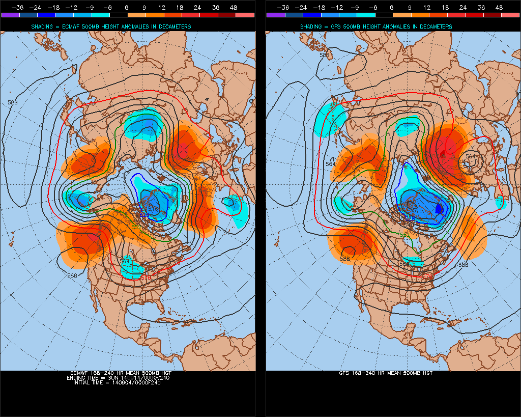
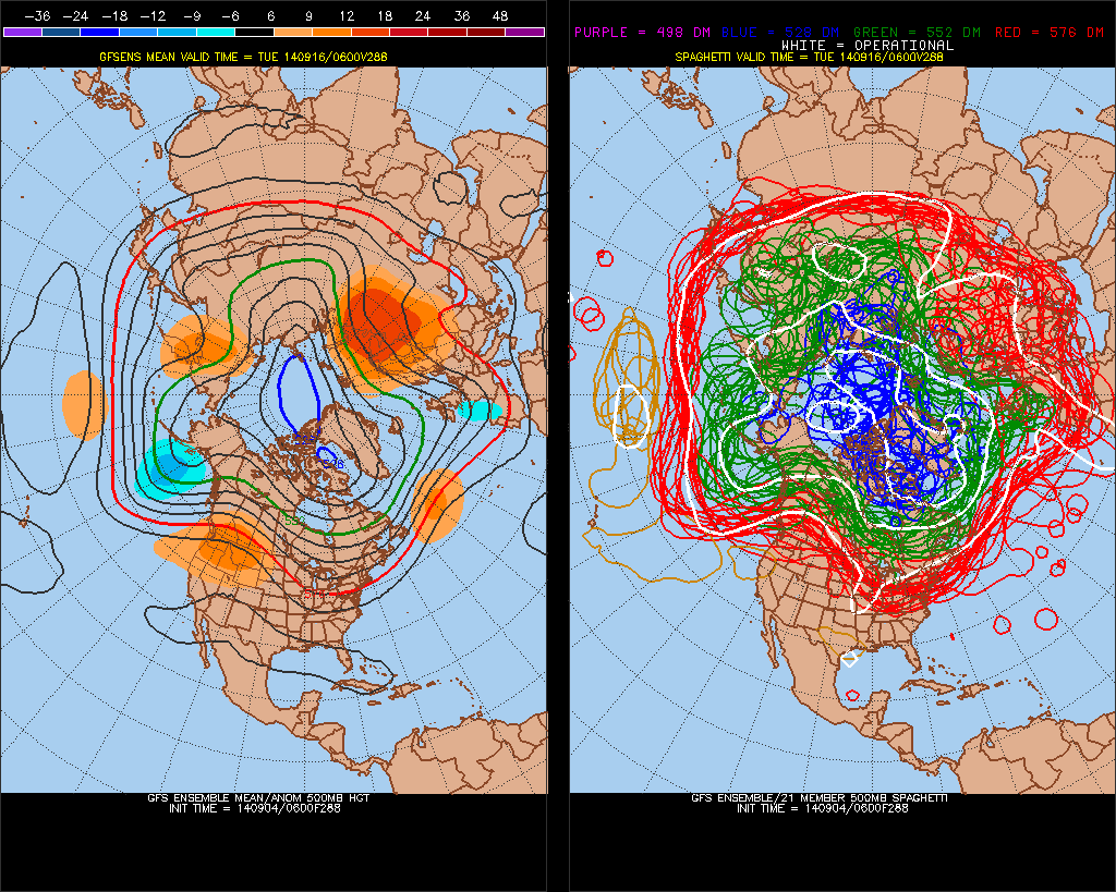
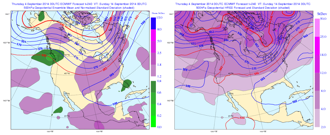
There is some uncertainty with the forecast for Memorial Day weekend. The ECMWF model shows the cold front and upper-level trough moving offshore, which will allow for high pressure and upper-level ridging to build over Northeast US. If this happens, it will be mainly dry with a warming trend each day with high temperatures.

However, the GFS model shows a cut-off low forming over the Ohio Valley and causing the frontal boundary to linger over the East Coast. If this occurs more unsettled weather with occasional showers and thunderstorms will be around each day. But not necessarily, any washouts.

At this time, ensemble guidance for both models suggest a more progressive trough and cold front. Thus warmer and drier conditions are now favored for much of the weekend. I will keep you posted this week, if that changes.

Volatile Weather Pattern the Next Few Weeks

Currently the guidance has an incoherent or erratic MJO, next the 15 days or so. This has an influence on model and ensemble long-range 500mb forecasts for North America. We’ve see go back and forth between a strong ridge over the United States to not deeper trough. Until the MJO signal becomes more coherent or weakens to point where there will be little influence, we continue to see alot of volatility on guidance:

NCPE_phase_21m_full

ECMF_phase_51m_full

Overnight guidance looks unsettled next week, with a couple a waves of low pressure over the Mid-Atlantic states. If correct, this will have an influence on temperatures next week. Otherwise temperatures will start out near to slight below normal next week. Then trend above average later next week. Whether we same type of heat or large positive departures, we saw this week, remains to be seen. Long guidance overnight seems to be more pronounced with the trough over North America. But the GFS and it ensembles still faster bring the trough to the east than the Euro and it’s ensembles overall. The Euro still holds on to WAR and well above average for day or two before trough and cold front arrives Sept 13-14th. Their might be some GFS trough and Euro ridge bias at play here. So I’d be careful picking one guidance over the other right now, and look for consistency, trends first:


0zGFSEC500mb

6zGEFSf2880zECENS

The NAFES 8 to 14 day outlooks shows high probabilities of below normal temperatures over Midwest, Great Lakes and Ohio Valley  Lower probabilities for below normal temperatures further east. Probably due to strong Western Atlantic ridge keep cooler anomalies to the west. At this time, for the local tri-state area, I’m leaning towards temperatures fluctuating  between slightly below normal to well above average and precipitation near normal, for the next 15 days at least. More updates this discussion may over the next couple days as more data comes in:


00zNAFES

Some Heat Returns, Labor Day Weekend Looking Unsettled

Some heat is making comeback this week, as ridge builds over the Eastern US. This ridge has been enhanced by Cristobal. Which is now a category 1 hurricane just northwest of the Bahamas and will recurve out to sea this week. Today we saw sunny skies with highs in the middle to upper 80s through much of the local tri-state area. Tomorrow looks pretty same, except a stronger south to southwest flow may keep areas near the shore a little cooler tomorrow.

On Wednesday a cold front will be across the region, during the afternoon. The flow will turn more west to southwest, pumping in more heat and humidity. Temperatures with enough sunshine could get to or above 90F degress for highs on Wednesday for much of NJ and NYC area. Some showers and thunderstorms may form along this cold front. The NAM shows very unstable airmass away from the coast, with MLCAPE values between 1500 J/kg and 2500 J/kg. Shear is also marginal enough for threat of some isolated strong to severe thunderstorms. Other models such as GFS and ECMWF have the atmosphere more capped and stable, keep coverage of showers and thunderstorm very low. It should become clearer tomorrow if we are looking at threat of severe weather.

After this cold passes through Wednesday night, a cooler less humid airmass will be ushered in again. Higher temperatures return to near normal, in the lower 80s for most spots. Heat and humidity may try to return over the Labor Day weekend. As a ridge starting building east again. However, a frontal system approaching the west, may keep unsettled weather conditions for the weekend. At this time, it doesn’t look a like complete washout, and I don’t advise to change any plans yet. But there will probably be some showers or thunderstorms, at some point. Model guidance shows different timing of this system’s warm and cold front moving through the area. This should become clearer as we draw closer.