Fri evening update: Latest guidance now keeps accumulating snow south of NYC. Due the less interaction between northern and southern streams. As well as a stronger high pressure over the Great Lakes/Northeast. My confidence is increasing that this will occur. But will continue to monitor for any changes. Look at 7-day forecast for updates.
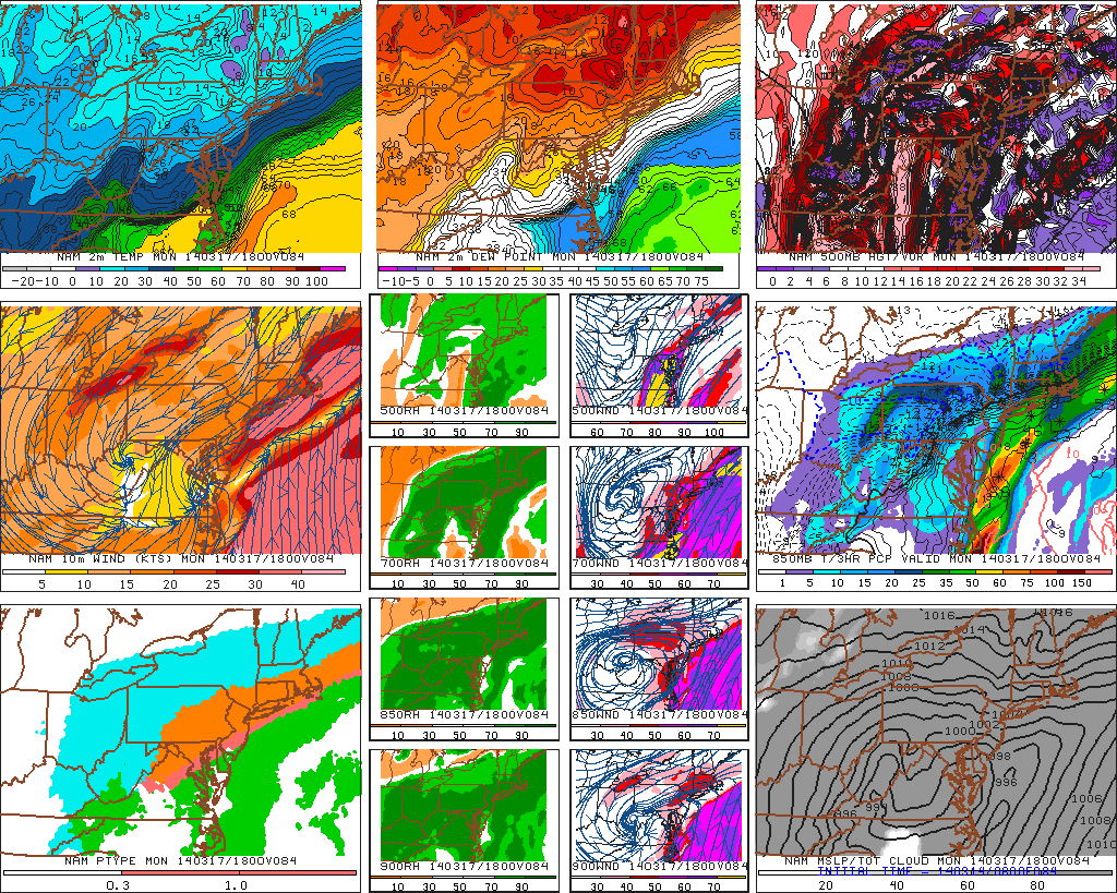
Guidance shows another winter storm possibly for late Sunday night into Monday. What complicates this winter storm threat, are models handling of another system coming into Pacific NW and flattening heights over the Western US. Each model has slight differently 500mb pattern that results in different impacts in our area.
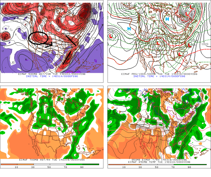
The 0z ECMWF and 6z GFS hangs back more southern stream energy over Gulf coast. While also showing a little northern stream interaction. This more strung out area of low pressure with two waves that remain weak and farther east. The reason for this because Pacific system has already moving into Northern Rockies. These solutions would keeper is colder and drier.give a light to moderate snowfall for the tri-state area:
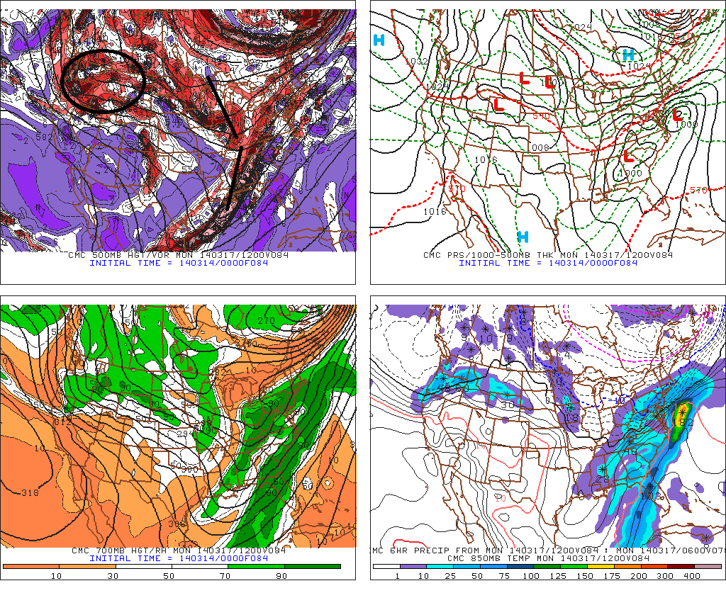
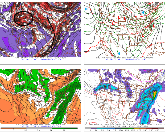
 The 0z CMC model is showing more southern stream energy coming out and interacting with northern stream energy. This results in a stronger first wave and the second wave coming further north. The reason this can happen here, is that Pacific system is little slower coming into the Northern Rockies. Strong high pressure will also be supply us with cold air and enhance a thermal gradient just to our south.. This solution would result in moderate to significant snowfall for much of the tri-state area.
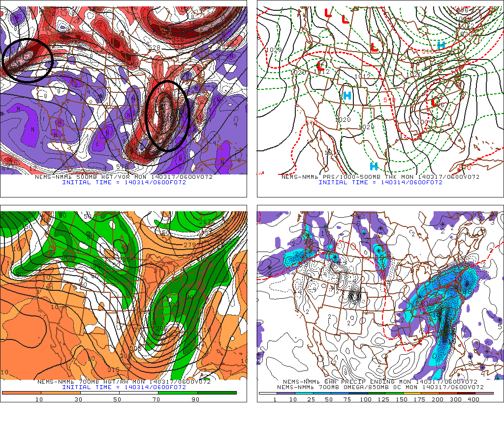
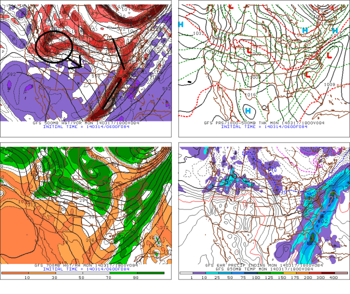
 The 6z NAM has more phasing between northern and southern streams. Therefore has more consolidated storm, tracking further west. The reason it is able to do this, is because Pacific system is much slower coming into NW coast and heights remain stronger over Northern Rockies. This solution would actually cause more warmer air to surge aloft, changing many of us over from heavy snow to sleet or freezing rain:
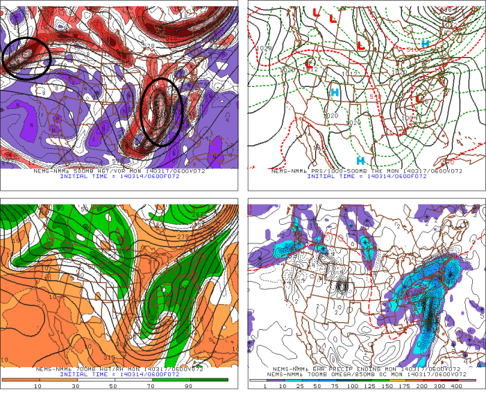
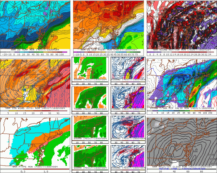 ECMWF,GFS, GGEM all have support form their ensemble means. The ECMWF and GFS , have a little more support from the current progressive pattern, as well. However, the GGEM has been most consistent with ejection of more southern stream energy. So it’s solutions should be strongly weighed here. The NAM at this range is unreliable for winter storms. So I would be wary of it, without any other model support. Models will get a better on all this energy as it comes onshore the next few days. I will have another update this evening, with new set of models runs.
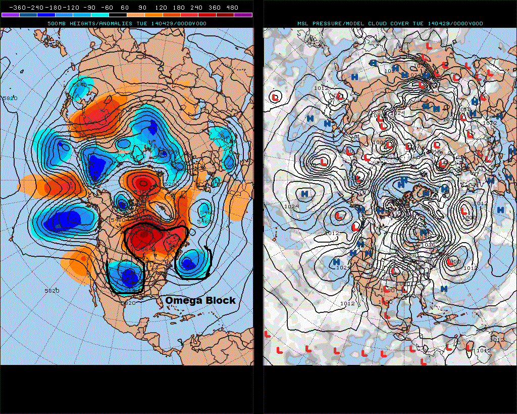
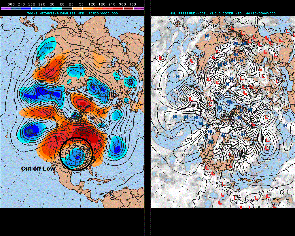
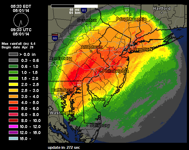 Central Park in New York also set a daily record rainfall record of 4.97″ for April 30th (storm total for two days is 5.12″). This was also the 10th wettest day recorded. Daily rainfall records were also set in LaGuardia Airport 5.26″ and JFK Airport 4.68, Newark Airport 5.24″. LaGuardia and JFK had their 4th wettest days record. Newark had their 6th wettest day recorded.