This is an update to the previous post on the cold & storm pattern in late February and early March
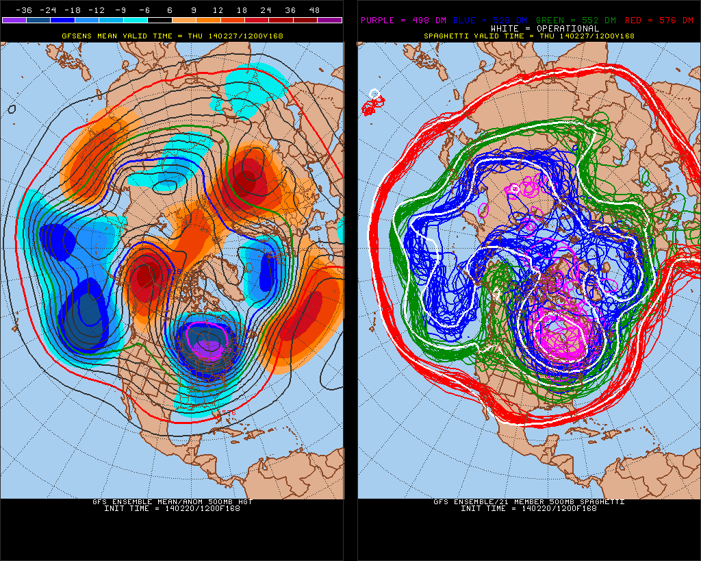
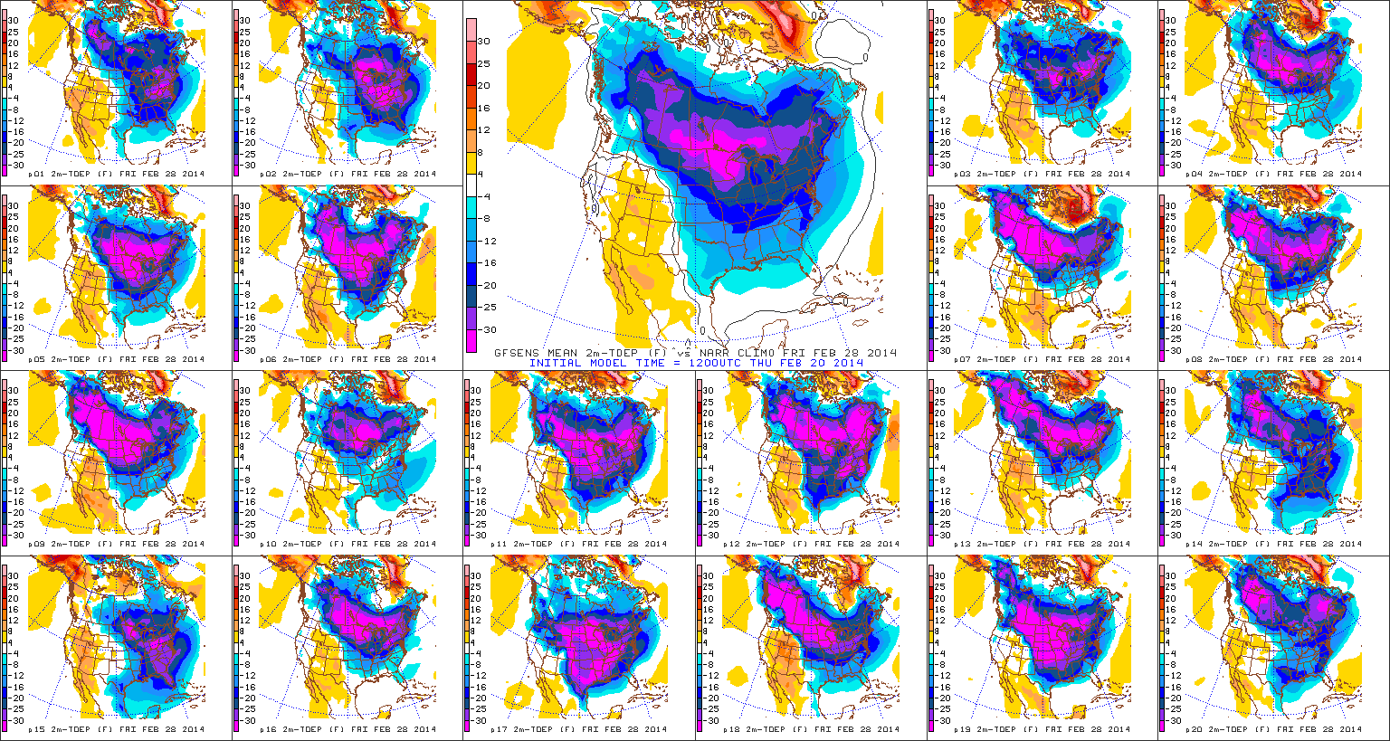
First, the model guidance now the Polar vortex drop further south in SE Canada. This is due the 500mb heights increasing around North Pole. This is similar pattern evolution we saw in the last two weeks of January So there is now more potential for more extreme cold for late February and early March. You may have to wear you big coats again. The GEFS shows this potential for very anomalous negative 500mb height and surface temparture departures, near end of the next week.
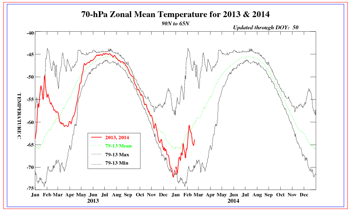
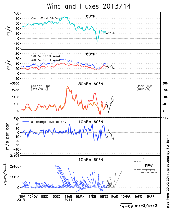
 Another minor stratospheric warm event is occurring. The EP vectors are forecast shift more to right (poleward) by ECMWF. This would means that warm would be downwell in higher latitudes. Possibly resulting more west-based blocking over Greenland/Davis Strait.
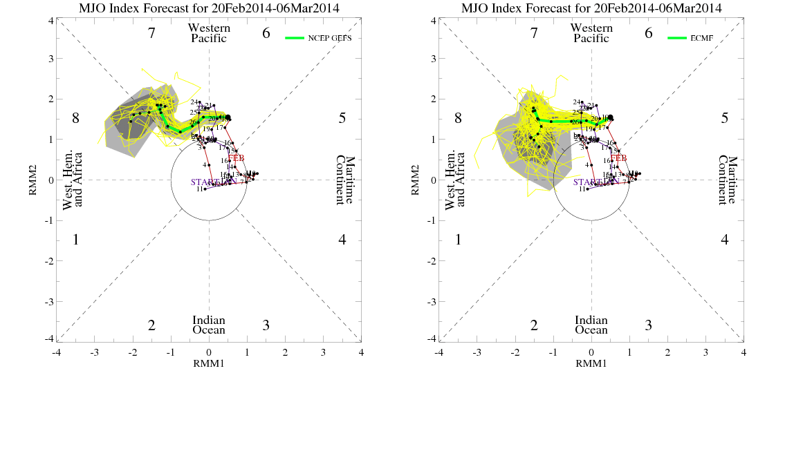
 The MJO still forecast by GFS and ECMWF ensembles to head in through phases 7 and 8. These forecasts are a little less than reliable. But they have been fairly consistent this week. There is more support for progression by westerly vector wind anomalies being shown at 200mb and 850mb, over the Central Pacific.
 More later…
