No we aren’t done with snow yet. Sometimes winter likes to linger into late March and even April.
An inverted trough with bands of snow will develop over New England and Long Island tomorrow afternoon and evening. This an elongated area of low pressure that extends from a larger storm developing well offshore. Upper-level shortwave energy enhances lifting and instability along this trough. Often there is narrow band of heavier snowfall associated with these troughs. The exact placement and intensity of the banding with these type of systems, are often difficult models to handle and these solutions vary from run to run. At this time it appears, that there is enough agreement to increase chances for accumulating snow tomorrow afternoon and even more so tomorrow night for parts of Long Island and New England.
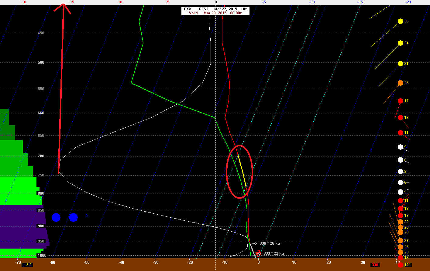
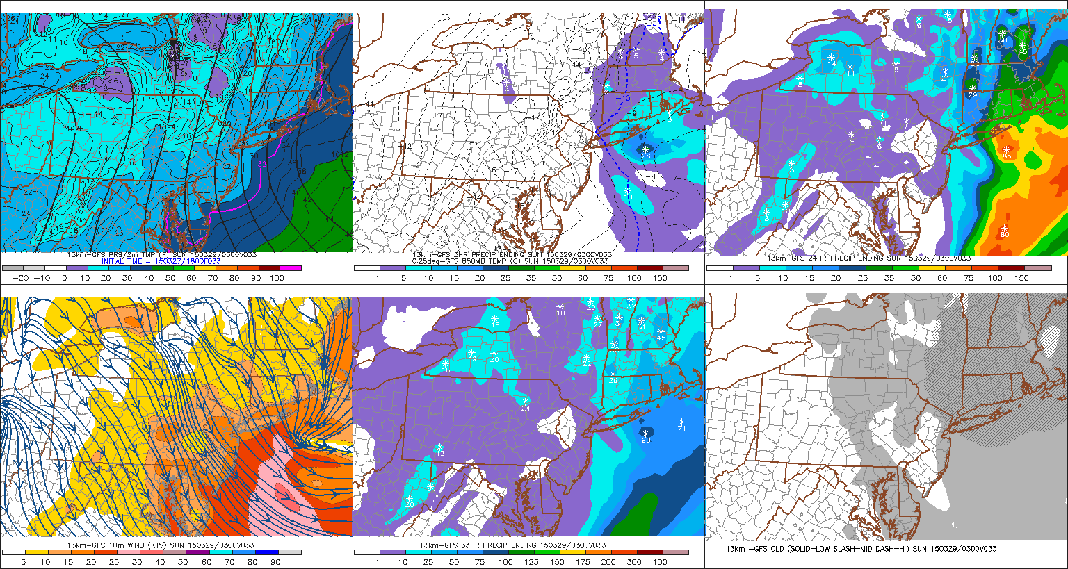 The latest run of the 18z GFS, shows a band of moderate to heavy snow falling over Eastern Long Island by tomorrow evening. The GFS sounding over OKX (Brookhaven, NY) shows significant omega values of up to -15 ub/s in snow growth region between 700mb and 800mb. Temperatures early tomorrow afternoon will be middle 30s. So initially some melting will occur, especially the roads and streets. However, after 4pm temperatures will fall into lower 30s and upper 20s as snowfall rates begin to increase and more cold air starts to advect in from the northwest. Snow should start accumulate on most surfaces at this point. At this time, a 1″ – 3″ snowfall looks most likely over Eastern Long Island and Southeast Connecticut. Localized snowfall totals between 3″ to 6″ are possible if heavier banding develops Saturday night. This will continued to be monitored and I will have another update tomorrow morning
Elsewhere over tri-state some snow showers or flurries are possible tomorrow afternoon and early tomorrow evening.. These will not amount to much than some dustings or coating on the grass and colder surfaces. These areas will be too far away from the inverted trough. Some places west of New York City may not even see a flake. Snow will begin to end for Eastern Long Island and Southeast Connecticut, after midnight Saturday night. Sunday will become mostly sunny with high temperatures in upper 30s to lower 40s. As high pressure builds in from the west.