The potential for major winter storm over Eastern US is increasing for Sunday night and Monday A Pacific storm will move inland over California and weaken on Saturday. The remaining energy from this system will track into the Southern Plains on Sunday. Where new area of low pressure will from along a strong baroclinic zone.
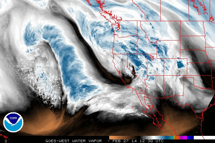
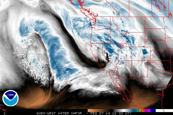
This afternoon’s water vapor of the storm now in the Pacific:
Overrunning precipitation will developing well ahead of this system on Sunday evening, over the tri-state area, What form this precipitation take depends on timing and placement artic boundary moves through the area. At this time, most of guidance pushes this boundary through to south late Sunday night, with low-level and mid-level temperatures falling behind it. So precipitation could start of mix of rain,sleet, and snow early Sunday night before changing over to all snow.
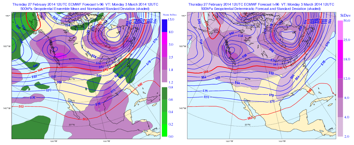
A strong thermal gradient form between along the artic boundary, as the Southern Plains low being to track NE and push warmer air over a very cold airmass support by a polar vortex over Southeast Canada and large, strong high pressure system to north. Just north this gradient, is where snowfall rates will be higher due to isentropic lifting. This is important for significant snowfall to occur, especially during the daylight hours on Monday. Surface temperatures will also lower 20s and teens throughout the region. So there will be some accumulation, despite the stronger sun angle in early March. Anywhere, south of this gradient, snow changes over to sleet, freezing rain, or plain rain near the coast. These details will be fined tuned as get closer.
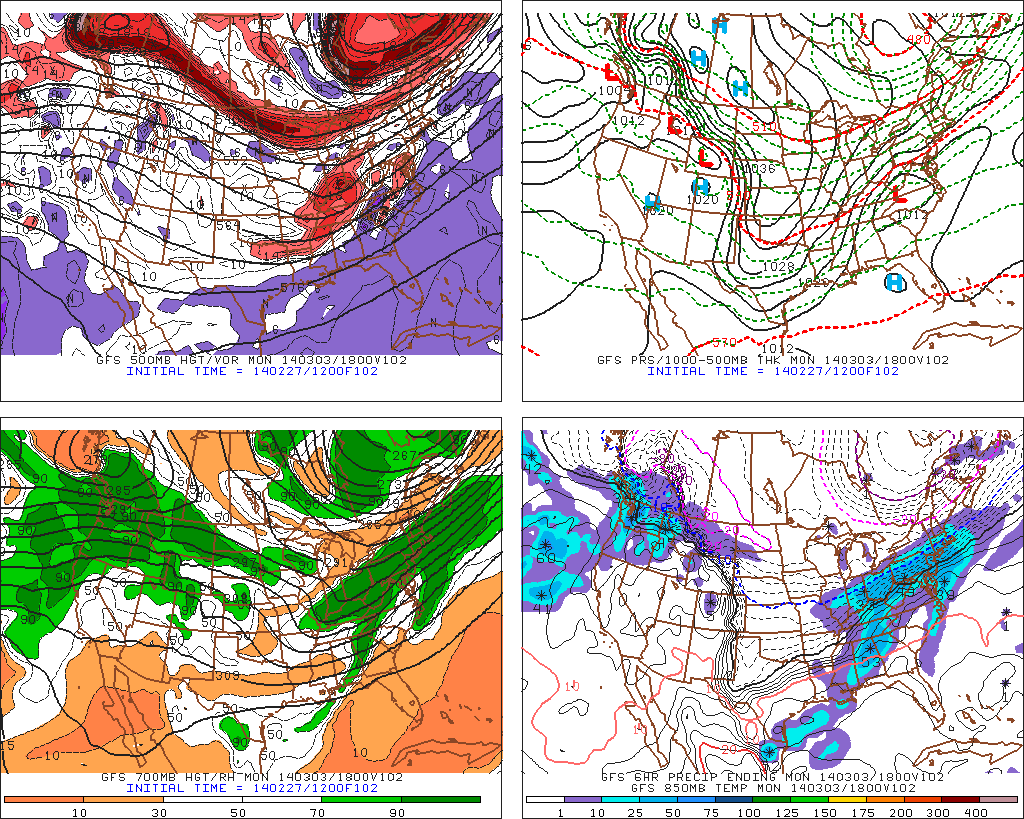
Today’s 12z GFS forecasting heavy snowfall just north of thermal gradient over the tri-state area on Monday :
 The evolution of the polar vortex, will be a determining factor on far north and amplified this storm system will be and the placement of thermal gradient in our region. A stronger vortex over all of SE Canada will shear out this system and keep us north of the gradient. A weaker vortex would allow this storm to amplify more and pushing the thermal gradient to our north.
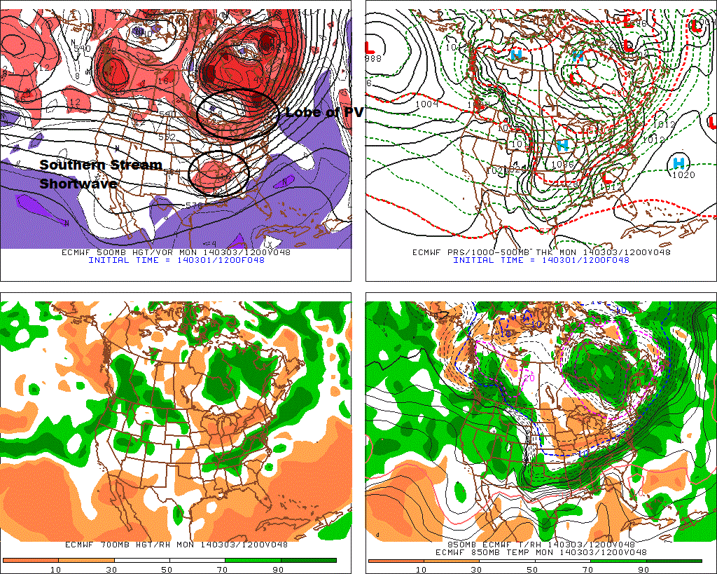
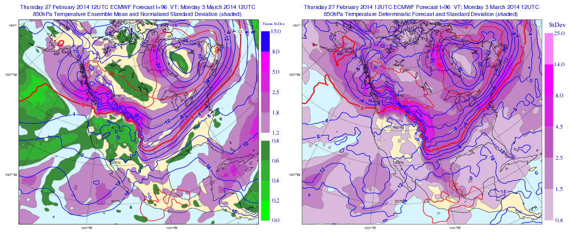
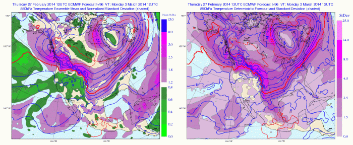
500mb heights and 850mb temperatures from today’s 12z ECMWF (right) and ECMWF Ensemble Mean (left):
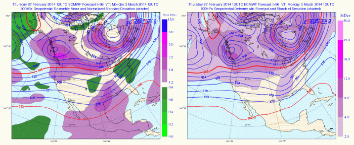
 On the extreme sides, of possible scenarios, is one that leads to complete suppression by a very strong Polar vortex. The other scenario is that this is mostly rain with weaker Polar Vortex, allowing more warm air to surge northward. Based today’s guidance, for stronger polar vortex and more organized system, these scenarios appear, very unlikely at this time.
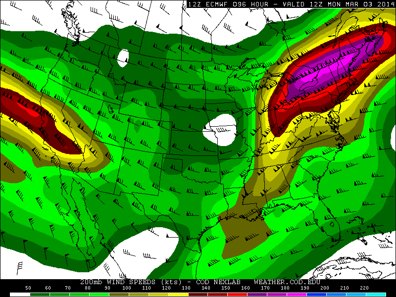
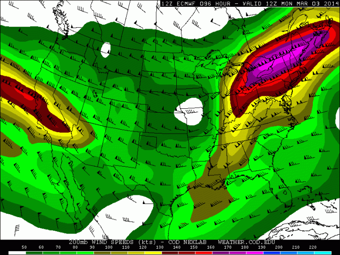
A couple more notes on this system. First one, is that there is a 150kt+ upper-level jet streak running to north of it. Underneath this jet streak is alot of divergence (forcing). This will cause an expansion of snow well north of the low track.
Today’s 12z ECMWF 200mb jet forecast:
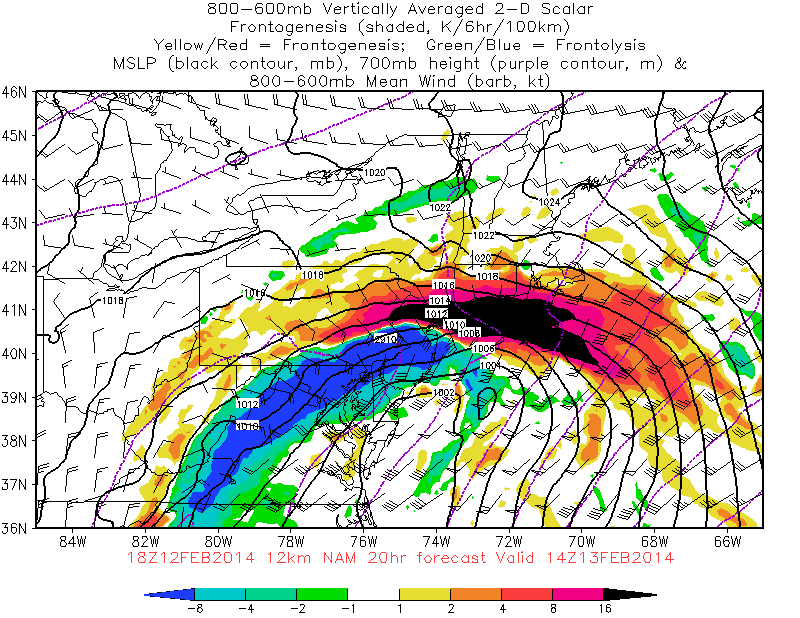
Second note, is that s stronger/organized storm, would increase warm-air advection into very cold airmass already in place. This results in strong frontogenesis. An example is from the 2/13/14 winter storm, where many of saw snowfall rates of 2-4″ per hour, during the early morning. In this case, this may not be as extreme. But it potential, that would have evaluated, as we get closer.
NAM frontogenesis forecast for the morning of 2/13/14:
 Check back for more posts on this system here over the next few days!