This is a forecast discussion is for the NYC-PHL Tri-State area.
A cold front will move across the region tonight, with some rain showers. Then a wave of low pressure will track up front offshore. As it turns it colder rain showers will change over to snow showers and become steadier and heavier tomorrow morning. Snowfall could be falling at the 1″-2″ per hr. Especially over Parts of NJ, NYC and LI. Snow should begin to taper off and end late Monday afternoon.
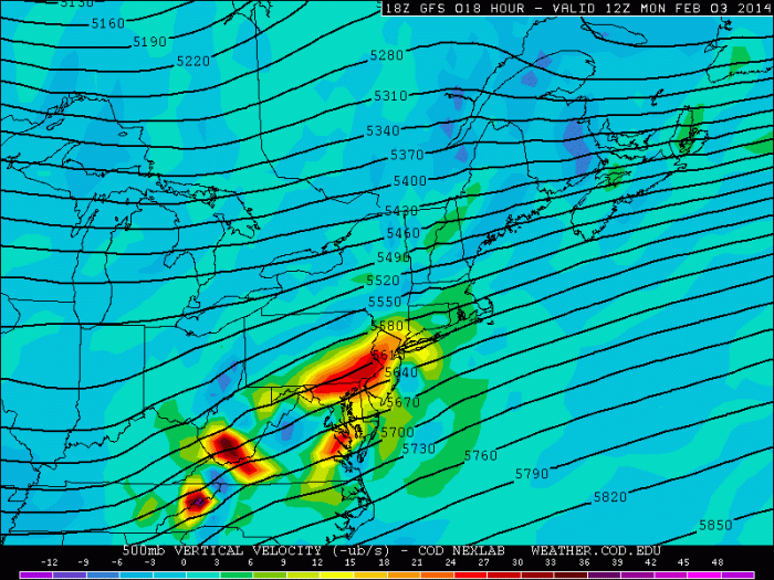
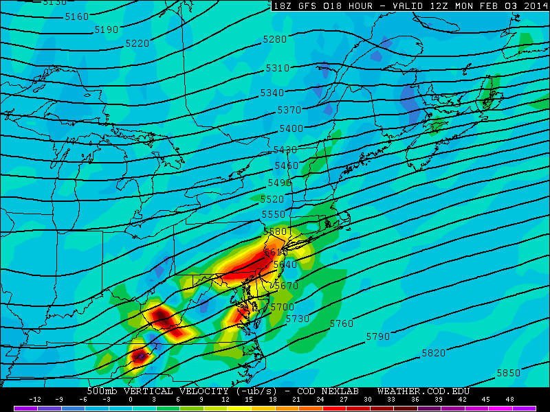
Models have the best UVVs going over parts of SE PA and CNJ tomorrow. This where I’m predicting highest snowfall total Extreme SNJ/DE will have more warm to overcome tomorrow morning.
 QPF totals on the models and ensembles range anywhere from .50″ to 1.00″ the area, expect farthest northern suburbs. It’s possible these totals too high, due progressive moving on the storm. But this system unlike past system, this system in picking more moisture out the Gulf.
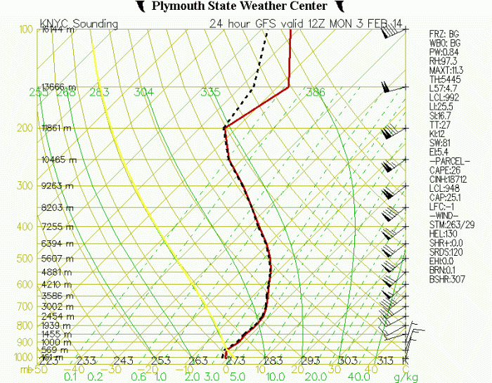
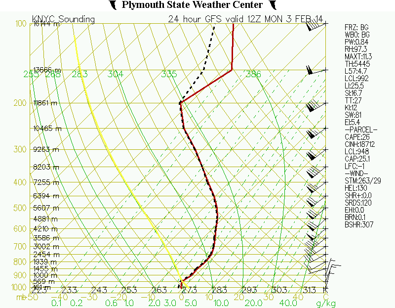
The main concern here is with temperatures. Especially in the boundary layer. Today many places around NYC where in low and mid 50s. Several degrees higher than guidance suggested. If the column doesn’t cool off as fast as modeled, early tomorrow morning, than snowfall totals will be less than predicted.
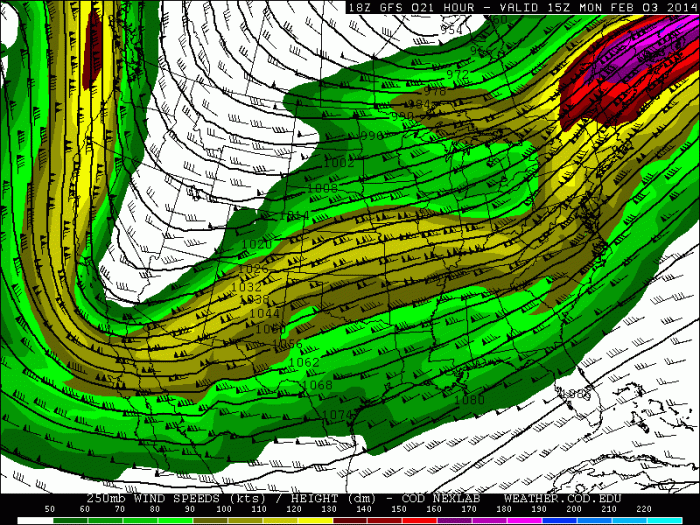
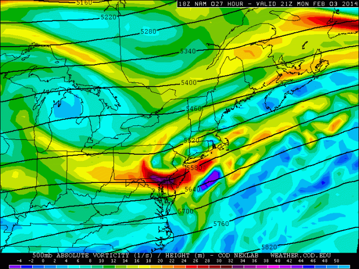
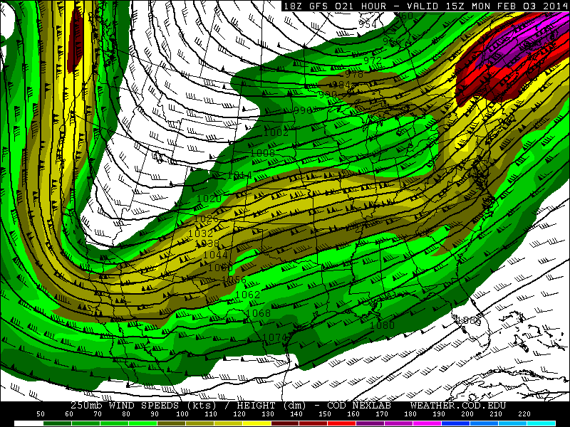
 On the other hand, if this farther north with stronger forcing, we could see higher totals, more dynamic cooling and heavier precip. We are right-rear exit region of a 250mb upper-level streak. 500mb vorticity has all trending stronger today on all the models. So this isn’t out of the question.
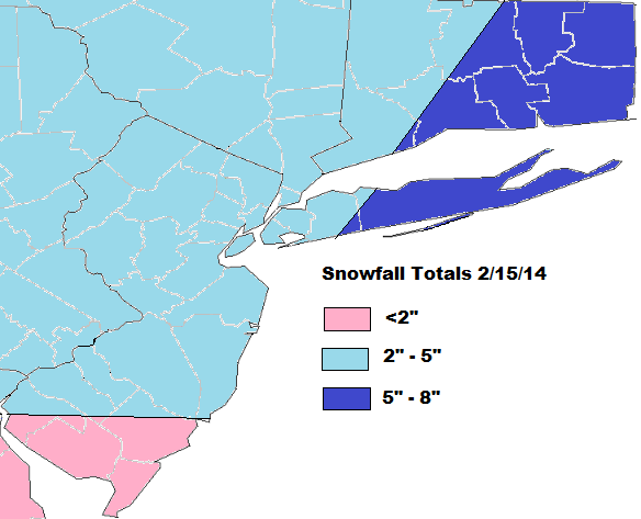
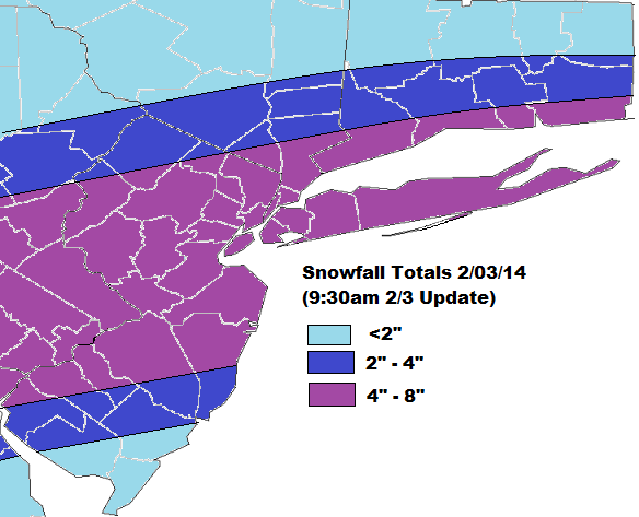
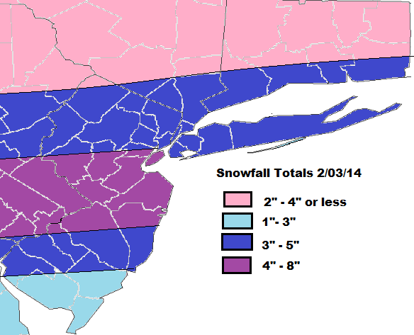
Here’s is the snowfall total forecast:


