There’s been much discussion in the media and weather forums about another winter storm next week. I haven’t posted too much about it here, because model guidance haven’t shown alot of consistency or agreement. Particularly, on amount of cold air/confluence over the Northeast and the handling northern and southern stream energy. However, the models now appear to be converging on solutions, that doesn’t support a major snowfall for much of the Tri-State Area, at least.
First let’s discuss, what we have ahead of this storm. We have temperatures several degrees above average for early March, next few days. Highs will be near 50 degrees on Monday. Then models show temperatures in the low or middle 50s on for NYC and south on Tuesday. So unlike other winter storm this seasons, we don’t have cold air mass in already in place to begin with. Which is not a good sign for major snowfall in our area.
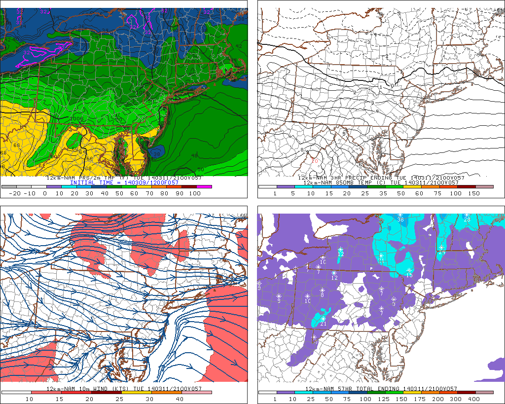
12z NAM showing high temperatures 40s and 50s on Tuesday:
During Tuesday night, a disturbance rotating around the polar vortex over Canada, will be dragging an cold front into Upstate NY and New England. Behind this is colder airmass, that will support snow in those areas. However, this cold front shown by the guidance stay north of the NYC area. This front, also marks leading of edge of the confluence zone, that will be too far north to suppress this storm to the south.
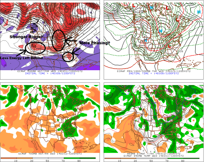
Now let’s discuss at what we have coming together for this storm. We have northern stream energy coming out Pacific and around the Polar Vortex, out of Canada. The issue with the model guidance, has been how much of the Pacific energy comes out and begins interacting with energy coming from Canada. The latest guidance now brings out a little more this Pacific energy east. However, the phasing between disturbances, is somewhat sloppy and trough remains broad. This happens because the ridge over the West Coast is flattening east. Energy has difficult time consolidating and phasing more cleanly along the the trough axis. The result is storm that only slowly deepens and organizes as it moves east. Development of a strong cold-conveyor belt or deformation band behind this low, occurs too late for us. Especially for the coastal plain. Some dry-slotting near the low track will also be a concern.
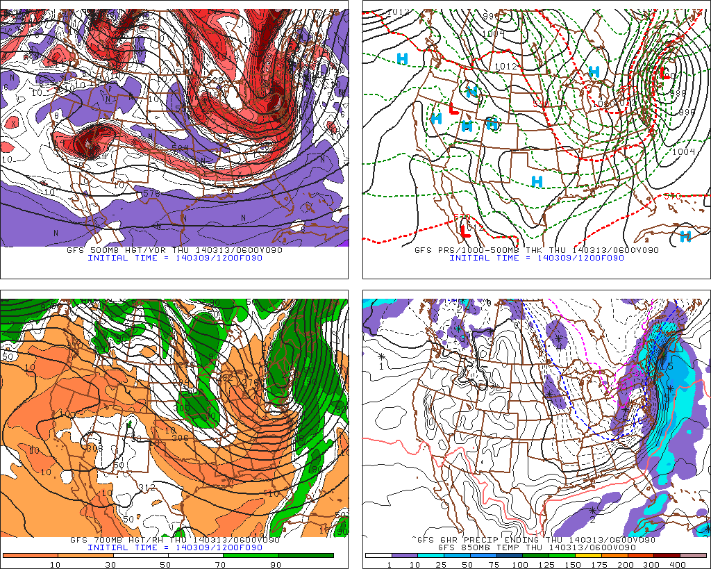
The 12z GFS showing a broad trough over Eastern US and a shortwave flattening the ridge over Western US: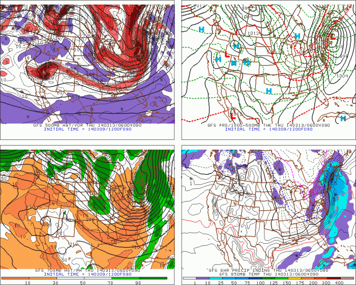 Based on latest guidance, this storm would be mostly rain for much of New Jersey, NYC, Long Island and Coastal Connecticut. As the low moves offshore and intensifies Wednesday night, it might pull down enough cold air for rain to change to snow before ending or cause a flash freeze. For the Lower Hudson Valley, and Interior CT, precipitation types are less certain. If the low tracks far enough south, we could possible see more snow or a wintry mix throughout most of the storm. If low tracks farther north, there would likely be a wintry mix changing to rain, before ending as snow. The specifics here on precipitation types and amounts will become clearer the next few days.
That all being said, there is still enough time for some changes here, that could affect the outcome of this storm. The Pacific shortwave energy won’t be onshore until tomorrow. So the models have start having better grasp on he amplitude of that energy coming east. If the models today are flattening the Western US ridge too much, this will result in more Pacific energy ejecting east and more southern stream energy involved. Also the disturbances rotating around the Polar Vortex are always difficult for the models handle. If any of these disturbances are stronger, than confluence will be ahead of this storm. That would result in a colder or further south solution. I will be watching for these changes on future model runs and post more blog updates here accordingly.
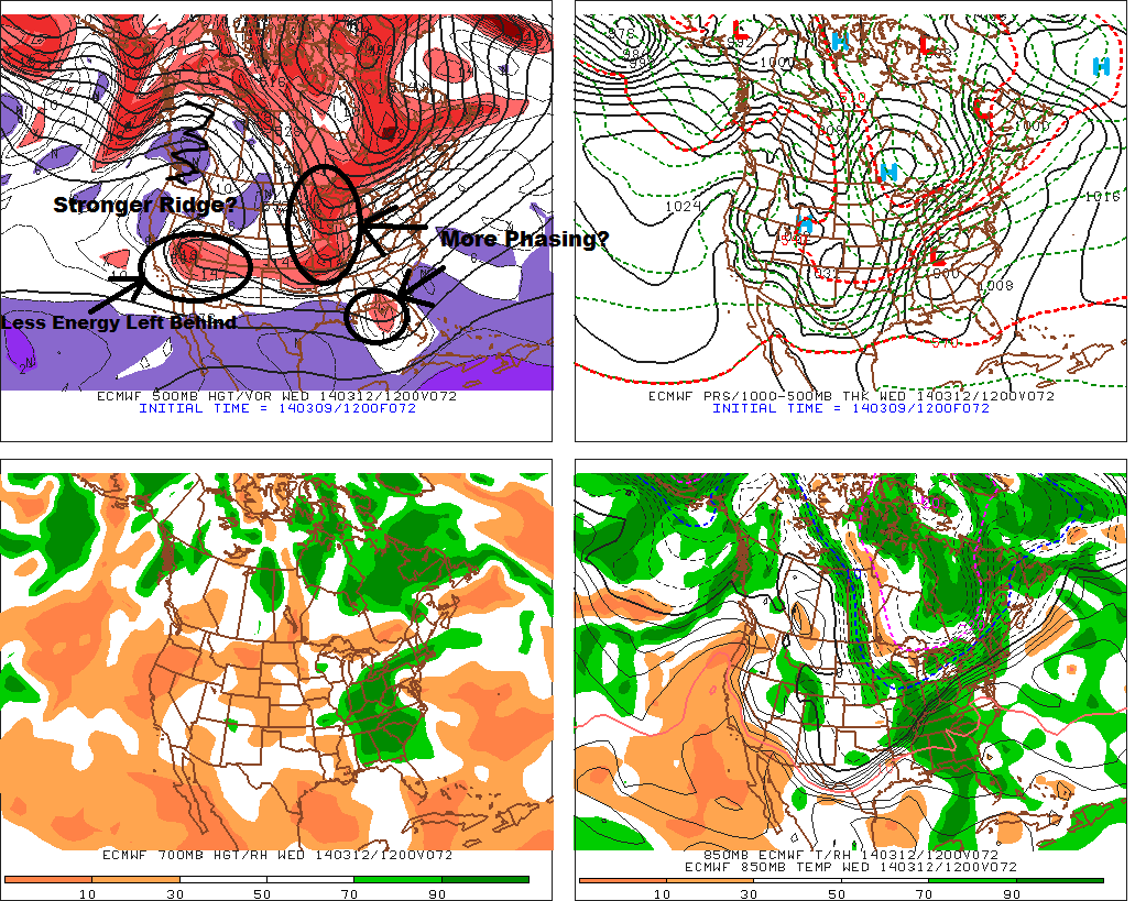
The 12z ECMWF today at 72hrs:

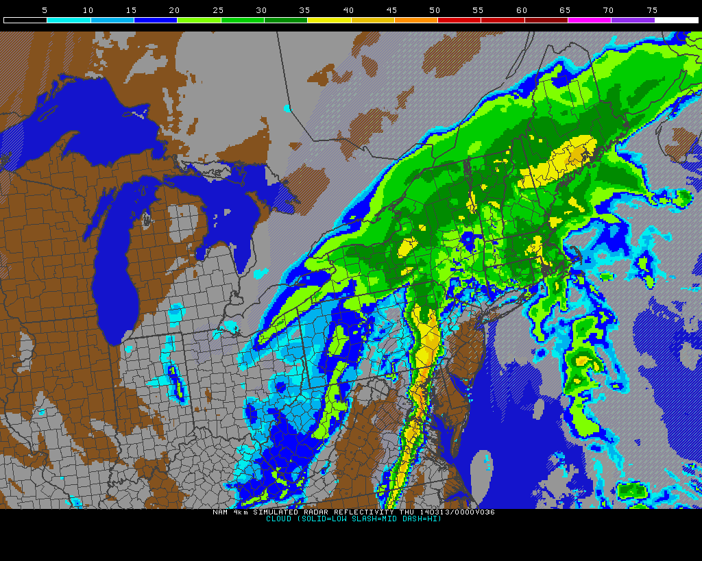 Behind this cold front, it will turn windy with temperatures will rapidly fall back into 20s and teens later tomorrow night. Any wet roadways could see some black ice form. Some snow showers that could coat the ground, are also possible with the upper-level trough with swinging through tomorrow night. Especially north and west of NYC. Thursday will be big change from the last few days. It will be windy with temperatures only slowly climbing out of the teens into lower 20s. This arctic blast will not last longer, however. After a cold Friday morning, temperatures will rise into upper 30s and lower 40s in the afternoon.