No Rest from Old Man Winter

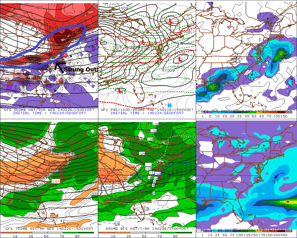
Low pressure is now forming over Delmarva region this morning, will move well south and east of region today. A steady area light to moderate snow now over Southern New Jersey and Delaware could give those areas 1-2 inches. While the rest of the Tri-state area see more light snow showers and flurries, with any accumulation likely under 1 inch.

LongIsland.rad

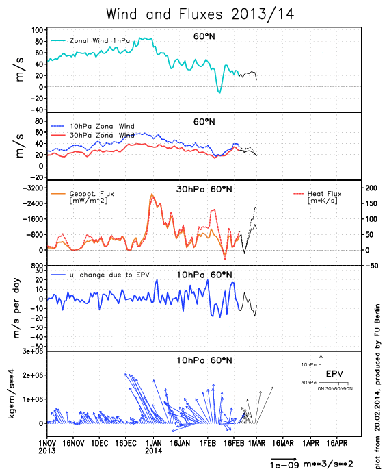
Another shortwave and artic front, may produce few snow showers and flurries on Thursday afternoon and evening. Mainly north of NYC. The coldest airmass this week, will arrive on Thursday night and Friday. The NAM,GFS, ECMWF show 850mb near or below -20C Thursday night, early Friday. NW winds should relax by dawn and with some snow cover left, low temperatures in the single digits are likely for NYC area and near or below 0 for the NW suburbs.

12zNAMf66
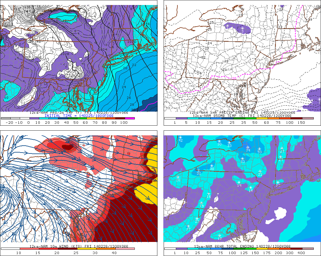
Some record low temps will be challenged on Friday. Especially for JFK and LGA. NYC and EWR look to be just out of reach. Temperatures will slowly rise into lower 20s in the afternoon. These are some record lows around for the tri-state area on Friday 2/28/14:

NYC 5 1934
LGA 12 1980
JFK 15 1950
EWR 1 1934
BDR 10 1950
ISP 12 2008

A weak shortwave coming out from SW may produce a period of light snow or flurries on Saturday. A bigger system coming out the Southwest US, is likely produce more significant wintry precipitation in the form of snow, Sunday into Monday.  Still several days away to hone any down specific details.

Cold Pattern Arrives, Storms to Follow

The cold pattern that has been discussed for this week, has arrived. An artic front pass through overnight with some showers. As colder continues filter into region,  temperatures may fall back in the lower 30s and upper 20s. Before rising back into middle 30s this early this afternoon. Tonight will be much colder, with temperatures dropping into lower 20s in NYC and the teens for most of the suburbs. Tomorrow will be mostly sunny with temperatures rising into upper 20s or lower 30s for highs.

The storm for Wednesday, now appears will far enough south, it will just give us a light snowfall at best. We have seen storms this season trend stronger or farther NW, just inside 24-48hr. However, latest model trends show the shortwave energy along trough, that will responsible for spawning this storm, is more strung out Without this energy being more consolidated, the trough can’t sharpen, to tighten the baroclinic zone farther NW. There is also other polar jet disturbances, keep the height flatter ahead and behind this system. This results in weaker low developing along Mid-Atlantic coast and tracking well south and east of the 40/70 benchmark. I will still monitor this for any significant changes in handling shortwave energy and other features. But right now I don’t expect no more than a couple of inches of snow accumulation.

6zGFS57

Thursday and Friday will be high pressure will be control resulting in cold and dry weather. Then pattern will be more active, starting this weekend. The Polar Vortex will slowly begin to retrograde and with the MJO entering phase 8, the sub-tropical jet will become active with disturbances moving across the southern CONUS. There will also be high-amplitude ridge along the West Coast of North America. So anyone of these disturbance has potential to interact or phase with northern stream disturbances, and produce a significant storm for the Eastern US.

However details vary with each prognostication of every disturbance on the models from run to run. It’s important for everyone to not get infatuated with model solutions, at this point. Instead use pattern recognition, ensembles and trends to determine the probability of that solution occurring, without getting into specifics.  I will have more posts here this week about these storm threats.

More Cold and Snow for Next Week into March

This is an update to the previous post on the cold & storm pattern in late February and early March

First, the model guidance now the Polar vortex drop further south in SE Canada. This is due the 500mb heights increasing around North Pole. This is similar pattern evolution we saw in the last two weeks of January  So there is now more potential for more extreme cold for late February and early March. You may have to wear you big coats again. The GEFS shows this potential for very anomalous negative 500mb height and surface temparture departures, near end of the next week.

12zGEFSf168

12zGEFSD8Another minor stratospheric warm event is occurring. The EP vectors are forecast shift more to right (poleward) by ECMWF. This would means that warm would be downwell in higher latitudes. Possibly resulting more west-based blocking over Greenland/Davis Strait.

70mb9065

ECfluxesThe MJO still forecast by GFS and ECMWF ensembles to head in through phases 7 and 8. These forecasts are a little less than reliable. But they have been fairly consistent this week. There is more support for progression by westerly vector wind anomalies being shown at 200mb and 850mb, over the Central Pacific.

220MJOforecastsMore later…