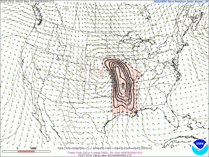
A strong storm and upper-level low taking a negative tilt will cause severe t-storms with potential of producing straight-line damaging winds, large hail and tornadoes are parts Central Plains and Mississippi River Valley. At this time, the storm prediction center in Norman, Oklahoma, has place much the area in moderate risk. However an upgrade to a high risk is possible later today:
 Curved low-level and mid-level jet streaks at over 50kts, will be providing directional shear and forcing. Surface dewpoints in the 60s and 70s, steepening lapse rates and high CAPE (convective available potential energy), will provide ample moisture and instability. Large, curved hodographs on the forecast models, also show potential for some strong tornadoes to form. Latest SREF at 9z today, has moderate and to high probabilities for ingredients for signficant tornadoes over large parts of Central and Lower Mississippi Valleys
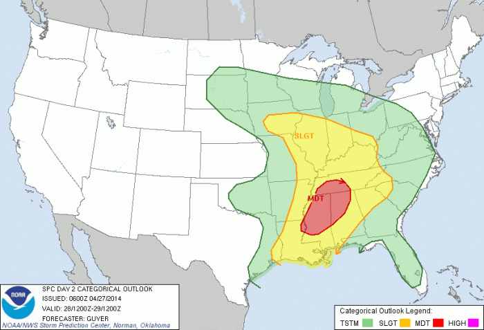
 This severe wx outbreak like spread east into parts Ohio Valley and Tennessee Valley, later tonight and tomorrow. As this storm system and upper-level low begins to slowly move east. The threat for strong tornadoes will continue to exist. Slight risk and moderate risk have been issued by SPC:
